Pont de Bercy
Coordinates: 48 ° 50 ′ 17 ″ N , 2 ° 22 ′ 30 ″ E
| Pont de Bercy | ||
|---|---|---|
| View of the bridge upstream | ||
| Convicted | His | |
| place | Paris | |
| Building number | 0873 | |
| construction | Arch bridge | |
| overall length | 175 m | |
| width | 40 m | |
| start of building | 1863-1864, 1904, 1989-1991 | |
| planner |
E.-J. Feline-Romany , J. Monthioux , J. Résal |
|
| location | ||
|
|
||
| Location in the 12th arrondissement | ||
The Pont de Bercy is a bridge over the Seine in Paris . It was built in its current form in 1864 and widened twice. At the beginning of the 20th century, an elevated railway line was built on it, which is used by the Métro ( station: Quai de la Gare ).
history
In 1832 a suspension bridge was built at this point - at that time still outside Paris - to replace a river ferry that had operated until then . But it soon became apparent that their load-bearing capacity was insufficient. That is why it was replaced by a brick bridge in 1863/64.
The first widening of 5.50 m was carried out in 1904 so that it could accommodate the Métro viaduct . This was initially on the upstream edge of the bridge.
In 1992 the bridge was widened by 16 m, and new lanes were added beyond the Métroviadukt. Since then, the railway line has been located between the directional lanes.
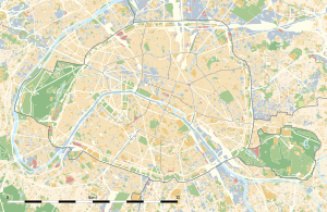
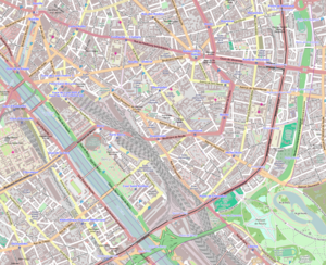
The bridge connects the Boulevard de Bercy with the Boulevard Vincent-Auriol , which are in the 12th and 13th arrondissement . Your neighboring bridges are downstream the road bridge Pont Charles-de-Gaulle and upstream a footbridge, the Passerelle Simone de Beauvoir . At the north end of the bridge are the Ministry of Finance and the multi-purpose sports hall Palais Omnisports de Paris-Bercy .
The bridge is 175 m long and 40 m wide. The five brick arches have a span of 29 m each. The new part is made of prestressed concrete with stone cladding.
A bridge for the metro
In 1904 the bridge was widened by 5.5 m to accommodate a viaduct for Métroline 6, which was under construction . This viaduct rests partly on the widening, but partly also on the existing bridge. It consists of two rows of 41 brick arcade arches on which a steel deck structure rests on which the rails lie. The bridge is located between the metro stations Quai de la Gare in the south and Bercy in the north.
Others
The bridge is the subject of the song Sous le ciel de Paris by the singer Edith Piaf .
location
| Position of the bridge on the Seine | ||
|---|---|---|
|
downstream: Pont Charles-de-Gaulle |

|
upstream: Passerelle Simone-de-Beauvoir |
See also
Other bridges with an underground viaduct above street level are the downstream Pont de Bir-Hakeim and the Berlin Oberbaum Bridge .
Web links
Individual evidence
- ↑ a b Jean Tricoire: Un siècle de métro en 14 lignes. De Bienvenüe à Météor . 2nd Edition. La Vie du Rail, Paris 2000, ISBN 2-902808-87-9 , p. 209 .


