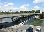
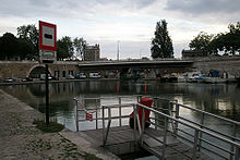
Seine bridges in the Paris area
The Seine bridges in Paris connect the right, northern bank of the Seine , known as the Rive Droite , with the left bank, the Rive Gauche . They are sometimes located on river islands or simply cross an arm of the river.
Of its 777 kilometers total length, the Seine flows 13 km through what is now the capital of France . Depending on the number of bridges and footbridges, there are 37 to 43 copies. While on the one hand it was the most important factor in the formation and development of the city of Paris as a transport route , which had its origin here on or on the largest island in the Seine, on the other hand the bridges had to connect the land routes on both banks very early on. Initially, however, the bridges also had a protective character for the residents. From the perspective of road traffic, they are now often seen as an obstacle and no longer viewed in their original function as a means of connection.
The departments Direction de la voierie et des déplacements and the Division des ouvrages d'art of the city administration are responsible for the continuous maintenance, renovation and restoration of the Parisian bridges .


Paris
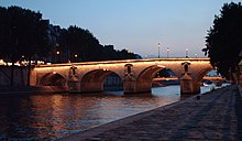
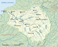
The Seine flows in the greater Paris area (agglomeration Île-de-France) from the confluence of the Marne near Vincennes in the Paris Basin in a wide left curve from the southeast through the center, and then in a tight right curve at Boulogne-Billancourt back to Saint-Denis to bend to the north and encompass once again the city from the north. Then it turns in an arc around Colombes / Villeneuve-la-Garenne again to the north-west, and then meanders towards the English Channel . In the wider city area, around 40 bridges and some footbridges span the Seine and connect the central arrondissements (city districts). The consideration or non-consideration of the bridges leading to one of the islands leads to different figures. The French Wikipedia, for example, only mentions 37 bridges across the width of the river in its list. The city names 31 road bridges, 4 pedestrian walkways and 2 railway bridges. The bridges are illuminated in the evening .
The two islands in the center, Île de la Cité and Île Saint-Louis , were ideal for building bridges between north and south.
The Grand Pont , which no longer exists, was the main bridge in Paris to the river island in the Middle Ages . For the location at the time, see the Pont au Change . It was built between 861 and 862. It replaced the probably damaged Pont Notre Dame . This stood protected by a fort on the north side of the Roman road from Soissons to Orléans. The Grand Pont was replaced by the Pont des Planches de Milbray in 886 . See the illustration on a plan below. The still existing counterpart on the other side of the island is the Petit Pont .
Île de la Cité
Of the total of nine bridges of the Île de la Cité , a pedestrian bridge on the eastern tip of the island ( Pont Saint-Louis ) connects with the neighboring Île Saint-Louis, seven lead either only to the right bank (in the direction of the Pont d 'Arcole , Pont Notre-Dame , Pont au Change ) or only to the left ( Pont de l'Archevêché , Pont au Double , Petit-Pont , Pont Saint-Michel ), while the bridge on the western tip ( Pont Neuf , German " New Bridge "), which, regardless of its name, is the oldest of the bridges in Paris, allows the crossing of the two arms of the Seine.
Ile Saint-Louis
, the six to and from the built-up until the 17th century Ile Saint-Louis leading bridges are independent in the west of the island two, separated by a road section of the Boulevard Henri-IV but combined under one name bridges that transport the between the north and south banks ( Pont de Sully ), two bridges crossing the right arm of the Seine ( Pont Marie and Pont Louis-Philippe ), one built over the left arm ( Pont de la Tournelle ) and the aforementioned pedestrian bridge Pont Saint-Louis to the Île de la Cité .
Further down the river follow other Seine islands accessible via bridges. In addition, there are around 300 other bridge structures in Paris: over canals and streets, over tracks and in parks.
( Note: The French word "Pont" = German bridge. For the French names used here (approximate German designation in brackets), the female gender is used grammatically in the text , corresponding to the German word Brücke for le pont (with male article). )
The bridges of the Romans
The Petit Pont , today named after the Parisian Cardinal Petit-Pont-Cardinal-Lustiger, has only existed in this form since 1853. However, it is one of the two oldest bridges in the city. As part of the Roman stronghold Cardo of Lutetia between the Rue de la Cité and the Rue du Petit Pont, a bridge over the river already existed at this point before the Roman conquest of Gaul . When the troops of Titus Labienus in 52 BC As the city approached, the Parisii destroyed these bridges to make it difficult for the enemy to cross over and capture the city. But the Romans won. They rebuilt the bridge in wood (as opposed to the bridge over the great Seine arm, for which they used stone) and made it a central part of the Roman road from Soissons to Orléans and the city's Cardos. A few meters south of this branched off the roads to Burgundy and Lyon (see Rue Galande ). During the siege of Paris (885-886) the Petit Pont was destroyed again.
List of bridges across the Seine in Paris from east to west
- Pont Amont
- Pont National
- Pont de Tolbiac
- Passerelle Simone de Beauvoir
- Pont de Bercy
- Pont Charles-de-Gaulle
- Viaduc d'Austerlitz
- Pont d'Austerlitz
- - Administrative border between 12./13. and 4th / 5th Arrondissement -
Île Saint-Louis
- Pont de Sully (from here downstream begins the area of the UNESCO World Heritage Site Seine river from Paris - up to the Pont d'Iéna)
- Pont Marie
- Pont de la Tournelle
- Pont Louis-Philippe
Île de la Cité
- Pont Saint-Louis
- Pont de l'Archeveché
- Pont au double
- Pont d'Arcole
- Petit-Pont
- Pont Notre-Dame
- Pont Saint-Michel
- - administrative limit between 4th / 5th and 1./6. Arrondissement -
- Pont au Change
- Pont Neuf
- Pont des Arts (Passerelle)
- - Administrative border between the 6th and 7th arrondissement -
- Pont du Carrousel
- Pont Royal
- Passerelle Léopold-Sédar-Senghor until 2006 Pont Solférino
- Pont de la Concorde
- Pont Alexandre III
- Pont des Invalides
- Pont de l'Alma
- Pont Debilly
- - Administrative border between the 7th and 15th arrondissement -
- Pont d'Iéna
- Pont de Bir-Hakeim on the Swan Island (Île aux Cygnes; see below picture)
- Pont Rouelle
- Pont de Grenelle
- Pont Mirabeau
- Pont du Garigliano
- Pont Aval
(The references in this list are possibly only links within this article. They refer to the brief information about the bridge further down in the article. There is a link to the Wikipedia article about the respective bridge.)
Brief information about the bridges in alphabetical order
The information on the individual bridges follows alphabetically the respective first main term after "bridge" (Pont etc. - e.g. at Passerelle Simone de Beauvoir under Beauv ... ). The link in the heading leads to the main article on the respective bridge structure.
Pont Alexandre III
Pont Alexandre III - 1900 - a 109 meter long steel arch (prefabricated in Le Creusot, among others ) - Architects Jean Résal, Amédée Alby, Cassien-Bernard, Gaston Cousin - connects the Invalides with the Grand and Petit Palais in the Jardins du Champs-Élysées - Name of Tsar Alexander III. (1845-1894). Built as part of the world exhibition .
Pont Amont
The bridge has no official name. But seen upstream it is the last bridge before leaving the Paris city area, which is why it has been popularly known as the Pont Amont (i.e. upstream bridge ). It was built in 1967-69 and is used by the Parisian motorway ring Boulevard périphérique . With a length of 270 m, the bridge is the second longest Seine bridge within Paris. The northern expansion joint of the bridge serves as the zero point for the kilometer division on the boulevard périphérique.
Pont de l'Archeveché
The Pont de l'Archevêché (Bridge of the Archbishop's Church ) connects the Île de la Cité with the left bank. In 1910, the previous bridge from 1828 was replaced by a structure with double width.
Pont d'Arcole
The Pont d'Arcole is an arched bridge made of wrought iron and connects the Île de la Cité with the right bank (Rive droite). Designed by Alphonse Oudry and Nicolas Cadiat, this bridge replaced a pedestrian bridge as its predecessor in 1856.
Pont d'Argenteuil - railway bridge
The railway bridge at Argenteuil from 1863 was replaced by the current bridge in 1949 after war damage and later doubled by another bridge. The framework of the older bridge is reminiscent of the previous building, a double-track, iron lattice girder construction on four concrete pillars, made famous by Claude Monet's painting The Railway Bridge of Argenteuil by Claude Monet .
Pont d'Argenteuil
The Pont d'Argenteuil road bridge consists of three steel arches over which the road runs at the level of the box-shaped pillars. The struts are carried by six arch elements, the protective coating is blue. The pillars expand somewhat like a ship under the supports.
By Claude Monet , a French Impressionist painter, there is a famous painting of the bridge from 1874 in the Neue Pinakothek in Munich. There are several variants of the subject elsewhere .
Asnières railway bridge
The Asnières railway bridge goes back to one of the oldest railway lines in France, the Paris - Saint-Germain-en-Laye line , which opened in 1837 . The bridge, renewed in 1852, was the first wrought-iron bridge and was later u. a. painted by Vincent van Gogh . After several extensions it is now one of the widest railway bridges in the world with ten tracks. It is to be widened again in 2015.
Pont d'Austerlitz
The Pont d'Austerlitz has existed in its current form since 1885. In 1806, an iron bridge was built here, the arches of which were supported on four brick pillars. In 1854 it was replaced by a stone bridge - while retaining the pillars - and finally widened considerably in the years 1884–85.
It is 174 m long and today has a usable width of 30 m. The roadway is 20 m, the two sidewalks are each 5 m wide.
Viaduc d'Austerlitz
The Viaduc d'Austerlitz bridge, which has existed since 1903, has been a listed building since 1986. It is a 140 m long railway bridge, which is used by line 5 of the Paris Métro .
Pont des Arts
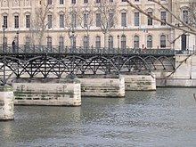
The Pont des Arts is a 155 meter long and 11 meter wide pedestrian bridge that connects the Quai du Louvre on the right bank of the Seine with the Quai de Malaquais on the left bank and thus connects the Louvre and the Institut de France . See figure below
Pont Aval
The bridge, which was put into operation in 1968, is used exclusively for vehicle traffic and is used by the Paris ring road ( Boulevard périphérique ). It consists of two identical bridges, which were erected independently of each other in 1968, the concrete girders of which rest on two pillars over four fields of different lengths (71.5 m, 81.5 m, 92 m, 67.5 m). With a total length of 312.5 m, it is the longest Parisian Seine bridge. Width: 34.6 m from two streets of 14 m and two sidewalks of 1.8 m, intermediate strips 3 m.
Since the bridge has no official name and is also the last road bridge downstream in the Parisian municipality, it is popularly called Pont aval (German river downstream bridge ).
Passerelle de l'Avre
The Passerelle de l'Avre footbridge between the Bois de Boulogne and Saint-Cloud is actually an aqueduct with a footbridge. It stands at the westernmost point of Paris. She lets the waters of the Avre cross the Seine. Designed by Gustave Eiffel ; Completion was in 1891.
Passerelle Simone de Beauvoir
The Passerelle Simone de Beauvoir is a 12 meter narrow, partly two-story pedestrian bridge that spans the Seine as a combination of arch and suspension bridge without buttresses. Their unusual external shape is somewhat reminiscent of the structure of DNA.
It is 194 meters long and was built in 2006. The architect is Dietmar Feichtinger from Austria . It is named after the author Simone de Beauvoir (1908–1986), who is particularly important for the global women's movement .
Pont de Bercy

A previous building, the Pont de Bercy , was opened in 1832 under Louis-Philippe I , reconstructed in 1864 and widened by 5.5 m in 1904 to accommodate the viaduct of Metro line 6 . It connects the 12th and 13th arrondissement . The bridge was doubled and the old parts were renovated in 1992.
The bridge is 175 m long and today 40 m wide. The original bridge consists of brick arches with a span of 29 m, the widening from 1992 made of prestressed concrete with stone cladding.
Pont de Billancourt
In Boulogne-Billancourt . It has a steel beam over two fields of different width. A sculpture by Badani stands on a pillar attachment . Length 115 m.
Pont de Bir-Hakeim
The Pont de Bir-Hakeim was built in 1905. It replaced an iron footbridge from 1878 and connects the 15th and 16th arrondissements of Paris. It is a double-decker bridge: there is a road bridge with sidewalks and cycle paths at street level. The tracks of Métrolinie 6 run above it on an iron bridge .
The original name of the bridge was Viaduc de Passy . In 1949, on the anniversary of the Appel du 18 juin, it was given its current name at a solemn commemoration. This is to commemorate the battle of Bir Hakeim .
Pont du Carrousel
The Pont du Carrousel is opposite the Tuileries and the Louvre and is 168 m long and 33 m wide. It was built in 1935-1939. Your architects were Gaspard, G. Umbdenstock, Tourry, H. Lang. The three flat reinforced concrete arches are clad with natural stone. At its corners are four allegories by Louis Petitot for the Seine, the city of Paris, prosperity and industry with bronze pillars in Art Deco style .
Pont au Change
The Pont au Change ( German : "Exchange Bridge" in the sense of money exchange) connects the Île de la Cité with the right bank. Until 1788 the bridge houses of the money changers stood on it. The predecessor building in the Middle Ages was the Grand Pont . The holiday beach fun of Parisians has also started at this bridge since 2002, the 4 km long sandy beach (Paris-Plages) with deck chairs, palm trees, etc.
Aqueduc de Colombes
An aqueduct in Colombes . Between the five arched ribs there are four iron pipes through which the sewage from Paris is drained. The “neighboring” Pont d'Argenteuil and the “Aqueduc” have a very similar construction. In contrast to the side panels, the arch in the middle section is pulled up under the roadway. Total length 210 m. It has a protective coating in blue-green.
Pont au double
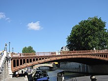
The Pont au Double connects the Île de la Cité with the left bank over the narrow arm of the Seine. The bridge takes its name from the toll that had to be paid when crossing it: a double denier .
Pont du Garigliano
The Pont du Garigliano replaced the Viaduc d'Auteuil . Named in 1944 in Italy, in memory of a World War II victory in the Battle of Monte Cassino by General Alphonse Juin . Sophie Calle and Frank Gehry have known each other since 1983. She met him for the first time in LA, he met her in Nîmes - at least that's how they both like to tell. Their first joint work, a telephone booth on the Pont Garigliano in Paris, was inaugurated in December 2006.
Pont Charles-de-Gaulle
The De Gaulle Bridge in the southeast complements the Pont de Bercy and Pont d'Austerlitz bridges since 1996. Named after the general and post-war president de Gaulle . Architects: Louis Arretche and Roman Karasinki. Length: 207.75 m. Steel bridge on two concrete pillars with a cross-section reminiscent of an airplane wing. At the Quai d'Austerlitz and Quai de la Rapée.
Pont de Grenelle
The predecessor of the Pont de Grenelle was an iron construction by Mallet from 1827. The Seine with its width of 200 m is spanned here by the longest Seine bridge of 220 m length. In 1873 it was followed by a design by engineers Vaudrey and Pesson. 1966 to 1968 Thenault, Grattesat and Pilon built the current bridge.
On their supports on Swan Island stands a small replica of the Statue of Liberty (French: Statue de la Liberté ), originally a gift from the French to the American people in 1886. Nearby is the Mirabeau metro station on line 10 .
Pont des Invalides
Built in 1878, a four-arched bridge, the forerunner of de Verges and Bayard de la Vingtrie from 1829 at the Hôtel des Invalides . Bridge figures are the goddesses of victory La Victoire terrestre by Victor Vilain and La Victoire maritime by Georges Diebolt (west).
Pont de l'Alma
The predecessor of today's 142.5 m long and 42 m wide steel Pont de l'Alma was built in 1856 by Napoleon III. opened arch bridge. It was lined with two statues at each end. A Zouave figure, which is an unofficial flood indicator, is of particular importance . When the water of the Seine reaches your feet, the bank paths are closed; when it is up to your hips, the river is no longer navigable.
Napoleon had the bridge named after the battle of the Alma . On August 31, 1997, Lady Di and Dodi Al-Fayed died after a car accident in the tunnel there.
- the pedestrian bridge Passerelle Léopold-Sédar-Senghor see under "S" for Passerelle Senghor , the common name.
Pont d'Issy
In Boulogne-Billancourt. The six-lane bridge leads over two arms of the Seine and rests on the tip of the island. Construction: concrete beams over three fields.
Pont d'Iéna
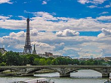
The Pont d'Iéna bridge is located between the Eiffel Tower and the Jardins du Trocadéro . It was built between 1808 and 1814 and named after the battle of Jena and Auerstedt . It consists of 5 bridge arches with a span of 28 m each.
In view of the planned World Exhibition in 1937 , the bridge was given its current width in 1935: Instead of 19 m, it is now 35 m. To do this, it was widened on both sides. The widenings rest on bridge arches of the same dimensions as the arches of the original construction, which in turn rest on additional pillars.
Up to here and including the river, from the Pont de Sully on both banks, the area of the UNESCO world cultural heritage goes according to the ICOMOS archive of the world cultural heritage, 1991.
Pont Louis-Philippe
This bridge, completed in 1862, connects the Île Saint-Louis with the right bank of the Seine. The bridge is 100 m long and only 15 m wide.
Its forerunner, a suspension bridge from 1834, was destroyed in the course of the February Revolution in 1848 .
Pont Marie
Pont Marie has its current name after the building contractor Christophe Marie. It was completed in 1635 and was originally built on with houses, which was common at the time. The Pont Marie opens up the Île Saint-Louis to the right bank. It is the counterpart to the Pont de la Tournelle on the left bank of the Seine. On March 1, 1658, the bridge together with the 20 houses and 60 residents on it was torn away by the flood. In 1660 a wooden replacement was built. In 1670 the two destroyed arches with no houses on them were rebuilt.
Length: 92 m, street width 14.6 m with two sidewalks, each 4 m wide.
There is a painting of the bridge from 1899 ( Neue Pinakothek in Munich) by Maximilien Luce , a French late impressionist painter .
Pont Mirabeau
Pont Mirabeau is an arched road bridge that was built between 1893 and 1896.
Pont National
Over 189 m in length it connects the Boulevard Poniatowski on the right bank of the Seine with the Boulevard Masséna. It was also used for rail traffic on the Inner Belt . (Built in 1853 or 1944)
( To the Pont National Weblink: Article ( Memento of November 16, 2006 in the Internet Archive ) by the city of P.)
Pont Neuf
The Pont Neuf ( German : New Bridge ) leads over the western tip of the Île de la Cité and connects both banks. It is the oldest of today's Paris bridges.
Pont Notre-Dame
Pont Notre-Dame connects the Île de la Cité with the right bank and leads to the Notre Dame Cathedral of the same name . Predecessor structures such as the Grand Pont already existed in the time of the Celts and Romans and in the Middle Ages. As an access to the island, it is supplemented by the Petit Pont (see below) to the south.
Petit Pont
Petit Pont ( German : "Small Bridge" , since 2013 with the expanded name Petit-Pont-Cardinal-Lustiger) has connected the Quai de Montebello and the Quai Saint-Michel between the Île de la Cité and the Rive Gauche since 1853 . Predecessor structures already existed in the Middle Ages or earlier.
Pont Rouelle
The Pont Rouelle crosses the Seine at the level of the Swan Island , on which one of its pillars stands.
The Pont Rouelle is a railway bridge that was built for the world exhibition in 1900 . It was shut down in 1937 and has only been in operation again since 1988. Today it is used by the RER trains of line C used.
It is named after the Rue de Rouelle , which bears its name in honor of the French chemist Guillaume-François Rouelle .
Pont Renault
The former main factory site of Renault , located on an island in the Seine, has been connected to the right bank of the Seine with a cantilever bridge since 1928. Length: 128 m, widths: 24.8 - 74.4 - 28.6 m.
Pont Royal
The wooden previous bridge of the Pont Royal (German royal bridge) was called Pont Sainte-Anne (1632, after Anna of Austria ) and also Pont Rouge ("red bridge") after their color. Louis XIV had the stone bridge built in 1689. The “royal” in their name therefore refers to him. It was revised in the 19th century. It is located between Rue du Bac (on the right) and Rue de Beaune (at the Pavillon de Flore ) with Avenue du Général Lemonnier on the left . Quai des Tuileries , Quai Voltaire . Nearby are the remains of the Tuileries and the station of the same name on the M1 metro line . Their length: 110 m, width: 16 m. The spans of the arches are 20, 22, 23, 22 and 20 m. Architects were Jacques IV Gabriel, Jules Hardouin-Mansart and François Romain.
It is the third oldest bridge in Paris (after the Pont Neuf and the Pont Marie ). In the story, the bridge saw the cannonade of Napoléon Bonaparte (Oct. 5, 1795). During the revolution it was called Pont national , then Pont Tuileries . ( Information on the website of the City of Paris ( Memento of November 16, 2006 in the Internet Archive ), French)
Pont Saint-Michel
The Pont Saint-Michel (1378, or 1855) connects the Île de la Cité with the Rive Gauche - the Boulevard Saint-Michel was named after her. The Archangel Michael is revered as the guardian of the Paradise Gate and was patron of a chapel in the formerly neighboring Royal Palace.
It was not until October 17, 2001, that the Mayor of Paris, Bertrand Delanoë , inaugurated a plaque on the bridge, commemorating the 1961 massacre of Paris police of demonstrators during the Algerian war.
(Image on the right: The bridge as seen from the Petit Pont)
Léopold-Sédar-Senghor walkway
The Passerelle Léopold-Sédar-Senghor or Passerelle Senghor for short was called Passerelle Solférino until 2006 . It connects the Quai Anatole-France on the left bank and the Quai des Tuileries . It dates from 1999 and had previous structures from 1861 (made of cast iron ) and 1961 (made of steel). It has two exits of different heights on both banks (bank promenade or street level above). Its length is 140 m, the span 106 m. It was renamed after the first President of Senegal , Leopold S. Senghor (1960–1980). He also worked as a poet and was a member of the French National Assembly for his homeland from 1934 . The previous name was reminiscent of the Battle of Solferino and the port of the same name (Port de S.) on the left bank.
Pont Saint-Louis
This pedestrian bridge has been connecting the Seine islands Île Saint-Louis with the Île de la Cité since 1970 . The length of this steel bridge is 67 m, the width 16 m.
It is the seventh bridge created between the two islands over the centuries. The first, generally Pont de Bois (German: wooden bridge), officially called Pont Saint Landry , was built a little further north in 1634, between the Quai de Bourbon and a small square from which the rue des Chantres and the rue Basse du port (today : rue des Ursins ) branched off.
Pont de Sèvres
The Pont de Sèvres , Boulogne-Billancourt and Sèvres , stands below the Renault Island. It has a steel beam over five fields, each of which is adjoined by a concrete beam across the riverside streets. The metro station of the same name is nearby .
Pont de Sully
Pont de Sully over 2 arms, 1876; (Successor to two pedestrian bridges, the Passerelles Damiette and Constantine) - connects Boulevard Henri IV , on the right, with Boulevard Saint-Germain and Quai Saint-Bernard - named in honor of Maximilien de Béthune , Duc de Sully, Minister of Henri IV . Web link to the bridge near the town of P. ( Memento from November 16, 2006 in the Internet Archive )
From here downstream the area of the UNESCO world cultural heritage begins, according to the ICOMOS archive of the world cultural heritage, 1991 (up to the Pont d'Iéna ).
Pont de Tolbiac
The Pont de Tolbiac opened in 1882. It has five arches with a span of 29 m, 32 m, 35 m, 32 m and 29 m. Design: Bernard, Perouse. The web link to the Pont de Tolbiac near the city of P. ( Memento of November 16, 2006 in the Internet Archive )
Pont de la Tournelle
The Pont de la Tournelle (bridge on the turret) has connected the Île Saint-Louis with the quay of the same name since 1651 . The water level for Paris has been measured on it since 1759 . The high water of the Seine in 1910 reached a record level.
Its counterpart on the other side of the island is the Pont Marie .
The design comes from the brothers Louis and Pierre Guidetti . Today's reinforced concrete construction dates from 1930. Length 122 m, width 23 m - of which street 15 m and two sidewalks of 4 m each. The three arcs are asymmetrical, the middle one being the widest. On the pillar on the right bank is a 14 m high statue of the patron saint of Paris, Saint Geneviève by Paul Landowski . The name Tournelle comes from a tower in Philipp Augustus' city wall from the 13th century.
The lighting concept from 1993

In addition to the Eiffel Tower, over 200 historical buildings are illuminated in Paris. There has been a special lighting concept for the Seine bridges since 1993. It was tested and introduced in sections: in 1994 the Pont-au-Change and Pont Notre-Dame ; 1995 the Pont de l'Archevêché , Pont Saint-Michel , Pont-au-Double , Petit Pont ; 1996 the Pont d'Arcole , Pont Louis-Philippe and the Pont Neuf (grand bras). The other bridges (excluding the bypass roads) were then included.
In the case of stone bridges, above all the material and, in the case of iron bridges, their structures should be illuminated from the inside.
An exception is the Louvre Bridge, the Pont des Arts , which remains largely in the penumbra and is only contoured by the reflection of the headlights below the bridge on the water. Only the stone pillars are emphasized.
The concept also had to take into account that the bank fortifications of the Seine, the quays , are part of a monument in the UNESCO world cultural heritage .
history
The old Roman bridge still existed until the end of the 9th century ( cf. main article Lutetia ).

After that, Paris had only two wooden bridges until the 14th century, the Grand Pont ( Pont au Changean , at the site of today's Pont au Change ) to the right bank and the Petit Pont to the left bank . The bridges were repeatedly damaged or torn away by ice and floods.
In 1313, the first bank fortifications, the Quai de Nesle (today Quai de Conti) and the Quai des Grands Augustins , were built, at the upper end of which the Pont Saint-Michel was built as a stone bridge.
The 19th century can be called in Paris the heyday of bridge from today's perspective. Most of the bridges were built from iron or steel during this period and have been in use ever since. Their stylistic development is therefore often shaped by elements from the early days. A part has since been reconstructed in the same place, practically all renovated repeatedly. Some of the new bridges served the new means of transport, rail. Only a few bridges were added at the beginning of the 20th century or later. Most of the changes resulted from the construction of road lanes - which often led to the structures doubling in width. The separation of the street and sidewalks has also been a frequent intervention.
Military destruction
During the First and Second World Wars, some bridges were damaged by bombing by their own allies, which should damage the German occupiers. During the First World War, General Gallieni , the military governor of Paris, prepared the demolition of all bridges over the Seine. During the Second World War, 14 bridges over the Seine were destroyed (attack on June 22, 1944).
At the end of the war it was possible to prevent the demolition of the bridges, which had been ordered and prepared by the Germans (cf. 24/25 August 1944 - La Liberation , General Choltitz (German OB), Colonel Rol-Tanguy for the Resistance). After the evacuation by the German military, there was an air raid on the night of August 26th to 27th.
Known floods
→ see Seine floods
World Heritage
The entirety of the river and its banks (Les berges de la Seine à Paris) has been in the ICOMOS archive of the world cultural heritage since 1991
This concerns the area between the Pont de Sully and the bridges Pont d'Iéna (right) and Pont de Bir-Hakeim (left bank) with an area of 365 hectares.
Seine bridges in art
Visual arts
The river and its bridges have always been popular subjects for painters. The river level is of great interest because of its play of colors, similar to the horizon. The bridges also appeared in the pictures as symbols of progress in the 18th and 19th centuries . See the examples (right) by Monet, Renoir, Sisley, van Gogh or by Maximilien Luce the Pont Marie .
Examples of this are also the pictures by Nicolas Raguenet from these 4 years
- 1750: Vue de l'Archevêché, de Île Saint-Louis et du Pont de la Tournelle , Paris, Musée Carnavalet
- 1754: La Seine en aval du Pont-Neuf à Paris , Paris, Musée du Louvre
- 1755: Le Pont-Neuf et la Samaritaine à Paris , Paris, Musée du Louvre
- 1757: Le Pont Marie et l'Île Saint-Louis , Paris, Musée Carnavalet
The covering of a bridge as an art project should also be mentioned: Christo and Jeanne-Claude outlined the Pont Neuf in 1985 with sand-colored fabric
Movie
- La Seine a rencontré Paris (1957), French Short documentary by Joris Ivens based on a script by Jacques Prévert . The film, a kind of road movie about everyday life on the river, won the Palme d'Or at the Cannes Film Festival in 1958 .
- The Pont de Bir-Hakeim at the eastern end of the Île des Cygnes appears in two films by Louis Malle : " Ascenseur pour l'échafaud " (1958), " Zazie dans le métro " (1960) as a silent actress.
- The Pont Neuf was the central setting for B. in " The Lovers of Pont-Neuf " (1991) by Leos Carax .
Bridges over the Seine in the Île-de-France
East of Paris, upstream
- Ponts Nelson-Mandela (2 bridges with the name) - aval (French, German, downstream) (D 50b) or amont (French; German, upstream) (D 50), Charenton-le-Pont
- Industrial bridge Ivry-Charenton (Passerelle Industrielle d'Ivry-Charenton)
- Pont d'Ivry (N 19, 1957), Alfortville - Ivry-sur-Seine
- Passerelle de l'écluse du Port à l'Anglais, Alfortville - Ivry-sur-Seine
- Pont du Port-à-l'Anglais (D 48, cable-stayed bridge, 1928)
- GDF de Vitry walkway
- Viaduc de l' A 86 , Choisy-le-Roi - Thiais
- Pont de Choisy (N 186, 1965)
- Pont ferroviaire ( Grande Ceinture line ), Choisy-le-Roi
- Pont de Villeneuve-le-Roi (D 136, 1950), Villeneuve-Saint-Georges - Villeneuve-le-Roi
- Passerelle de l'écluse d'Ablon, Vigneux-sur-Seine - Ablon-sur-Seine
West of Paris, downstream
- Pont d'Issy , Boulogne-Billancourt
- Pont de Billancourt
- Pont Renault
- Pont de Sèvres
- Pont de Saint-Cloud
- Viaduc de Saint-Cloud
- Pipeline bridge , Boulogne-Billancourt
- Pont de Suresnes
- Pont de Puteaux
- Passerelle piétonnière Neuilly-sur-Seine - Ile de la Jatte
- Pont de Courbevoie
- Passerelle piétonnière Levallois-Perret - Ile de la Jatte
- Pont de Levallois
- Asnières railway bridge
- Pont d'Asnières
- Pont Metro (Line 13 of the Paris Metro )
- Pont de Clichy
- Pont de Gennevilliers
63 more bridges follow to the sea ( English Channel ).
Canal bridges in Paris
Bridges over canals connected to the Seine
See also
- The city's sewage flows into the Seine
- Eugène Belgrand , expansion of the water supply in Paris, director from 1867, partly water from the headwaters of the Seine, aqueducts
- Marne (river)
- Paris in the Middle Ages
- Quais de Seine
- Ourcq (inflow and water supplier for the Canal de l'Ourcq )
- For the sequence of the quays, which are not only bank reinforcements and also serve as ship berths / harbors, but have in some cases been developed into important traffic routes, see Rive Droite (north bank) and Rive Gauche (south bank)
- The term Seine River in Paris in use on UNESCO World Heritage Sites (since 1991)
literature
historical literature
- Pierre-Simon Girard : Recherches sur les eaux publiques de Paris, les distributions successives qui en ont été faites, et les divers projets, qui ont été proposés pour en augmenter le volume . Imprimerie imperiale, Paris 1812.
- Antoine Picon: L'invention de l'ingénieur modern: l ' École des ponts et chaussées 1747-1851 . Presses de l'École nationale des ponts et chaussées, Paris 1992. ISBN 2-85978-178-1 . (Reprint of the Paris edition, 1812)
modern literature
- Jocelyne van Deputte: Ponts de Paris. Architecture et histoire . Éditions Sauret, Paris 1994, ISBN 2-85051-015-7 .
- Marc Gaillard: Quais et Ponts de Paris. Martelle Editions, Amiens 1996, ISBN 2-87890-058-8 . (French)
- Guy Grattesat, Auguste Arsac: Ponts de France. Presses Ponts et chaussées, Paris 1984, ISBN 2-85978-030-0 . (French)
- Guy Lambert: Les Ponts de Paris. (Collection Paris et son Patrimoine). Action Artistique, Paris 1999, ISBN 2-913246-05-2 . (Exhibition catalog)
- Jean-Marc Larbodières: Les Bords de Seine. ("Reconnaitre"). Éditions Massin, Paris 2003, ISBN 2-7072-0475-7 .
- Pierre Pinon: Patrimoine fluvial. Canaux et rivières navigables. Nouvelles Editions Scala, Paris 2009. (French)
- Burkhard Maria Zimmermann: Paris - city on the river. In: Merian Magazin Paris. 1/2011, ISBN 978-3-8342-1027-2 . (online with photographs)
Photo books
- Hugues Demeude (text), Patrick Escudero (photographs): Ponts de Paris . Éditions Flammarion, Paris 2003, ISBN 2-08-011100-0 .
- Cendrine Mercier (text), Francesca Mantovani (photographs): Paris, péniches . Éditions Minerva, Geneva 2003, ISBN 2-8307-0682-X .
- Serge Montens: Les plus beaux ponts de France . Bonneton, Paris 2001, ISBN 2-86253-275-4 .
- Jean-Marc Parisis (text), Alexandra Boulat (photographs): Paris, Île-de-France, Dom-Tom . National Geographic France, Paris 2002, ISBN 2-84582-036-4 .
Web links
- Les ponts de Paris - (The bridges of Paris) Articles and data sheets on the website of the city of Paris (French) - overview of figures
- Seine bridges from Paris to Argenteuil - photo album by Karl Gotsch, D
- List of the Seine locks (French WP)
- Ourcq Canal (French WP)
- UNESCO World Heritage: ICOMOS World Heritage Archives, 1991 - This concerns an area between the Pont de Sully and the Pont d'Iéna (right) and Pont de Bir-Hakeim (left bank) bridges with an area of 365 hectares.
Individual evidence
- ↑ 2016: paris.fr/services-et-infos-pratiques
- ↑ https://structurae.de/structures/data/index.cfm?id=s0022580
- ^ Pont du Garigliano ( French ) paris.fr. Archived from the original on February 26, 2009. Retrieved October 26, 2019.
- ↑ "Mirabeau Bridge". June 28, 2007, accessed February 27, 2012 .
- ↑ From August 26th to 27th, 50 Luftwaffe aircraft dropped bombs on Paris. About 593 buildings were destroyed.
- ↑ 600 Les rives de la Seine à Paris: délimitation du bien lors de son inscription sur la liste en 1991
- ^ Nelly Martin: Atlas des biens français inscrits sur la liste du patrimoine mondial , rapport périodique de 2005, Atlas de l'architecture et du patrimoine, Ministère de la Culture (DAPA)
- ↑ Map on the website of the Center du patrimoine mondial de l'UNESCO: carte à l'échelle 1: 25,000.

