
Metro line 6 (Paris)
|
|
|||||||||||||||||||||||||||||||||||||||||||||||||||||||||||||||||||||||||||||||||||||||||||||||||||||||||||||||||||||||||||||||||||||||||||||||||||||||||||||||||||||||||||||||||||||||||||||||||||||||||||||||||
|---|---|---|---|---|---|---|---|---|---|---|---|---|---|---|---|---|---|---|---|---|---|---|---|---|---|---|---|---|---|---|---|---|---|---|---|---|---|---|---|---|---|---|---|---|---|---|---|---|---|---|---|---|---|---|---|---|---|---|---|---|---|---|---|---|---|---|---|---|---|---|---|---|---|---|---|---|---|---|---|---|---|---|---|---|---|---|---|---|---|---|---|---|---|---|---|---|---|---|---|---|---|---|---|---|---|---|---|---|---|---|---|---|---|---|---|---|---|---|---|---|---|---|---|---|---|---|---|---|---|---|---|---|---|---|---|---|---|---|---|---|---|---|---|---|---|---|---|---|---|---|---|---|---|---|---|---|---|---|---|---|---|---|---|---|---|---|---|---|---|---|---|---|---|---|---|---|---|---|---|---|---|---|---|---|---|---|---|---|---|---|---|---|---|---|---|---|---|---|---|---|---|---|---|---|---|---|---|---|---|
 Stop sequence
| |||||||||||||||||||||||||||||||||||||||||||||||||||||||||||||||||||||||||||||||||||||||||||||||||||||||||||||||||||||||||||||||||||||||||||||||||||||||||||||||||||||||||||||||||||||||||||||||||||||||||||||||||
| Route length: | 13.6 km | ||||||||||||||||||||||||||||||||||||||||||||||||||||||||||||||||||||||||||||||||||||||||||||||||||||||||||||||||||||||||||||||||||||||||||||||||||||||||||||||||||||||||||||||||||||||||||||||||||||||||||||||||
| Gauge : | 1435 mm ( standard gauge ) | ||||||||||||||||||||||||||||||||||||||||||||||||||||||||||||||||||||||||||||||||||||||||||||||||||||||||||||||||||||||||||||||||||||||||||||||||||||||||||||||||||||||||||||||||||||||||||||||||||||||||||||||||
| Opening: | 1909 | ||||||||||||||||||||||||||||||||||||||||||||||||||||||||||||||||||||||||||||||||||||||||||||||||||||||||||||||||||||||||||||||||||||||||||||||||||||||||||||||||||||||||||||||||||||||||||||||||||||||||||||||||
| Passengers (daily) : | 277,000 | ||||||||||||||||||||||||||||||||||||||||||||||||||||||||||||||||||||||||||||||||||||||||||||||||||||||||||||||||||||||||||||||||||||||||||||||||||||||||||||||||||||||||||||||||||||||||||||||||||||||||||||||||
| Stations: | 28 | ||||||||||||||||||||||||||||||||||||||||||||||||||||||||||||||||||||||||||||||||||||||||||||||||||||||||||||||||||||||||||||||||||||||||||||||||||||||||||||||||||||||||||||||||||||||||||||||||||||||||||||||||
|
|||||||||||||||||||||||||||||||||||||||||||||||||||||||||||||||||||||||||||||||||||||||||||||||||||||||||||||||||||||||||||||||||||||||||||||||||||||||||||||||||||||||||||||||||||||||||||||||||||||||||||||||||
The line 6 of the Paris Métro connects the metro stations Charles de Gaulle - Etoile (until 1970: Étoile) in the west and Nation in the east of Paris . Together with Line 2 , it forms a ring around the city center.
History and description

.jpg)


In the original network planning, a ring was provided that would run along the outer boulevards. This ring line was planned as line B in addition to line A (today's line 1 ). In the execution, however, two half rings were created. The northern half-ring began as a continuation of the branch line opened on December 13, 1900 from Porte Dauphine to Étoile and ran with line number 2 north from October 7, 1902 to Anvers and on January 31, 1903 to Bagnolet , before the line on April 2 1903 reached its terminus at Nation .
The south ring "Circulaire Sud" from Ètoile via Place d'Italie to Nation was operated as a continuous line 6 temporarily in 1931 and finally only from October 12, 1942. The first section was put into operation on October 2, 1900 as the second Paris metro line (line 2 south) from Étoile to Trocadéro . The intention of completing it by the opening of the world exhibition on April 15, 1900 (essential parts of the exhibition were located near the Trocadéro station) could not be realized in the short period of time available. On November 6, 1903, line 2 Sud was extended to Passy , and on April 24, 1906 to Place d'Italie .
The design of the elevated railway sections and stations was very similar to that of Line 2 North. The most striking structure is the crossing of the Seine on the almost 230 meter long Viaduc de Passy along the Pont de Bir-Hakeim bridge , which includes the northern tip of the Île aux Cygnes (Swan Island ). The bridge viaduct consists of three parts: a 114-meter-long section over the north-western main arm of the Seine, a 90-meter-long section over its tributary and an intermediate, 23.5-meter-long brick arch on the artificial island .
Initially, line 2 Sud shared with line 5 the station and the Place d'Italie loop. In May 1907, the station of the future line 6 of this transfer station was completed and was henceforth used as the terminus of line 2 south. However, this resulted in longer distances for transferring passengers. For this reason, on October 14, 1907, line 2 Sud was combined with line 5 under the latter name (route: Étoile - Place d'Italie - Gare du Nord ). On that day, Line 2 North was given its final name, Line 2.
The further expansion plan originally intended to extend the 2 Sud to the Place de la Nation . Since this line, completed in 1906 - now as the first section of line 6 - did not promise much traffic, its opening dragged on until March 1, 1909. The Compagnie du chemin de fer métropolitain de Paris (CMP) withdrew behind a condition of the transport contract, which provided for the lines to be opened in the order of the numbers. So you could wait until line 4 opened before traffic on line 6 (Place d'Italie - Nation) started. Again, the Seine had to be crossed with a larger bridge ( Pont de Bercy ).
Line 6 is characterized by the high proportion of above-ground routes and stations. The sections from Passy to Pasteur (2679 m), Saint-Jacques to Corvisart (1240 m) and Place d'Italie to Bercy (1748 m) lie largely on uniformly designed viaducts . Their lower edge is usually at a height of 5.20 m to enable double-decker tram vehicles to pass under. Most of the stations, all 75 m long, also follow a uniform construction plan. The elevated stations have brick outer walls and are roofed over their entire length, otherwise they correspond to those of Line 2. The underground stations are under elliptical vaults, which were tiled in white to increase the light output of the initially very weak lamps. The stations Passy, Saint-Jacques and Bel-Air as well as the two terminus stations are designed differently due to their location . In the early 1970s, the Kléber station was fundamentally rebuilt.
Between January 18 and 26, 1910, after heavy rains, the water level of the Seine rose from 2.65 meters to 8.62 meters. In the Quartier de Bercy , on January 24, water penetrated a tunnel of the Métro for the first time and flooded line 6 over a length of 800 meters within two days. Traffic had already been suspended two days earlier due to the flooding of the Usine électrique de Bercy power station . On March 8, 1910, the first trains ran on the line again, and on April 17 of that year it was run again continuously.
When the colonial exhibition took place in Paris in 1931 , line 5 was temporarily withdrawn to the Gare du Nord - Place d'Italie section and the line to Étoile was assigned to line 6. At the end of the exhibition this was reversed.
On September 3, 1939, France declared war on Germany, at the same time, along with other lines, line 6, which at that time only ran from Place d'Italie to Nation, was completely closed. The reason was the conscription of many Métro employees to the military, but also the fear of the bombing of the elevated railway viaduct. The line was not reopened until July 6, 1940.
When line 5 was extended from Gare du Nord to Église de Pantin on October 12, 1942 , it was decided to finally take this line back to Place d'Italie and continue line 6 on the former section of the 2 Sud to Étoile.
Between October 1972 and May 1974 the line was rebuilt for operation with rubber-tire trains . To the west of Bercy station , a temporary railway maintenance office was set up for this purpose , which only existed during this period. Regular traffic with rubber-tired trains of the MP 73 series began in July 1974. In the same year a central route control center was set up for the line , and in 1975 the (semi) automatic train operation, the so-called Pilotage automatique , was added.
Line course

Line 6 begins under Place Charles-de-Gaulle , follows avenue Kléber to Place du Trocadéro-et-du-11-Novembre and then rue Benjamin Franklin. The route comes to light on Rue de l'Alboni and crosses the Seine. After that, the line runs as an elevated railway for a while in a straight line above the Boulevard de Grenelle - Boulevard Garibaldi, before it goes underground again on Boulevard Pasteur. In front of the Gare Montparnasse station , it crosses under Place Raoul Dautry. The line comes up again at Boulevard Saint-Jacques and reaches its southernmost point at Corvisart station . The Place d'Italie is crossed under, the Seine is crossed on the Pont de Bercy bridge south of the Gare de Lyon . The Nation terminus is reached in a tight arc from the southeast.
route


The tunnel and elevated railway lines were built according to uniform plans. With the exception of the operating lines to other lines, they are consistently double-tracked. The underground routes lie under brick-built elliptical vaults, they were built in Belgian construction after the Paris subsoil had proven unsuitable for shield driving . The largest clear width of the route tunnel is usually 7.10 meters at a height of 2.45 meters above the top of the rail . At the height of the upper edge of the rail it is 6.60 meters wide and in the middle of the tunnel 4.50 m above the upper edge of the rail. With radii of less than 100 m, the tunnels are almost 40 cm wider. Niches were created on both sides at intervals of 25 meters to protect against passing trains . The tracks lie on wooden sleepers in a ballast bed with a maximum height of 70 centimeters , the center-to-center distance between the tracks is 2.90 meters.
In order to impair pedestrian traffic as little as possible, the viaducts mostly rest on narrow pairs of cast iron pillars, 7.50 meters apart, which are usually 22.5 meters apart. However, these distances vary depending on the local conditions. They are the longest, each 48 meters above the intersections at the La Motte-Picquet - Grenelle and Cambronne stations . Longitudinal and transverse girders, which carry the track troughs , rest on the pillars - also on brick pillars in the intersection areas . Wherever possible, the tracks are laid in a ballast bed, which increases the weight per running meter from 1.9 tons to 9.6 tons. However, this reduces vibrations and the noise generated by passing trains. To reduce weight, the wooden sleepers were largely replaced by two-block sleepers .
To the west of Corvisart station , the tracks lie on a short section of brick viaduct.
Stations

With a few exceptions, the stations follow two uniform construction plans. All stations on line 6 are 75 meters long.
Tunnel stations
Stations in tunnels are usually located under elliptical vaults and, with the exception of some ceilings and side walls, are now tiled in white. At 14.14 meters, they have their greatest width 1.5 meters above the top of the rails. They have 4.07 meters wide side platforms on two parallel tracks that are located in a 5.33 meter wide track trough. The height of the platforms was originally 0.85 meters above the upper edge of the rails, but they were raised to 1.04 meters in the course of the renovation for traffic with rubber-tired trains. The greatest height of the vault at its apex is 5.20 meters above the top of the rail or 5.90 meters above the lowest point of the base.
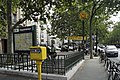
Many of the entrances to the tunnel stations are marked by masts with lamps and / or the word METRO or an “M” in a double circle.

Still typical of many approaches: decor designed by Hector Guimard in the Art Nouveau style at the Kléber station

By Adolphe Dervaux designed Art Deco - candelabra at the underground station Trocadéro
Yellow "M" in a double circle at the Dugommier station

Access with a modern sign at the Bercy transfer station


_May_27,_2010.jpg)

Elevated train stations


The stations in the viaduct area have 4.10 meter wide side platforms on the two parallel tracks. Two longitudinal beams, each resting on a row of iron columns, carry the track bed and the inner edges of the platforms. Their outer edges and the side walls rest on two further longitudinal girders, which are supported by brick pillars. At the four corners of the station, a pillar protrudes over the roof for design reasons. The stations are provided with a saddle roof - glass near the ridge - which also spans the tracks. The brick side walls show geometric ornaments on the outside.
The elevated stations have access stairs at one end, and at both ends of the Bir-Hakeim station, which begins in the middle under the viaduct and divides into two narrower stairs at an intermediate landing almost halfway up. They lead from there, often swiveled 180 degrees, to the two side platforms. In the lower part, designed as an open staircase, the access structure is enclosed and glazed in the upper part. Additional escalators and, in some cases, elevators were installed subsequently. The Corvisart station is a special case, where the stairs are integrated into a brick viaduct section.
Other stations

- Charles de Gaulle - Étoile : Tunnel station located within an end loop with only one track, which is flanked by two side platforms. The northern platform is only used for boarding, the southern one for getting passengers off ( Spanish solution ).
- Kléber : Originally it was a typical tunnel station with elliptical, tiled ceiling vaults, the side platforms of which were on two main tracks. Since the capacity of the nearby single-track terminus Charles de Gaulle - Étoile could not be increased, the Kleber station was expanded. The platforms on the two newly laid tracks on both sides of the old station were connected to their side platforms via large wall breakthroughs in such a way that there are now two central platforms on two main tracks each.
- Passy : There the route emerges from the north-western, steep embankment and then leads over the Seine on the Viaduc de Passy ( Pont de Bir-Hakeim ). The station is partly still in the tunnel, partly on the following viaduct. In contrast to the elevated train stations, only the side platforms, but not the tracks, are covered.
- Saint-Jacques : The station is located in a cut between the two carriageways of the Boulevard Saint-Jacques, which rises from east to west. Only the platforms on both sides of the tracks are covered. The brick entrance building is unique. Immediately to the west is the mouth of the tunnel, to the east of the station the route rises and becomes an elevated railway.
- Bel-Air : Located between the lanes of the Boulevard de Picpus, the station crosses the abandoned railway line to the former Gare de la Bastille station at its southern end . The route disappears into the tunnel on both sides.
- Nation : The station is located within an underground final loop. It has a central platform and is only used in one direction. During the rush hour , the two platform tracks are used alternately, in the off- peak hours the trains turn heads on the southern platform track .
vehicles

Like all Paris metro lines with the exception of line 11 , line 6 is also used by only one type of vehicle. In their case, it is the MP 73 series , which was specially developed and built for this line. They are trains running on nitrogen-filled rubber tires, which run in five-part units, each with an electric railcar at the ends, with a railcar without a driver's cab and two sidecars in between . They run on steel or concrete chassis beams attached to both sides of the track. The side rails, which keep the train on the track, also serve to supply power.
The first vehicles on the route were short, two-axle motor coaches and sidecars with wooden superstructures. The 7.68 meter long railcars belonged to a small series with driver's cabs on both sides, which were moved to the other end of the train due to the lack of reversing loops at Trocadéro and (from November 1903) Passy. As a result of the Couronnes disaster , these railcars were replaced by longer ones, the driver's cabs of which had metal superstructures and which, for better cornering, ran on bogies. After the extension to Place d'Italie was put into operation, longer trains (than the maximum four vehicles up until then) could be used with one multiple unit at each end of the train and sidecars lined up in between - initially two-axle.
The successors were trains of the Sprague-Thomson type , which still ran “classically” with steel wheels on rails. The 72 m long five-car trains painted green with a red 1st class area shaped the route and line 6 until July 1974. For a short time that year they ran in mixed traffic with the new, rubber-tired trains.
Name changes of stations
During the more than 100-year history of the Paris Metro, the official names of a number of stations have changed. Some stations have even been renamed several times. The following stations were affected on line 6:
| today's name | since | previous name (s) |
|---|---|---|
| Sèvres - Lecourbe | 1913 | until 1907: Avenue de Suffren 1907–1913: Rue de Sèvres |
| La Motte-Picquet - Grenelle | 1913 | La Motte-Picquet |
| Picpus | 1937 | Saint-Mandé |
| Dugommier | 1939 | Charenton |
| Montparnasse - Bienvenüe | 1942 | Montparnasse |
| Bir-Hakeim | 1949 | Grenelle |
| Charles de Gaulle - Étoile | 1970 | Étoile |
Remarks
- ↑ At the similarly constructed elevated railway stations on Line 2, the side walls are glazed and only the platforms, but not the tracks, are covered.
Web links
- Plan of the tracks and platforms of the Charles de Gaulle - Étoile and Kléber underground stations at cartometro.com
- Plan of the tracks and platforms of the Place d'Italie metro station and the surrounding stations at cartometro.com
- Plan of the tracks and platforms of the Nation terminus at cartometro.com
literature
- Jean Tricoire: Un siècle de métro en 14 lignes: De Bienvenüe à Météor . 3. Edition. La Vie du Rail, Paris 2004. ISBN 2-915034-32-X .
Individual evidence
- ^ Jean Robert: Notre Métro . 2nd Edition. J. Robert, Neuilly-sur-Seine 1983, p. 30th f .
- ↑ Jean Tricoire: op. Cit. , P. 218.
- ↑ Jean Tricoire: op..cit. , P. 209.
- ↑ Jean Tricoire: op..cit. , P. 196.
- ^ Jean Tricoire: Un siècle de métro en 14 lignes. De Bienvenüe à Météor . 2nd Edition. La Vie du Rail, Paris 2000, ISBN 2-902808-87-9 , p. 210 .
- ↑ Jean Robert: op..cit. , P. 206.
- ↑ Jean Tricoire: op. Cit. , P. 48.
- ^ Brian Hardy: Paris Metro Handbook . 3. Edition. Capital Transport Publishing, Harrow Weald 1999, ISBN 1-85414-212-7 , pp. 36 .
- ^ Gérard Roland: Stations de métro d'Abbesses à Wagram . Christine Bonneton, Clermont-Ferrand 2011, ISBN 978-2-86253-382-7 , pp. 124 .
- ↑ Jean Tricoire: op. Cit. , P. 21.
- ↑ Jean Tricoire: op. Cit. , P. 24.
- ↑ Le métro parisien sous l'occupation at archivchemindefer.free.fr, accessed on August 20, 2017
- ↑ Mark Ovenden: Paris Underground . Penguin Books, London 2009, ISBN 978-0-14-311639-4 , pp. 77 .
- ↑ Jean Tricoire: op. Cit. , P. 211.
- ↑ Jean Robert: op..cit. , P. 191.
- ↑ Jean Robert: op..cit. , P. 191.
- ↑ Jean Tricoire: op. Cit. , P. 38.
- ↑ Jean Tricoire: op. Cit. , P. 49.
- ↑ a b Jean Robert: op..cit. , P. 207.
- ^ Julian Pepinster: Le métro de Paris . Éditions La Vie du Rail, Paris 2010, ISBN 978-2-918758-12-9 , p. 66 .
- ↑ Jean Robert: op..cit. , P. 243.
- ↑ Jean Tricoire: op.cit. , P. 51.
- ↑ Jean Tricoire: op.cit. , P. 53.
- ↑ Jean Robert: op..cit. , P. 268.
- ^ Gérard Roland: op.cit. , P. 114 f.
Métro : • Grand Paris Express : •
RER : •
![]()
![]()
![]()
![]()
![]()
![]()
![]()
![]()
![]()
![]()
![]()
![]()
![]()
![]()
![]()
![]()
![]()
![]()
![]()
![]()
![]()
![]()
![]()
![]()
![]()
![]()
![]()
Transilien : •
Tram Express Nord • Tram Express Ouest • Tram Express Sud •
![]()
![]()
![]()
![]()
![]()
![]()
![]()
![]()
![]()
Tram : •
Bus •
Noctilien •
Funiculaire de Montmartre • OrlyVal • CDGVAL • LISA •
CDG Express![]()
![]()
![]()
![]()
![]()
![]()
![]()
![]()
![]()
![]()
![]()
![]()
![]()
![]()