
Principal channel
| Principal channel | |
|---|---|
 The principal channel at Nagykanizsa. |
|
| location | Hungary , Zala county |
| length | 57.4 km |
| Built | 1802 |
| Beginning | Misefa ( 46 ° 47 '49 " N , 16 ° 59' 12.8" O ) |
| The End | Murakeresztúr ( 46 ° 19 ′ 23.99 ″ N , 16 ° 52 ′ 23.12 ″ E ) |
| Used river | Bakónaki-patak, Berki-patak |
 |
|

| ||
Beginning and end of the principal channel |
The Prinzipal Canal (also: Principális- or Hauptkanal ; Hungarian Principális csatorna ) is a non-navigable drainage canal in southwest Hungary , in Zala County .
The watercourse, built in 1802, primarily serves to improve drainage in the valley of the same name (Principális-völgy) to the south towards the Mur River . A real waterway connection between the two rivers Mur and Zala does not exist today; There is no continuous body of water at Misefa for around 750 meters.
course
The canal runs in a riedel typical of the Zala hill country in a north-south direction. The main purpose of the canal is to drain swamps, as in Felsőrajk .
The highest point, quasi the source, is located south of the village of Misefa (near Nagykapornak) at 159 m in the Zala hill country , which here reaches heights of up to 305 m (Kő-hegy) . The Foglárbach , which flows north and is also canalized, is only 750 meters away at the watershed in wet meadows , which flows into the Zala river from the right after 20 km south of Pakod , but is not part of the actual course of the principal canal .
After its source at Misefa, the principal channel crosses and drains the swampy lowlands south of Nemesrádó and takes some backwaters (from the west: Kacorlaki-patak, Kürtös-patak, Homoki-patak, Mántai-patak, Berki-patak as well as Bakónaki-patak and Visszafolyós-patak from the east). It runs west of the city of Nagykanizsa and here turns slightly to the southwest, whereby its water flow increases (mean flow rate: 0.58 m³ / s). It runs in a straight line along the Miklósfa fish ponds, before following the naturally winding course of the Berki-patak brook to the east of Murakeresztúr and south of the village of Kollátszeg below the Zrínyiújvár castle and the Belezna railway stop at around 125 m in the Slovenian-Hungarian border river Mur flows into the Drava a few kilometers from where it flows .
At Nagykapornak the canal is crossed by national road 76 , at Pacsa by national road 75 , at Pötrete by the Zalaszentiván –Nagykanizsa railway line , at Korpavar by national road 74 . To the west of the city of Nagykanizsa, the canal is crossed by the M7 motorway , national road 7 .
On September 7, 2014 , a high water level of 258 cm was read at the Nagykanizsa gauge; in 1993, it reached 248 cm. Protective measures had to be taken to protect one hundred homes in Kiskanizsa .
Cities and towns on the canal
The largest city on the canal is Nagykanizsa .
Web links
- ^ Magical Hungary: Angling and fishing in Hungary - The Principal Canal ; accessed on August 16, 2018
- ↑ Horgasz.hu ; accessed on August 16, 2018
- ↑ Opentopomap
Historical maps
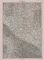
Southern course of the Prinzipal Canal, end of the 19th century (recording sheet of the land survey )

Northern course of the Principal Canal

