Chiriquí province
| Chiriquí | |
|---|---|
| Location of Chiriquí in Panamá | |
| Data | |
| Capital | David |
| population | 406,000 |
| surface | 6,477 km² |
| Population density | 63 people / km² |
| structure | 13 |
| Highest elevation | Volcán Barú 3,477 m above sea level d. M. |
| ISO 3166-2 | PA-4 |
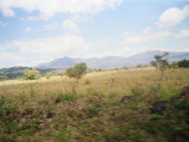
| On the Panamericana through Chiriquí | |
The province of Chiriquí is located in western Panama on the border with Costa Rica .
It is divided into 13 districts ( distritos ) (the respective capital in brackets):
- Alanje (Alanje)
- Baru (Puerto Armuelles)
- Boquerón (Boquerón)
- Boquete ( Bajo Boquete )
- Bugaba (La Concepción)
- Davíd ( David )
- Dolega (Dolega)
- Gualaca (Gualaca)
- Remedios (Remedios)
- Renacimiento (Río Sereno)
- San Lorenzo (Horconcitos)
- San Félix (Las Lajas)
- Tolé ( Tolé )
The main border crossing to Costa Rica , Paso Canoas , is also in this province. The Panamericana connects the border crossing with the next big city, Davíd .
history
Until the arrival of the Spanish conquerors, Chiriquí was inhabited by various Indian tribes (Changuinas, Zurias, Boquerones, Buricas, Doraces, Bugabas and Gualacas).
The Spaniard Gaspar de Espinosa discovered this region in 1519, the province was established on May 26, 1849, at the time when today's Panama was part of Greater Colombia .
economy
The largest economic pillar of this province is agriculture , which gives rise to the majority of the food produced in Panama.
tourism
Tourism is also gaining a foothold in Chiriquí, the most popular destinations are:
- Bajo Boquete , not big, but now one of the most relevant cities in Panama for tourists, a small coffee village in the north of Chiriquí.
- In the south is the marine national park Gulf of Chiriquí , if you follow the Panamericana further east you come to the very popular beach village of Las Lajas / San Felix.
- The Volcán Barú , which is located in the Parque Nacional Vulcan Barú National Park and can also be climbed. It is located near Bajo Boquete. The national bird of Panama, the quetzal , is said to be spotted particularly often here.
- The Parque Internacional La Amistad extends into the far north of Chiriquí, but is largely in the province of Bocas del Toro and is a common national park of Costa Rica and Panama.
- Playa Las Lajas is one of the longest palm-sand beaches in Central America. Tourism is slowly discovering this unique beach.
Web links
- Chiriqui.org - website of the province with photos and lots of information (Spanish / English)
- Website of a species protection project in Chiriqui
- German-language Panama info page
Coordinates: 8 ° 30 ′ N , 82 ° 30 ′ W


