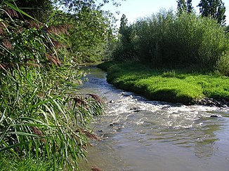
Río Alhama (Ebro)
| Rio Alhama | ||
|
Río Alhama near Alfaro |
||
| Data | ||
| location | northern Spain | |
| River system | Ebro | |
| Drain over | Ebro → Mediterranean | |
| source |
Sierra de Almuerzo 41 ° 51 ′ 25 ″ N , 2 ° 13 ′ 35 ″ W. |
|
| Source height | approx. 1595 msnm | |
| muzzle |
Ebro coordinates: 42 ° 11 '2 " N , 1 ° 43' 5" W 42 ° 11 '2 " N , 1 ° 43' 5" W. |
|
| Mouth height | approx. 305 msnm | |
| Height difference | approx. 1290 m | |
| Bottom slope | approx. 15 ‰ | |
| length | approx. 84 km | |
| Catchment area | 1254 km² | |

The Rio Alhama is an approximately 84 km long southern tributary of the Ebro in the northern Spanish provinces of Soria , Navarra and La Rioja .
course
The Río Alhama rises - depending on rainfall or meltwater - at an altitude of approx. 1595 m in the Sierra del Almuerzo , part of the Iberian Mountains , in the municipality of Suellacabras . It flows mainly in a north-easterly direction and flows into the Ebro about 2 km east of Alfaro .
Tributaries
|
Left |
right
|
places
Magaña , Cigudosa , Aguilar del Río Alhama , Cervera del Río Alhama , Fitero , Cintruénigo , Corella , Alfaro
Attractions
The upper reaches of the river are lined with forests. Almost every town on the banks of the Río Alhama offers cultural attractions. Particularly noteworthy is the well-preserved Cistercian monastery of Santa María la Real in Fitero from the 12th / 13th. Century.
Web links
- Río Alhama - Photos + Quick Facts (wikirioja, Spanish)
