Río Chokeyapu
| Choqueyapu | ||
|
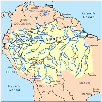
Amazon basin with the Río de la Paz (purple) |
||
| Data | ||
| location | Bolivia | |
| River system | Amazon | |
| Drain over | Río de la Paz → Río Beni → Madeira → Amazon → Atlantic | |
| source |
Laguna Pampalarama 16 ° 19 ′ 50 ″ S , 68 ° 4 ′ 45 ″ W |
|
| Source height | 4486 m | |
| muzzle | Transition to the Río de la Paz Coordinates: 16 ° 33 ′ 20 ″ S , 68 ° 5 ′ 39 ″ W 16 ° 33 ′ 20 ″ S , 68 ° 5 ′ 39 ″ W. |
|
| Mouth height | 3221 m | |
| Height difference | 1265 m | |
| Bottom slope | 33 ‰ | |
| length | 38.4 km | |
| Catchment area | 489 km² | |
| Big cities | La Paz | |
| Residents in the catchment area | around 1 million | |
|
Upper Choqueyapu |
||

The Río Chokeyapu (often written Choqueyapu ) is a river in the Andes of Bolivia .
course
The Río Chokeyapu has its origins in the Cordillera Oriental about 35 kilometers north of the metropolis of La Paz on the slopes of the Charquini and Wilamanquilisani peaks . The source of the water is the Laguna Pampalarama , a mountain lake about 250 m long and 150 m wide, located at an altitude of 4486 m and fed by several periodically flowing mountain streams. The Chokeyapu flows through the Chakanta valley in a southerly direction and after twenty kilometers reaches the northern outskirts of La Paz at an altitude of 4000 m .
On the way through the city, the little river, which usually has little water, is squeezed into a concreted streambed and in the city center is led underground for about four kilometers. At an altitude of 3365 m , the Río Chokeyapu meets the Río Orko Jahuira, which flows in from the left, at kilometer 31 and another four kilometers later the Río Irpavi , which also flows from the left, both of which also have only a low water flow . After a total of 36 km, the Chokeyapu leaves the La Paz basin in a southerly direction. From there it bears the name Río de la Paz , breaks through the Cordillera Real and then flows north to the confluence with the Río Beni , which drains over the Rio Madeira into the Amazon .
Tributaries
The Río de la Paz and especially the Río Chokeyapu as its upper course cut from the east into an area of the Altiplano that drains south , so that the following noteworthy tributaries flow into the river only from the north and thus from the left :
- Orko Jahuira; 29.1 km, 91.8 km²
- Irpavi; 32 km, 162.9 km²
- Achumani; 15.7 km, 62.1 km²
- Huayñajahuira; 10.1 km, 17.8 km²
The water supply of the city of La Paz also brings water from neighboring rivers to the west that drain the mountain region of the Huayna Potosi to the Altiplano. At Mallasa this water flows to the river together with the water collected in the catchment area of the Chokeyapu from the central sewage treatment plant of La Paz. This influx fluctuates between 2 m³ / s and 2.5 m³ / s.
Environmental situation
The valley slopes of the Chokeyapu are partly unstable as a result of mining activities and are also being eroded as surface water from the city flows into this trench.
In the year of the mountains , a worldwide architectural competition was held to develop design options for this central space. It was about on the one hand existing systems in the area, such as B. to integrate the Kusillo Museum on the orographic left side of the valley and, on the other hand, to upgrade the entire valley as a park landscape and urban connecting space. The concept of Axel Lohrer and Ursula Hochrein is currently being implemented in sub-projects. Further prizes were given to the offices of Aidin, Peter Bedner , Mallon, Morandi, Plinston, Valenzuela and Wagner.
Surname
The name is partly understood as a combination of the Aymara words chuqi ("fine gold ") and apu ("high lord"), partly as a combination of ch'uqi ("potato") and yapu ("estate"), which refers to potato fields in the basin. The location of La Paz is still called "Chuquiyapu Marka" or "Chuquiago Marka" ( Marka : "place") by the Aymara .
Individual evidence
- ↑ a b c d Ministerio de Medio Ambiente y Agua (ed.): Plan Maestro Metropolitano de Agua Potable y Saneamiento de La Paz y El Alto, Informe Especial Nro. 2: Estrategia de Saneamiento ( page no longer available , search in web archives ) Info: The link was automatically marked as defective. Please check the link according to the instructions and then remove this notice. , La Paz 2013; Retrieved June 18, 2014
- ↑ Ramiro Fernández: Río Choqueyapu, el caudal del oro , Ecologia, Medio Ambiente Bolivia. Informacion de medio ambiente y propuestas verdes en Bolivia 2008


