Rat Island (Houtman-Abrolhos)
| Council Iceland | ||
|---|---|---|
| Aerial view of Rat Island (view from the north). | ||
| Waters | Indian Ocean | |
| Archipelago | Easter Group ( Houtman-Abrolhos Archipelago ) | |
| Geographical location | 28 ° 43 ′ S , 113 ° 47 ′ E | |
|
|
||
| length | 1.6 km | |
| width | 600 m | |
| surface | 0.65 km² | |
| Highest elevation | 5 m | |
| Residents | uninhabited | |
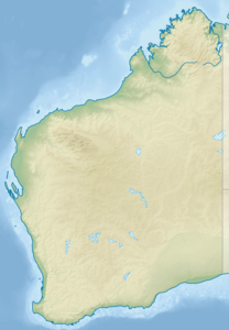
Rat Island is located in the Indian Ocean around 80 km west of the western Australian coastal town of Geraldton . The approximately 0.65 km² island is the largest in the Easter Group , the central archipelago in the Houtman Abrolhos Archipelago .
geography
The wedge-shaped and consistently flat island is surrounded by a dense coral reef, which also includes the neighboring islands of Bushby Island , Little Rat Island , Roma Island , Little Roma Island and Dry Island to the south . Rat Island can be reached via the Good Friday Bay (" Good Friday Bay ") in the north. Good Friday Bay provides a safe anchorage. There is a jetty on the northeast side.
use
The island is only inhabited seasonally by a few lobster fishermen and their families. Their accommodations are densely packed along the entire east coast of the island. The lobster season runs from March 15th to June 30th.
In the southwest of the island is Big Rat Airstrip , a 600 m long, paved sand runway for small aircraft ( 28 ° 43 ′ 11.3 ″ S , 113 ° 47 ′ 2.4 ″ E ).


