Pelsaert Islands

from Wikipedia, the free encyclopedia
Pelsaert Islands
NASA Landsat image of the Pelsaert Islands
NASA landsat image of the Pelsaert Islands
Waters Indian Ocean
archipelago Houtman Abrolhos Archipelago
Geographical location 28 ° 56 ′  S , 113 ° 55 ′  E Coordinates: 28 ° 56 ′  S , 113 ° 55 ′  E
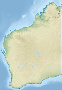
Pelsaert Islands (Western Australia)
Pelsaert Islands
Number of islands approx. 60
Main island Pelsaert Island
Total land area 2.5 km²
Residents uninhabited

The Pelsaert Islands ( English Pelsaert Group ) are a small group of islands in the Indian Ocean , about 50 km off the coast of Western Australia . They represent the southernmost group in the Houtman-Abrolhos Archipelago and at the same time the southernmost coral reef in the Indian Ocean.

geography

The island area is about 10 km southeast of the Easter Group , the central archipelago in the Houtman-Abrolhos Archipelago, separated by the Zeewijk Channel .

Islands

The group includes, in addition to a large number of reef and small rock formations , u. a. the following islands:

f1Georeferencing Map with all coordinates: OSM | WikiMap

 
Island name Coordinates Area
1 Iceland ! 471.0913895613.883614528 ° 54 ′ 31 ″ S, 113 ° 53 ′ 1 ″ E 000000000017661.000000000017,661
2 Iceland ! 471.0913895613.879448528 ° 54 ′ 31 ″ S, 113 ° 52 ′ 46 ″ E 000000000003207.00000000003,207
3 Iceland ! 471.0938895613.872498528 ° 54 ′ 22 ″ S, 113 ° 52 ′ 21 ″ E 000000000017166.000000000017.166
7 Iceland ! 471.0944445613.857498528 ° 54 ′ 20 ″ S, 113 ° 51 ′ 27 ″ E 000000000004419.00000000004,419
8 Iceland ! 471.1016675613.861664528 ° 53 ′ 54 ″ S, 113 ° 51 ′ 42 ″ E 000000000006154.00000000006.154
Arthur Island ! 471.1030565614.004448528 ° 53 ′ 49 ″ S, 114 ° 0 ′ 16 ″ E 000000000005671.00000000005,671
Basile Island ! 471.1249995613.962776528 ° 52 ′ 30 ″ S, 113 ° 57 ′ 46 ″ E 000000000010554.000000000010,554
Burnett Island ! 471.1286115613.964996528 ° 52 '17 "S, 113 ° 57' 54" E 000000000023782.000000000023,782
Burton Island ! 471.1347225613.986664528 ° 51 ′ 55 ″ S, 113 ° 59 ′ 12 ″ E 000000000012731.000000000012,731
Coronation Island ! 471.1305565613.987221528 ° 52 ′ 10 ″ S, 113 ° 59 ′ 14 ″ E 000000000028529.000000000028,529
Davis Island ! 471.0861115613.877502528 ° 54 '50 "S, 113 ° 52' 39" E 000000000018080.000000000018,080
Diver Island ! 471.1338885613.974442528 ° 51 ′ 58 ″ S, 113 ° 58 ′ 28 ″ E 000000000002298.00000000002,298
Foale Island ! 471.1219445614.004997528 ° 52 ′ 41 ″ S, 114 ° 0 ′ 18 ″ E 000000000000970.0000000000970
Gaze Island ! 471.1372225613.991386528 ° 51 ′ 46 ″ S, 113 ° 59 ′ 29 ″ E 000000000007031.00000000007,031
Gregory Island ! 471.1025015614.006111528 ° 53 ′ 51 ″ S, 114 ° 0 ′ 22 ″ E 000000000008492.00000000008,492
Gun Island ! 471.1136115613.859726528 ° 53 '11 "S, 113 ° 51' 35" E 000000000190591.0000000000190,591
Hummock Island ! 471.2000015614.040001528 ° 48 ′ 0 ″ S, 114 ° 2 ′ 24 ″ E 000000000028562.000000000028,562
Iris Refuge Island ! 471.1205565614.004021528 ° 52 ′ 46 ″ S, 114 ° 0 ′ 14 ″ E 000000000001082.00000000001,082
Jackson Island ! 471.1291685614.001114528 ° 52 ′ 15 ″ S, 114 ° 0 ′ 4 ″ E 000000000017415.000000000017,415
Jon Jim Island ! 471.0133325613.961388528 ° 59 ′ 12 ″ S, 113 ° 57 ′ 41 ″ E 000000000003857.00000000003,857
Lagoon Island ! 471.1283345613.996109528 ° 52 ′ 18 ″ S, 113 ° 59 ′ 46 ″ E 000000000005831.00000000005,831
Little Jackson Island ! 471.1277775614.003891528 ° 52 ′ 20 ″ S, 114 ° 0 ′ 14 ″ E 000000000012000.000000000012,000
Middle Island ! 471.0922225613.912224528 ° 54 ′ 28 ″ S, 113 ° 54 ′ 44 ″ E 000000000217585.0000000000217,585
Murray Island ! 471.1027775613.898056528 ° 53 '50 "S, 113 ° 53' 53" E 000000000043236.000000000043,236
Newbold Island ! 471.1190415614.004997528 ° 52 ′ 51 ″ S, 114 ° 0 ′ 18 ″ E 000000000000718.0000000000718
Newman Island ! 471.1363895613.996948528 ° 51 ′ 49 ″ S, 113 ° 59 ′ 49 ″ E 000000000064417.000000000064,417
Nook Island ! 471.1349995614.001114528 ° 51 ′ 54 ″ S, 114 ° 0 ′ 4 ″ E 000000000001516.00000000001,516
Pelsaert Island ! 471.0380555613.960281528 ° 57 ′ 43 "S, 113 ° 57 ′ 37" E 000000001556278.00000000001,556,278
Post Office Island ! 471.1352775613.976669528 ° 51 ′ 53 "S, 113 ° 58 ′ 36" E 000000000070016.000000000070.016
Robertson Island ! 471.1183345614.004997528 ° 52 ′ 54 ″ S, 114 ° 0 ′ 18 ″ E 000000000004039.00000000004,039
Rotondella Island ! 471.1286115613.997498528 ° 52 ′ 17 ″ S, 113 ° 59 ′ 51 ″ E 000000000000881.0000000000881
Sid Liddon Island ! 471.0894455613.865281528 ° 54 ′ 38 ″ S, 113 ° 51 ′ 55 ″ E 000000000008812.00000000008,812
Square Island ! 471.0994455613.945831528 ° 54 ′ 2 ″ S, 113 ° 56 ′ 45 ″ E 000000000007584.00000000007,584
Stick Island ! 471.1111115613.921669528 ° 53 ′ 20 ″ S, 113 ° 55 ′ 18 ″ E 000000000024231.000000000024,231
Sweet Island ! 471.0836115613.873886528 ° 54 '59 "S, 113 ° 52' 26" E 000000000021454.000000000021,454
Uncle Margie Island ! 471.1327785613.968331528 ° 52 ′ 2 ″ S, 113 ° 58 ′ 6 ″ E 000000000015501.000000000015,501

Subgroups

Some of the islands to the northeast form the Mangrove Group , including Newman Island and Post Office Island .

Other islands in the west form the subgroup of the Numbered Islands (literally Numbered Islands ), including 1 Island , 2 Island , 3 Island , 7 Island and 8 Island .

history

The name of the archipelago (as well as the main island Pelsaert Island ), which was discovered at the end of the 16th century, was given in honor of François Pelsaert , commander of the Dutch merchant ship Batavia, which sank in 1629 off the reefs of the Wallabi Islands, 10 km to the north . After the Batavia stranded , Pelsaert sailed with a few sailors in a simple lifeboat as far as Jakarta and later returned to the site of the accident to rescue the survivors of the accident. Due to a bloody mutiny in the meantime , however, he found only a few survivors.

On June 9, 1727, another Dutch merchant ship, the " Zeewijk " with a crew of 208 , ran aground in Half Moon Reef on the Pelsaert Islands . Survivors of the accident were able to save themselves on Gun Island and 82 of them reached the original destination of Batavia on April 30, 1728 in a self-built boat (" Sloepie ").

use

Today all islands are uninhabited due to a lack of drinking water sources. To protect fauna and flora, they may only be entered with special permission.

See also

Web links