East Wallabi Island
| East Wallabi Island | ||
|---|---|---|
|
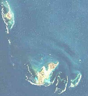
NASA landsat image of the Wallabi Islands. East Wallabi in the middle of the picture. |
||
| Waters | Indian Ocean | |
| Archipelago | Wallabi Islands ( Houtman Abrolhos Archipelago ) | |
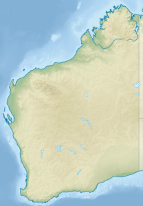
| Geographical location | 28 ° 26 '23 " S , 113 ° 43' 33" O | |
|
|
||
| length | 3.3 km | |
| width | 1.8 km | |
| surface | 3.27 km² | |
| Highest elevation |
Flag Hill 15 m |
|
| Residents | uninhabited | |
| Nautical chart from 1723 | ||
East Wallabi Island is located in the Indian Ocean 88 km northwest of the western Australian coastal town of Geraldton . The 3.27 km² island is the second largest of the Houtman Abrolhos Archipelago (after the western, much larger neighboring island of West Wallabi Island ) and has the highest point in the entire archipelago with the 15 meter high Flag Hill .
The name wallabi goes back to a genus of smaller kangaroos , the wallabies , which can be found here occasionally.
geography
The island is located in the center of the Wallabi Islands , 20 km southeast of North Island and just under 2 km northeast of West Wallabi Island , the largest of the Houtman-Abrolhos. It is surrounded in the southwest by a dense coral reef that is only just below sea level , so that the neighboring island of West Wallabi can be reached on foot when the water level is normal.
Flag Hill , with 15 meters the highest point of the Houtman Abrolhos, lies close to the coast in the northeast of the island. Eagle Hill , 9 meters high, is located in the southeast, also near the coast.
history
The islands of East Wallabi and West Wallabi gained historical importance in connection with the Dutch merchant ship Batavia, which was stranded in the Morning Reef of the Wallabi Islands in 1629 . While some of the survivors started a bloody mutiny on Beacon Island, about 7 km south-east, 40 officers loyal to the captain were able to holed up on West Wallabi. There and on East Wallabi Island there was enough fresh water (from rainwater cisterns ) and abundant food sources.
use
East Wallabi is uninhabited. In the east of the island, however, there is a 650 meter long, paved sand runway for small aircraft ( 28 ° 26 ′ 12.8 ″ S , 113 ° 44 ′ 6.8 ″ E ).
East Wallabi Island may only be entered with special permission to protect fauna and flora.


