| Island name |
Coordinates |
Area
ha
|
|
Akerstrom Island
|
! 471.5255555613.698891528 ° 28 ′ 28 ″ S, 113 ° 41 ′ 56 ″ E
|
000000000000001.14900000001.149
|
|
Alcatraz Island
|
! 471.5391675613.723053528 ° 27 '39 "S, 113 ° 43' 23" E
|
000000000000000.06900000000.069
|
|
Barge rock
|
! 471.5497235613.721664528 ° 27 ′ 1 ″ S, 113 ° 43 ′ 18 ″ E
|
000000000000000.13700000000.137
|
|
Beacon Island
|
! 471.5250005613.785835528 ° 28 ′ 30 ″ S, 113 ° 47 ′ 9 ″ E
|
000000000000002.77800000002,778
|
|
Dakin Island
|
! 471.5244455613.808609528 ° 28 ′ 32 "S, 113 ° 48 ′ 31" E
|
000000000000000.93200000000.932
|
|
Dick Island
|
! 471.5038895613.766670528 ° 29 ′ 46 ″ S, 113 ° 46 ′ 0 ″ E
|
000000000000003.46300000003.463
|
|
Eagle Point Islet 1)
|
! 471.5544455613.728615528 ° 26 '44 "S, 113 ° 43' 43" E
|
000000000000000.07800000000.078
|
|
East Mangrove Island 1)
|
! 471.5258335613.701294528 ° 28 ′ 27 ″ S, 113 ° 42 ′ 5 ″ E
|
000000000000000.04700000000.047
|
|
East Wallabi Island
|
! 471.5627785613.730553528 ° 26 '14 "S, 113 ° 43' 50" E
|
000000000000321.6050000000321,605
|
|
Eastern Island
|
! 471.5355555613.813614528 ° 27 ′ 52 ″ S, 113 ° 48 ′ 49 ″ E
|
000000000000002.63500000002.635
|
|
Far Island
|
! 471.5394445613.807220528 ° 27 '38 "S, 113 ° 48' 26" E
|
000000000000000.08200000000.082
|
|
First sister
|
! 471.5233335613.744164528 ° 28 ′ 36 "S, 113 ° 44 ′ 39" E
|
000000000000000.41200000000.412
|
|
Hall Island
|
! 471.5286105613.811111528 ° 28 ′ 17 "S, 113 ° 48 ′ 40" E
|
000000000000000.08100000000.081
|
|
Little Pigeon Island
|
! 471.5383345613.723610528 ° 27 '42 "S, 113 ° 43' 25" E
|
000000000000001.61000000001.610
|
|
long Island
|
! 471.5283345613.773613528 ° 28 ′ 18 ″ S, 113 ° 46 ′ 25 ″ E
|
000000000000011.833000000011.833
|
|
Marinula Island
|
! 471.5258335613.700554528 ° 28 ′ 27 ″ S, 113 ° 42 ′ 2 ″ E
|
000000000000000.20800000000.208
|
|
Naturalist Island 1)
|
! 471.5245785613.744026528 ° 28 ′ 32 "S, 113 ° 44 ′ 38" E
|
000000000000000.02600000000.026
|
|
North Island 2)
|
! 471.7008325613.595558528 ° 17 '57 "S, 113 ° 35' 44" E
|
000000000000182.4000000000182,400
|
|
Oystercatcher Island
|
! 471.5377775613.714722528 ° 27 '44 "S, 113 ° 42' 53" E
|
000000000000004.74300000004,743
|
|
Pelican Island
|
! 471.5411115613.677498528 ° 27 '32 "S, 113 ° 40' 39" E
|
000000000000000.29000000000.290
|
|
Pigeon Island
|
! 471.5455555613.726944528 ° 27 '16 "S, 113 ° 43' 37" E
|
000000000000004.21600000004.216
|
|
Plover Island
|
! 471.5327785613.713058528 ° 28 ′ 2 "S, 113 ° 42 ′ 47" E
|
000000000000000.26300000000.263
|
|
Saville-Kent Island
|
! 471.5258335613.809723528 ° 28 ′ 27 ″ S, 113 ° 48 ′ 35 ″ E
|
000000000000000.45100000000.451
|
|
Seagull Island
|
! 471.5430565613.716942528 ° 27 ′ 25 ″ S, 113 ° 43 ′ 1 ″ E
|
000000000000007.61400000007.614
|
|
Seal Island
|
! 471.5166665613.803612528 ° 29 ′ 0 ″ S, 113 ° 48 ′ 13 ″ E
|
000000000000000.88700000000.887
|
|
Second sister
|
! 471.5158335613.741943528 ° 29 ′ 3 ″ S, 113 ° 44 ′ 31 ″ E
|
000000000000000.09100000000.091
|
|
Shag rock
|
! 471.5255555613.713333528 ° 28 ′ 28 ″ S, 113 ° 42 ′ 48 ″ E
|
000000000000000.12100000000.121
|
|
Short Island 1)
|
! 471.5366675613.773163528 ° 27 '48 "S, 113 ° 46" 23 "E
|
000000000000000.15000000000.150
|
|
Tattler Island
|
! 471.5316665613.707222528 ° 28 ′ 6 "S, 113 ° 42 ′ 26" E
|
000000000000000.68900000000.689
|
|
Tectus Island 1)
|
! 471.5259675613.743736528 ° 28 ′ 27 ″ S, 113 ° 44 ′ 37 ″ E
|
000000000000000.03700000000.037
|
|
Third sister
|
! 471.5052785613.741386528 ° 29 ′ 41 ″ S, 113 ° 44 ′ 29 ″ E
|
000000000000000.20800000000.208
|
|
Traitors Island
|
! 471.5163885613.785004528 ° 29 ′ 1 ″ S, 113 ° 47 ′ 6 ″ E
|
000000000000000.09400000000.094
|
|
Turnstone Island
|
! 471.5483345613.717224528 ° 27 ′ 6 ″ S, 113 ° 43 ′ 2 ″ E
|
000000000000001.30900000001.309
|
|
When Iceland
|
! 471.5288895613.763885528 ° 28 ′ 16 ″ S, 113 ° 45 ′ 50 ″ E
|
000000000000000.07000000000.070
|
|
West Wallabi Island
|
! 471.5366675613.696114528 ° 27 ′ 48 ″ S, 113 ° 41 ′ 46 ″ E
|
000000000000621.5000000000621,500
|
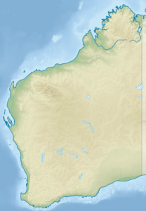
![]() Map with all coordinates: OSM | WikiMap
Map with all coordinates: OSM | WikiMap


