Revúca (river)
| Revúca | ||
|
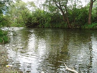
The Revúca near Biely Potok |
||
| Data | ||
| location | Slovakia | |
| River system | Danube | |
| Drain over | Waag → Danube → Black Sea | |
| source | below the mountain Ostredok 48 ° 53 ′ 21 ″ N , 19 ° 6 ′ 52 ″ E |
|
| Source height | 1250 m | |
| muzzle | in Ružomberok coordinates: 49 ° 4 ′ 59 " N , 19 ° 18 ′ 25" E 49 ° 4 ′ 59 " N , 19 ° 18 ′ 25" E |
|
| Mouth height | 475 m | |
| Height difference | 775 m | |
| Bottom slope | 23 ‰ | |
| length | 33 km | |
| Catchment area | 265 km² | |
| Medium-sized cities | Ružomberok | |
| Communities | Liptovské Revúce , Liptovská Osada | |
The Revúca is a 33 km long left bank tributary of the Waag in northern Slovakia .
It rises on the eastern slope of Ostredok , the highest mountain of the Great Fatra at an altitude of about 1250 m nm and initially flows in an easterly to north-easterly direction. In Liptovská Osada the Revúca increases the right bank tributaries Korytnica and Lúžňanka and then flows north to the confluence with the Waag behind the city center of Ružomberok . At the same time, the Revúca valley forms the border between the Great Fatra and the Low Tatras .
The river is navigable from the mouth of the Trlenská brook to the mouth.
From 1908 to 1974, most of the Ružomberok – Korytnica narrow-gauge railway ran through the Revúca Valley .
Places and communities on the river
- Liptovské Revúce
- Liptovská Osada
- Podsuchá
- Biely Potok
- Ružomberok
literature
- Ernst Hochberger: The big book of Slovakia . 4th edition. Sinn, 2003, ISBN 3-921888-10-7 , pp. 317 (keyword Revúca ).
