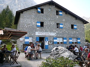
Rifugio Vandelli
| Rifugio Vandelli CAI refuge category C |
||
|---|---|---|
|
The Rifugio Vandelli |
||
| location | Below the Dito di Dio on the Sorapissee; Belluno Province , Italy ; Valley location: Cortina d'Ampezzo | |
| Mountain range | Sorapiss , Dolomites | |
| Geographical location: | 46 ° 31 '18.1 " N , 12 ° 13' 35.8" E | |
| Altitude | 1926 m slm | |
|
|
||
| builder | DÖAV Mannheim section | |
| owner | CAI section Venice | |
| Built | 1891 | |
| Construction type | Refuge | |
| Usual opening times | Mid-June to mid-September | |
| accommodation | 57 beds, 0 camps | |
| Winter room | 4 beds | |
| Web link | www.rifugiovandelli.it | |
The Rifugio Vandelli (German also Vandellihütte or Sorapisshütte , full name Rifugio Alfonso Vandelli al Sorapiss ) is an alpine refuge of the CAI in the Italian province of Belluno in the Sorapiss within the Dolomites . It is located at an altitude of 1926 m slm within the municipality of Cortina d'Ampezzo . The hut is generally open from June 20th to September 20th. It offers beds for 57 mountaineers and has a winter room with four beds.
Accesses
- From Passo Tre Croci , 1805 m ⊙ on path 215 in approx. 1.5 hours
Neighboring huts and crossings
The hut is located on the Dolomites High Trail 3 , also known as the Chamois Trail . It serves as a third accommodation (starting in Toblach).
- To Rifugio San Marco , 1823 m ⊙ in approx. 7 hours
- To the Rifugio Bosi , 2205 m ⊙
literature
- Tabacco card 1: 25,000, sheet no.03, Cortina d'Ampezzo e Dolomiti Ampezzane
- Compass map 1: 50,000, sheet No. 55, Cortina d'Ampezzo
Web links
Commons : Rifugio Vandelli - Collection of images, videos and audio files

