Riosucio (Chocó)
| Riosucio | ||
|---|---|---|
|
Coordinates: 7 ° 26 ′ N , 77 ° 7 ′ W Riosucio on the map of Colombia
|
||
|
Location of the municipality of Riosucio on the map of Chocó
|
||
| Basic data | ||
| Country | Colombia | |
| Department | Chocó | |
| City foundation | 1518 | |
| Residents | 29,036 (2019) | |
| City insignia | ||
| Detailed data | ||
| surface | 9,318 km 2 | |
| Population density | 3 people / km 2 | |
| height | 8 m | |
| Waters | Río Atrato | |
| Time zone | UTC -5 | |
| City Presidency | Luis Enrique Mena (2016-2019) | |
| Website | ||
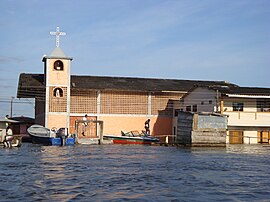
| Church of Riosucio | ||
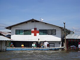
| Red Cross in Riosucio | ||
Riosucio is a municipality ( municipio ) in the department of Chocó in Colombia .
geography
Riosucio is located in the north of Chocó in the Darién primeval forest on the Río Atrato . The municipality borders the province of Darién in Panama and Unguía in the north, Turbo , Mutatá and Dabeiba in the Antioquia department in the east, Carmen del Darién and Bahía Solano in the south and Juradó and the province of Darién in Panama in the west . Much of the Los Katíos National Park is located in the area of Riosucio .
population
The municipality of Riosucio has 29,036 inhabitants, of which 8723 live in the urban part (cabecera municipal) of the municipality (as of 2019).
Personalities
- Tressor Moreno (* 1979), soccer player
Web links
Commons : Riosucio - collection of images, videos and audio files
- Riosucio Chocó. Alcaldía de Riosucio - Chocó, accessed February 12, 2019 (Spanish, website of the municipality).
Individual evidence
- ↑ ESTIMACIONES DE POBLACIÓN 1985 - 2005 Y PROYECCIONES DE POBLACIÓN 2005 - 2020 TOTAL DEPARTAMENTAL POR ÁREA. (Excel; 1.72 MB) DANE, May 11, 2011, accessed on February 12, 2019 (Spanish, extrapolation of the population of Colombia).


