Rocas Atoll
| Rocas Atoll | |
|---|---|
| Rocas Atoll, photographed from the International Space Station ( Expedition 22 ) | |
| Waters | Atlantic Ocean |
| Geographical location | 3 ° 52 ′ S , 33 ° 48 ′ W |
| Number of islands | 2 |
| Main island | Ilha do Farol |
| length | 3.7 km |
| width | 2.5 km |
| Land area | 36 ha |
| total area | 7.5 km² |
| Residents | uninhabited |
| Old and new lighthouse | |
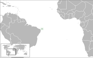
The Rocas Atoll , Brazilian Atol das Rocas , is an atoll in the Atlantic Ocean and belongs to the Brazilian state of Rio Grande do Norte .
The atoll is a nature reserve and since 2001 one of the UNESCO recognized World Heritage and a natural monument . Many different turtles , sharks , dolphins and sea birds live in the nature reserve . The atoll itself consists largely of corals and red algae .
The atoll is elliptical and covers 7.5 km². The major axis is 3.7 km and the minor axis 2.5 km. The ring reef is almost closed. In the north there is a 200 m wide canal, in the west a much narrower one.
The land area of the two islands of the atoll Ilha do Cemitério (cemetery island - Cemitério Island ) in the southwest and Ilha do Farol (lighthouse island - Farol Cay ) in the northwest is 0.36 km². Farol Cay is almost twice the size of Cemetério Island. The highest point is a 6 m high sand dune in the south of Farol Cay. The islands are overgrown with grass, bushes and some palm trees . There are crabs, spiders, sand fleas, beetles and large cockroaches, as well as numerous species of birds.
At the north end of Farol Cay is a Brazilian Coast Guard lighthouse that has been in operation since the 1960s. Nearby is a dilapidated lighthouse from 1933.
Web links
- Entry on the UNESCO World Heritage Center website ( English and French ).
- Sigep - Brazilian Commission of Geological and Palaeobilogical Sites ( English / Portuguese ) - detailed description
- Data sheet of the UNEP-WCMC (English; PDF; 120 kB)
- Additional information from Wolfgang Schippke, Geographical Information Pool


