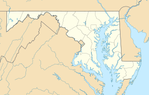
Rockville, Maryland
| Rockville | ||
|---|---|---|
 |
||
| Location in Maryland | ||
|
|
||
| Basic data | ||
| Foundation : | 1717 | |
| State : | United States | |
| State : | Maryland | |
| County : | Montgomery County | |
| Coordinates : | 39 ° 5 ′ N , 77 ° 9 ′ W | |
| Time zone : | Eastern ( UTC − 5 / −4 ) | |
|
Inhabitants : - Metropolitan Area : |
66,940 (as of 2016) 5,306,565 (as of 2010) |
|
| Population density : | 1,923.6 inhabitants per km 2 | |
| Area : | 34.8 km 2 (approx. 13 mi 2 ) of which 34.8 km 2 (approx. 13 mi 2 ) are land |
|
| Height : | 137 m | |
| Postcodes : | 20847-20859 | |
| Area code : | +1 301 | |
| FIPS : | 24-67675 | |
| GNIS ID : | 0586901 | |
| Website : | www.rockvillemd.gov | |
 Map of Rockville |
||
Rockville is the fourth largest city in the US state of Maryland , United States . It is the county seat of Montgomery County . In 2010 the city had more than 60,000 inhabitants. For 2016, the population is estimated at around 67,000 ( US Census Bureau ).
The city was founded in 1717 and is approximately 20 km from Washington DC . The Federal Food and Drug Administration (FDA) is based here. The computer game developer Bethesda Softworks is also based here.
In 2002, the first Indoor Pan American Cup in indoor hockey took place in Rockville .
Twin cities
The city has a partnership with Pinneberg in Schleswig-Holstein .
sons and daughters of the town
- Spike Jonze (* 1969), film and music video director
- Elden Henson (born 1977), actor
- Father John Misty (born 1981), rock musician
Web links
Commons : Rockville (Maryland) - Collection of pictures, videos, and audio files
Individual evidence
- ↑ Quickfacts: Rockville (English) ( Memento of the original from June 7, 2013 in the Internet Archive ) Info: The archive link was inserted automatically and has not yet been checked. Please check the original and archive link according to the instructions and then remove this notice.
