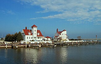
Root River (Lake Michigan, Wisconsin)
| Root River | ||
| Data | ||
| Water code | US : 1572589 | |
| location | Wisconsin (USA) | |
| River system | Saint Lawrence River | |
| Drain over | St. Clair River → Detroit River → Niagara River → Saint Lawrence River → Atlantic Ocean | |
| source |
New Berlin 43 ° 0 ′ 14 ″ N , 88 ° 5 ′ 3 ″ W. |
|
| Source height | 281 m | |
| muzzle |
Lake Michigan coordinates: 42 ° 44 ′ 1 " N , 87 ° 46 ′ 43" W 42 ° 44 ′ 1 " N , 87 ° 46 ′ 43" W. |
|
| Mouth height | 176 m | |
| Height difference | 105 m | |
| Bottom slope | 1.9 ‰ | |
| length | 55 km | |
The Root River is a 55 km long river in southeastern Wisconsin that flows into Lake Michigan at Racine . The name "Racine" is derived from the French word for "root", English root .
course
The Root River rises in Waukesha County , on the outskirts of New Berlin . The river flows mostly in a southeast direction through Milwaukee County with the cities of West Allis , Greenfield , Greendale and Franklin . The river then enters Racine County , where it flows into Lake Michigan in its capital, Racine .
Individual evidence
- ^ A b Root River in the United States Geological Survey's Geographic Names Information System.Retrieved April 24, 2011
