Ryvarden fyr
| Ryvarden fyr | ||
|---|---|---|
| Ryvarden fyr | ||
| Place: |
|
|
| Location: | Ryvardsneset headland | |
| Geographical location: | 59 ° 18 '58 " N , 5 ° 8' 6.4" E | |
| Height of tower base: | 17 moh. | |
| Fire carrier height : | 10 m | |
| Fire height : | 22.3 m | |
|
|
||
| Identifier : | Oc (3) WRG 10s | |
| Scope knows: | 12.4 nm (23 km ) | |
| Scope green: | 9.3 nm (17.2 km ) | |
| Scope red: | 9.8 nm (18.1 km ) | |
| Operating mode: | electrified 1960, automated 1984 | |
| Function: | Beacon | |
| Construction time: | 1849–1935 (current lighthouse) | |
| Operating time: | since 1849 | |
| International ordinal number: | B3578 | |
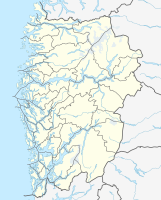
Ryvarden fyr (also marketed as Ryvarden Kulturfyr) is a lighthouse in the municipality of Sveio in the Norwegian province of Vestland , about 12 km north of the town of Haugesund .
location
The lighthouse is at the end of the headland Ryvardsneset in the Bay Mølstrevågen on the south end of the village Sveio, approximately two kilometers from the border with the neighboring province of Rogaland removed. A private gravel path about two kilometers long leads from Fv2 in Mølstrevåg to the lighthouse, which makes it one of the more accessible in Norway. It marks the southern entrance to the Bømlafjord and the northern end of Sletta Bay , which forms the entrance to Haugesund.
history
The first human traces on Ryvardsneset date from the late Bronze or early Iron Age . On a hill about 150 meters from the lighthouse, there are traces of a destroyed burial mound. The headland in Landnámabók in old Iceland is mentioned for the first time . This describes how Flóki Vilgerðarson (Ramna – Floke) had a stone man ( Norwegian : varde ) built on Ryvardsneset before his trip to Iceland in 869 . This Flokavarði marked the historical border between Hordaland and Rogaland. The name Ryvarden goes back to the old name of Rogaland, Rygjafylki .
The Viking Age marking stood well into the 19th century, when the herring fishery gained importance in late winter and better marking for the fishing boats was necessary. First, a so-called "fiskefyr" (fishing fire) was built, which consisted of a small guard room with an oil lamp on the wall and should be lit from December 21st to March 1st. After protests from other seafarers, however, the time was extended to the period from July 15th to May 1st after a few years. In 1861 the remains of Flokavarði were demolished and used as the foundation for a new lighthouse keeper's house. In 1890 a new lighthouse was built, which was replaced in 1935 by the current building, which was also equipped with a powerful foghorn. A new lighthouse keeper's house was built in 1958, and a path to the lighthouse finally came in the 1970s. In 1984 the lighthouse was automated.
At the lighthouse there is a memorial stone for the 16 victims of the sinking of the Sleipner speedboat , which ran aground and sank on November 26, 1999 when visibility was poor on the Store Bloksen cliff north of the lighthouse.
After the lighthouse was automated and the lighthouse keeper's family moved out, the municipality of Sveio took over the operation of the buildings. A gallery, a café and overnight accommodation were set up and the story of Ramna – Floke was conveyed. In 2000 Ryvarden Kulturfyr was awarded the Norwegian quality mark for cultural facilities and experiences, the Olavsrose .
See also
Web links
- Specifications of the lighthouse on the Kystverket website
- Site of the lighthouse
Individual evidence
- ↑ a b Om Ryvarden Kulturfyr. Ryvarden.no, accessed August 10, 2020 .
- ↑ Mølstravågnes - fat fk 1, Ryvarden.. In: Kulturminnesok.no. Riksantikvaren, accessed on August 10, 2020 .
- ↑ a b c d Ryvarden. Digitalt Museum, November 17, 2014, accessed August 10, 2020 .
- ↑ a b Per Roger Lauritzen: Ryvarden fyr. In: Store norske leksikon. June 2, 2020, accessed August 10, 2020 .
- ↑ Sleipner-ulykken. In: Store norske leksikon. November 27, 2019, accessed August 10, 2020 .

