San Francisco (Peten)
| San Francisco | ||
|---|---|---|
|
Coordinates: 16 ° 48 ′ N , 89 ° 56 ′ W San Francisco on the map of Guatemala
|
||
| Basic data | ||
| Country | Guatemala | |
| Department | Peten | |
| City foundation | 1828 | |
| Residents | 8917 (2002) | |
| - in the metropolitan area | 3,485 | |
| Detailed data | ||
| surface | 502 km 2 | |
| Population density | 18 people / km 2 | |
| height | 220 m | |
| City structure | 8 districts | |
| Post Code | 17006 | |
| Time zone | UTC −6 | |
| City patron | San Francisco de Asís (Festival: September 26th to October 4th) | |
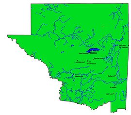
| Peténs map | ||
San Francisco is a town in Guatemala with a population of about 4,000 . It is located in the Departamento Peten and is the administrative seat of the municipality of San Francisco, which extends over 502 km² and has almost 10,000 inhabitants.
geography
San Francisco is located in a hilly area in the center of Peten, 18 km south of Lake Peten-Itzá at an altitude of 220 m. The place is connected by a country road with Flores , the capital of the department on the lake. Branch lines lead to the neighboring municipality of San Benito in the northwest, La Libertad in the west and Santa Ana in the east. In the southwest, San Francisco borders on the Municipio Sayaxché , which can be reached from La Libertad on national road 5, in the southeast on Dolores , where the CA 13 leads from Flores and Santa Ana. Both highways connect Peten with the rest of Guatemala.
Because of the territorial extent of Petén and the very low population density, the Municipios of the Departamentos Petén are usually extremely large. San Francisco is located in the relatively well-developed area around the metropolitan area of Flores and is an exception with its around 500 square kilometers. Of the twelve municipalities in the department, only San Benito is even smaller.
history
The area around the Petén-Itzá-See was originally only inhabited by Itzá- Maya , who the Spaniards only subjugated in 1697 because of the fierce resistance. Today's San Francisco was founded shortly after Central America's independence in 1828 as Chachaclúm. On October 7, 1927, the name was changed at the request of the residents. On May 30, 1931, the recently founded Municipio San Juan de Dios was dissolved and slammed as a " rural community " ( Aldea ) San Francisco. In addition to the main town and San Juan, the municipality now has ten hamlets: Santa Cruz, Zapotal, San José Pinares, Eben Ezer, Nuevo San Francisco, San Valentín, Santa Teresa, San Martín, Nueva Guatemala and Nueva Concepción.
population
Today over three quarters of the population are Ladinos , the remaining part consists of Kekchí , who live almost exclusively in the countryside. The people live mainly from forestry , agriculture and livestock .
See also
Web links
- Data on inforpressca.com (span.)

