Flores (Guatemala)
| Flores | ||
|---|---|---|
|
Coordinates: 16 ° 56 ' N , 89 ° 54' W Flores on the map of Guatemala
|
||
| Basic data | ||
| Country | Guatemala | |
| Department | Peten | |
| Residents | 11,843 (2002) | |
| - in the metropolitan area | 22,639 | |
| Detailed data | ||
| surface | 4336 km 2 | |
| Population density | 3 people / km 2 | |
| height | 127 m | |
| Waters | Lake Peten Itza | |
| Post Code | 17001 | |
| Time zone | UTC −6 | |
| City patron | Cristo Negro de Esquipulas (Festival: January 15th) | |
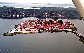
| Flores seen from the air | ||
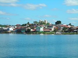
| View of Flores | ||
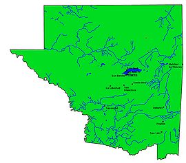
| Peténs map | ||
Flores is a city in Guatemala . It is the capital of Petén , the northernmost and largest department in the country, and the administrative seat of the Municipios of Flores.
The 1st Brigada de Infantería “General Luis García León” of the Guatemalan Army has its headquarters in Flores .
geography
Flores is located on the island of San Andrés in the south-western part of Lake Petén Itzá . In 2005 the city, which is only connected to the mainland by an artificial dam, had 18,399 inhabitants. Together with the suburb of Santa Elena and the neighboring San Benito in the west , it forms a metropolitan area in the heart of Peten, which plays a central role within the department in the areas of trade, transport and tourism. Flores is connected with Belize in the east and with Izabal in the south via the CA 13 , and with Alta Verapaz via the national route 5 . It is 506 km to Guatemala City via Izabal . A few kilometers east of the suburb of Santa Elena is the international airport of Flores .
Around 25,000 people live in the municipality of over 4,000 km². It is divided into four rural communities ( Aldeas ) and 41 hamlets. Because of the territorial extent of Petén and the very low population density, the Municipios of the Departamentos are extremely large. The main towns of the Municipios are concentrated on larger traffic axes or around Lake Petén-Itzá, while their administrative area extends far into the rear, sparsely populated regions. In the case of Flores, there is a smaller area on the south bank of Lake Petén-Itza, which then extends to the east of the lake into a broad, north-running strip that extends to the Mexican border. This tropical lowland rarely reaches heights of more than 300 meters. The north, almost completely covered by tropical rainforest , is part of the Reserva de la Biósfera Maya biosphere reserve .
The municipality borders on San Benito, San Francisco and Santa Ana in the south , the said administrative area in the northeast borders on that of Melchor de Mencos and on the west on that of San José .
history
The Itzá people arrived in northern Petén in the 12th century. It had originally immigrated to the Yucatán from Mexico , mixed with the Maya living there and founded the metropolis of Chichén Itzá in the 11th century . When this was destroyed by the great rival Mayapán in the 13th century , many Itzá moved south in several waves. On the shores of Lake Petén Itzá, they finally founded their metropolis Tayasal on the peninsula opposite Flores. It was one of the first settlements visited by the Spanish in Guatemala, but the last to be conquered.
As early as 1525, Hernán Cortés reached the capital of the Itzá on his way to Honduras . A decrepit horse ( El Morzillo ) that he left there was worshiped like a deity by the Itzá, but died soon afterwards. Franciscan brothers who visited Tayasal in 1618 destroyed a horse statue that was worshiped like a deity by the Itzá. A short time later, the indigenous people erected another stone replica of the revered animal, which fell into the lake during a transport. It should still be there today. In the following years of proselytizing and subjugating, the Itzá offered bitter resistance. It was not until 1697 that Martín de Ursúa defeated the rebellious Maya people. The colonial rulers built a fortress on the island that served as a prison for a long time. The small provincial capital was given its name in 1831 in memory of the former Vice President Cirilo Flores , who took office in 1824 and was insidiously murdered in 1826.
Due to its remote geographical location, Flores remained isolated from the rest of Guatemala for a long time and oriented itself more towards Mexico and Belize . This only changed with the better transport connections to Guatemala City.
Attractions
Today the small island capital is dominated by tourism . Nevertheless, it has largely been able to maintain its calm atmosphere. The main attractions include Parque Central and the whitewashed church. The Centro de Información sobre la Naturaleza, Cultura y Artesanías de Petén (CIN-CAP), a museum and an information center in the Castillo de Arismendi , the former fortress, is also located here. In addition to exhibitions about life in Peten in earlier times and the chicleros , other useful information is also offered here.
Because of its central location and good transport links, Flores and its neighboring towns are a popular starting point for tours in Petén, especially for excursions to the numerous Mayan ruins in the area. Tikal is of outstanding importance in this context . The other ruins in the (northeast) area of the Municipios Flores include Yaxhá , Topoxté , Tzikín, San Clemente, Volantún, Tres Pilas, Holmul , Nakum, Xamakbatún, Jimbal, El Encanto, Xultún, Uaxactún , La Honradez, La Muralla, Río Azul and Naachtún .
Changes
New regulations have contributed to a change in the cityscape in Flores. Nobody is allowed to position signs on the sidewalk or to use house facades as advertising space. The elaborate paintings and lettering had to be removed and replaced with wooden signs that correspond to certain dimensions. The new regulations are intended to bring out the colors and architecture of the colonial houses. Due to the new regulations, all garbage cans ( walkways ) had to be removed. With that, all "floating restaurants" that had positioned themselves around the island disappeared. On the east side of the island, the new Malecón was completed at the end of 2007.
The sometimes strongly fluctuating water level of Lake Petén-Itza also causes striking changes in the cityscape. In 1996 parts of the houses on the bank were flooded, in December 2006 low water exposed a ten to thirty meter wide bank area, on which a gravel road was built around parts of the island. At the end of 2013 the water level rose sharply again, and in January 2014 large parts of the embankment were under water.
Web links
- Enjoy Guatemala
- Tayasal (English)


