San Andrés (Peten)
| San Andrés | ||
|---|---|---|
|
Coordinates: 16 ° 58 ′ N , 89 ° 55 ′ W San Andrés on the map of Guatemala
|
||
| Basic data | ||
| Country | Guatemala | |
| Department | Peten | |
| City foundation | 1820 | |
| Residents | 5740 (2002) | |
| - in the metropolitan area | 20,295 | |
| Detailed data | ||
| surface | 8874 km 2 | |
| Population density | 1 inhabitant / km 2 | |
| height | 150 m | |
| Waters | Laguna del Tigre, Río Escondido | |
| Post Code | 17004 | |
| Time zone | UTC −6 | |
| City patron | San Andrés Apóstol (Festival: November 21st to 30th) | |
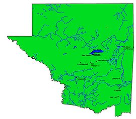
| Peténs map | ||
San Andrés is a place in Guatemala with a population of over 6,000 . It is located in the Departamento Petén and is the administrative seat of the municipality of San Andrés, which extends over 8,874 km² and has over 25,000 inhabitants.
geography
The town of San Andrés is located in the center of Peten on the west bank of Lake Peten-Itzá at an altitude of 190 m. From Flores , the capital of the department on the south bank of the lake, San Andrés can be reached by road or by boat.
As with all Municipios Peténs, the main town is on Lake Petén-Itza or on a major traffic axis, while the administrative area extends far into the back, sparsely populated regions. With almost 8,900 km², San Andrés is not only the largest municipality in Guatemala, but also larger than 20 of the country's 22 departments in terms of area. It encompasses the northwestern, water-rich, tropical rainforest- covered lowlands of Peténs and thus around a quarter of the entire department. Over 90 percent of the municipality is a biosphere reserve ( Reserva de la Biósfera Maya ) under nature protection . Within this area lies the Laguna del Tigre National Park . The nature reserves are intended to help protect the diverse flora and fauna , in particular from deforestation , poaching and illegal settlement. There are oil deposits in the region , the exploitation of which poses a particular threat to nature.
In addition to the main town, the municipality of San Andrés consists of two subordinate " rural communities " ( Aldeas ), Paso Caballos and Carmelita, as well as numerous smaller rural settlements and hamlets that can often only be reached by boat or plane or on gravel roads and beaten paths.
The neighboring municipalities are La Libertad and San Benito in the south and San José in the east. To the north and west, San Andrés borders the Mexican states of Campeche and Tabasco .
history
The village of San Andrés was only founded around 1800, probably by immigrants from other parts of the country and from the Yucatán . The original inhabitants of the region, the Itzá Maya , also came from Yucatán . For a long time San Andrés belonged to Flores, in 1962 it became an independent municipality.
population
Today the population consists mainly of Ladinos , the remaining inhabitants are Maya of various ethnic groups, especially Itzá and the Kekchí , Cakchiquel and Pocomchí who have moved there.
economy
San Andrés lives mainly from agriculture , forestry and timber industry as well as from cattle breeding . The production of chicle and the controversial extraction of petroleum are also important. Because of the charming landscape and the rich Mayan cultural heritage, tourism also plays a role. There are airfields for general aviation at the major traffic areas of Paso Caballos and Carmelitas . Smaller, sometimes illegal airfields can be found in other places in the municipality. They are often used by drug smugglers .
Attractions
There are numerous Mayan ruins in the municipality of La Libertad . Notable are Kantekul, Paso Caballos, El Perú, Caoba, Xunal, Santa Clara, La Profundidad, El Tigre, El Límite, El Yesal, Sibalhá, Jukulkan, Tzakal, Manaos, Los Monos, La Pitocha, La Conga, Las Cojolitas, Buenaventura , Los Pizotes, La Cocachana, La Ceiba, Tucán, Sucely, Grant, El Cruce, El Muco, El Sereque, Canek, Cucho, El Escondido, Los Reyes, Junkiej, El Saraguate, Kabul, El Cedro, El Tintal , El Desquite , Gûiro ( Wakná ), Ramonal, Zacatal, Chuntuqui, Las Delicias, Arroyón, Nacimiento, Lemieux, USAC, 4 Ahau, Dos Naciones, El Ruinal, La Cueva, La Frontera Bis, El Pavo, Aguada Inés, Danto, Las Animas, Tepán, Paxbán I, Paxbán II, Paxbán III, El Chontal and El Copó. The wetlands with their numerous "lagoons" (lakes) and rivers are worth seeing .
See also
Web links
- Data on inforpressca.com (span.)
- Mayan Biosphere Reserve (span.)

