Santa Ana (Peten)
| Santa Ana | ||
|---|---|---|
|
Coordinates: 16 ° 48 ′ N , 89 ° 50 ′ W Santa Ana on the map of Guatemala
|
||
| Basic data | ||
| Country | Guatemala | |
| Department | Peten | |
| City foundation | 1840 | |
| Residents | 14,602 (2002) | |
| - in the metropolitan area | 6.215 | |
| Detailed data | ||
| surface | 1008 km 2 | |
| Population density | 14 people / km 2 | |
| height | 220 m | |
| City structure | 11 districts | |
| Post Code | 17007 | |
| Time zone | UTC −6 | |
| City patron | Santa Ana (festival: July 17th to 26th) | |
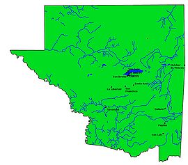
| Peténs map | ||
Santa Ana is a small town in Guatemala with about 8000 inhabitants . Santa Ana is located in the Department of Peten and is the administrative seat of the municipality of Santa Ana, which extends over 1008 km² and has almost 20,000 inhabitants.
geography
The town of Santa Ana is located around 20 km south of Lake Petén-Itzá in the middle of the department at an altitude of 220 m. A few kilometers west of the town, the CA 13 road leads past in a north-south direction, connecting Flores , the capital of Pentén, with Izabal in the south and the rest of the country. Santa Ana is 21 km to Flores and 487 km to Guatemala City .
As with all Municipios Peténs, the main town is located on a major traffic axis, while the administrative area extends far into the back, sparsely populated regions. In the case of Santa Ana, it covers an area of around 1000 km², located in the western foothills of the Maya Mountains , southeast of Lake Petén Itzá. From the rainforest , the Petén once completely covered, in the area of Municipalities today about a third remains. The climate is generally tropical and hot.
The neighboring municipalities are Flores in the north, San Francisco in the west and south-west, Dolores in the south-east and Melchor de Mencos in the east.
history
The town of Santa Ana was founded in 1840, but relocated twice over time. The founding place Santa Ana Vieja ("Alt-Santa-Ana") is about 20 km south of today's city near the Mayan ruins of Ixponé. From there he came to Buena Vista, a village that is now part of the small town of Santa Ana, in 1890. The name Santa Ana is said to come from a Mexican woman who settled near Ixponé and who is said to have had a particularly beautiful image of Saint Anne , which eventually became a local religious devotional .
population
Besides Kekchí , a large part of the local population consists of Ladinos . The municipality consists of the main town Santa Ana (with 11 districts), 15 rural communities ( Aldeas ) and a total of 42 hamlets.
Economy and Transport
Santa Ana lives mainly from agriculture, especially from growing corn , beans and sugar cane . The forestry , timber industry and animal husbandry are less important . Trade and the service sector play a role on trunk road CA 13. A number of secondary routes branch off from the trunk road, connecting the western part of the municipality with the urban area around Flores quite well. The remaining parts are poorly developed.
See also
Web links
- Data on Santa Ana (span.)

