Las Cruces (Peten)
| Las Cruces | ||
|---|---|---|
|
Coordinates: 16 ° 39 ′ N , 90 ° 18 ′ W Las Cruces on the map of Guatemala
|
||
| Basic data | ||
| Country | Guatemala | |
| Department | Peten | |
| City foundation | 1968, 2011 as a municipality | |
| Residents | 35,000 | |
| - in the metropolitan area | 3,000 | |
| City insignia | ||
| Detailed data | ||
| surface | 1775 km 2 | |
| Population density | 20 people / km 2 | |
| height | 130 m | |
| Waters | Rìo Usumacinta and others | |
| Post Code | 17027 | |
| Time zone | UTC −6 | |
| City patron | Santa Cruz (Festival: May 3rd to 5th) | |
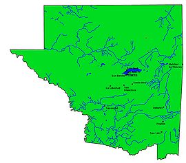
| Peténs map | ||
Las Cruces is a small town in Guatemala with around 3,000 inhabitants . Las Cruces is located in the Department of Peten and is the administrative seat of a municipality founded in 2011 , which extends over 1775 km² and has over 35,000 inhabitants. Las Cruces was formerly a rural community (aldea) of the Municipios La Libertad .
geography
The municipality of Las Cruces is located in the west of Petén. It is bounded in the south by the Río de la Pasión , in the west and northwest by Río Usumacinta , which also forms the border with the Mexican state of Chiapas . Where in the northwest the Usumacinta leaves Guatemala completely, the border of the municipality at the foot of the rainforest-covered and up to 672 m high range of hills Sierra del Lacandón turns in a wide arc to the southeast. This delimits a relatively narrow strip of land along the Usumacinta. In the east, Las Cruces borders on La Libertad and in the south on Sayaxché . This hill country still belongs to La Libertad, while the lowlands to the Usumacinta are part of Las Cruces. The areas along the Usumacinta were declared a national park, mainly to protect them from further deforestation, which is already well advanced in the southeast. The climate is hot and humid.
As with all Municipios Peténs, the main town is located on a major traffic axis, while the administrative area extends far into the back, sparsely populated regions. The place Las Cruces is located around 32 km southwest of La Libertad and 60 km southwest of Lake Petén-Itzá at 130 m altitude. From Flores , the lakeside capital of the Petén department, the national road 5 leads via La Libertad and Sayaxché to Alta Verapaz further south . Between the small towns of Santa Teresa in the north and El Subín in the south, a partially unpaved road branches off from national road 5 in a westerly direction, on which the town of Las Cruces can be reached after around ten kilometers. In the further course it leads to the vicinity of the Río Usumacinta and thus to the remote, hardly developed areas in the northwest of the municipality. Branch lines branch off to Usumacinta, including to Bonanza and on to Lacantún, Ixmucané and Santa Rosita in the south, to La Providencia and to Bethel, an important border crossing into Mexico. The remaining areas in the northwest can only be reached by rivers or unpaved roads.
history
In the train of the Spanish Conquista who fled Lacandon from Yucatán to the then largely uninhabited land on the Usumacinta. Over time, Kekchí moved from the south and then, in addition to Ladinos, also highland Maya . Today's Las Cruces was founded in 1968 by immigrants from Retalhuleu . The remote area was often neglected by the authorities, which is why the residents demanded the establishment of their own municipality. In 1993, a citizens' committee was formed for this purpose, which worked for the higher authorities for self-government for 18 years. On November 22, 2011, the parliament of Guatemala voted for the establishment of the new municipality. Structural measures against flood damage are a priority for the new mayor.
A massacre took place in Dos Erres during the Guatemalan Civil War . Kaibiles , elite soldiers of the Guatemalan armed forces , cruelly murdered a total of 252 people here between December 6 and 8, 1982.
According to a legend , Las Cruces (Eng. "The Crosses") got its name from three wooden crosses that the first settlers supposedly found here.
population
The population of the Municipio Las Cruces consists of Ladinos and Kekchís . In the last few decades the population has increased significantly. Around 40,000 people are currently likely to live in the municipality of Las Cruces, over 80% of them in rural areas.
economy
Las Cruces lives mainly from agriculture, especially from the cultivation of corn and beans as well as from cattle breeding . The town of Las Cruces is an important trading center for agricultural products. Tourism also plays a role because of the delightful landscape on the Usumacinta River and the rich Mayan cultural heritage.
Attractions
There are numerous Mayan ruins in the parish of Las Cruces, the most famous of which is Piedras Negras . The Maya city of Yaxchilán lies on the banks of the Usumacinta in a distinctive bend in the river, but on the Mexican side. The Usumacinta is ideal for onward journeys to Palenque ( Chiapas ).


