Santa Ynez River
| Santa Ynez River | ||
|
Santa Ynez River |
||
| Data | ||
| Water code | US : 249134 | |
| location | California , United States | |
| River system | Santa Ynez River | |
| source | Los Padres National Forest, California 34 ° 28 ′ 40 ″ N , 119 ° 26 ′ 51 ″ W. |
|
| Source height | 1262 m | |
| muzzle |
Pacific Ocean at Lompoc Coordinates: 34 ° 41 ′ 31 ″ N , 120 ° 36 ′ 7 ″ W 34 ° 41 ′ 31 ″ N , 120 ° 36 ′ 7 ″ W |
|
| Mouth height | 0 m | |
| Height difference | 1262 m | |
| Bottom slope | 8.5 ‰ | |
| length | 148 km | |
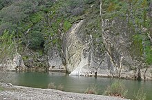
The Santa Ynez River is a river in the US state of California . It is 148 kilometers (92 miles ) long, making it one of the longest in California. It flows east to west through the Santa Ynez Valley and later flows into the Pacific Ocean near the city of Lompoc .
The river forms the end of the northern slopes of the Santa Ynez Mountains and the southern slopes of the San Rafael Mountains . Its catchment area covers an area of 2,320 square kilometers. The amount of water that the Santa Ynez River carries is subject to strong fluctuations in the context of the seasons: while it often almost dries up in summer, it can become a torrent in the wetter months. In its course, the river is dammed several times, creating several reservoirs for the purpose of water and electricity generation.
Except for smaller boats, the river is not navigable.
course

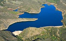
The Santa Ynez River has its source in the Los Padres National Forest , on the northern slope of the Santa Ynez Mountains in Ventura County . The river flows westward, where various smaller tributaries and mountain streams flow into it. After flowing through the Billiard Flats the river enters Jameson Lake , a reservoir. Below the dam, the Alder Creek flows into the Santa Ynez River from the south.
As it continues west, the river is surrounded by several campsites and canyons, including the Blue Canyon . Since the river is also a destination for tourists, other tourist facilities are located next to campsites . In the further course of the Santa Ynez with the Gibraltar Reservoir is dammed again.
Lake Cachuma, the largest reservoir along the river, is about eight kilometers long. Below this dam, other tributaries flow into the stream, including Santa Cruz Creek and Cachuma Creek from the north, and a number of smaller streams from the south. The lake area is known as the Lake Cachuma Recreation Area and is under special conservation. The Cachuma County Park, near Tequepis Point , offers direct public access to the lake, which is also used for tourism.
Below Lake Cachuma , the Santa Ynez River continues its course west. A few miles west of Lompoc , the Santa Ynes River reaches the Pacific Ocean. The estuary is also very popular with tourists and is very popular with surfers.
Web links
Individual evidence
- ↑ a b Santa Ynez River information ( memento of the original from October 15, 2013 in the Internet Archive ) Info: The archive link was inserted automatically and has not yet been checked. Please check the original and archive link according to the instructions and then remove this notice.
- ↑ Water Resources Data (PDF; 5.8 MB)

