Schwerin Lake (Storkow)
| schweriner Lake | ||
|---|---|---|

|
||
| Location of the Schweriner See | ||
| Geographical location | Germany, Brandenburg, Oder-Spree district | |
| Tributaries | Canals from Gutssee and the Linowsee-Dutzendsee nature reserve | |
| Drain | Groß Schauener chain of lakes → Köllnitzer Fließ → Wolziger See → Storkower Gewässer → Dahme-Wasserstraße → Spree | |
| Places on the shore | Schwerin | |
| Data | ||
| Coordinates | 52 ° 11 '56 " N , 13 ° 53' 8" E | |
|
|
||
| Altitude above sea level | 35.7 m above sea level HN | |
| surface | 2.37 km² | |
| length | 1.194 km | |
| width | 2.893 km | |
| volume | 3,995,000 m³ | |
| Maximum depth | 5 m | |
| Catchment area | 30.33 km² | |
|
particularities |
calcareous, unstratified lake |
|
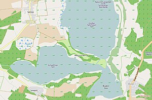
The Schweriner See is located in the urban area of Storkow (Mark) in the Oder-Spree district in Brandenburg . The namesake of the 2.37 km² large body of water is the Storkow district of Schwerin , which is located on the south bank.
geography
The Schweriner See is part of the nature reserve Groß Schauener Seenkette and the nature park Dahme-Heideseen . In the east, the Schweriner See merges into the Bugker See via an 80 meter wide connection . The Woppusch peninsula and an offshore island border the lake to the north to the Großer Selchower See .
The Linowsee-Dutzendsee nature reserve extends right up to the south-western tip of the lake . The core of the protected area is formed by the Linowsee and the silting moor of the former Dutzendsee, which drain into Lake Schwerin via various ditches.
ecology
As part of a shallow chain of lakes, the calcareous lake does not form any temperature stratification . For the most part, it is surrounded by a silting belt with broken forest of varying density . A forest area borders on the north-western bank. The maximum extension is 2.9 kilometers in the west-east direction and 1.2 kilometers from north to south. The catchment area covers 30 km².
Since April 2000 the Groß Schauener chain of lakes, which provides habitat for endangered plant and animal species, has been designated as a nature reserve. In January 2002, the Heinz Sielmann Foundation acquired over 1000 hectares of lakes and land in this area ( Sielmann's Groß Schauener Lakes natural landscape ), including Lake Schwerin.
Leisure, tourism, sport
Fishing is allowed in special areas of the lake.
See also
- List of lakes in Brandenburg
- Great look chain of lakes
- Sielmann's natural landscape, the Groß Schauener Lakes
Web links
- Lake profile of the Brandenburg State Environment Agency (PDF; 215 kB)
Individual evidence
- ^ Sophie Wauer: Brandenburgisches Namenbuch. Part 12 The place names of the Beeskow-Storkow district , Steiner-Verlag, Stuttgart 2005, ISBN 978-3-515-08664-6
- ↑ City of Storkow - Sights worth seeing ( Memento of the original from September 4, 2009 in the Internet Archive ) Info: The archive link was inserted automatically and has not yet been checked. Please check the original and archive link according to the instructions and then remove this notice.
- ↑ Flyer Groß Schauener Seen from the Sielmann Foundation (PDF file; 766 kB)
- ↑ Fishing areas in the Groß Schauener chain of lakes (PDF; 514 kB)

