Wolziger See
| Wolziger See | ||
|---|---|---|

|
||
| Mole in Lake Wolziger | ||
| Geographical location | Central Europe , Germany , Brandenburg , Dahme-Spreewald district | |
| Tributaries | Storkower Canal , Mühlenfließ | |
| Drain | Blossiner flow to the long lake | |
| Data | ||
| Coordinates | 52 ° 15 ′ 23 " N , 13 ° 49 ′ 15" E | |
|
|
||
| Altitude above sea level | 33.7 m | |
| surface | 5.79 km² | |
| length | 3.2 km | |
| width | Max. 2.5 km | |
| volume | 32,000,000 m³ | |
| scope | 10 km | |
| Maximum depth | 13 m | |
| Middle deep | 5.5 m | |
The Wolziger Lake is a 597 hectares comprehensive lake in Brandenburg Dahme-Spreewald in nature park Dahme-Heide lakes and the largest lake of the municipality Heidesee . The eponymous district of Wolzig as well as Blossin , Kolberg and Görsdorf b are on its banks . Storkow . It is part of the 33 kilometer long federal waterway Storkower Gewässer (SkG) with waterway class I; The Berlin Waterways and Shipping Office is responsible .
description
The approximately circular lake has a diameter of about 3.2 kilometers, the area is 579 hectares . The greatest depth is around 13 meters. It was created in the Ice Age and is located in a hollow in Berlin's glacial valley .
The lake gets its inflow from the Storkower Canal in the northeast and in the southeast from the Mühlenfließ , which connects the Groß Schauener chain of lakes with the Wolziger See. Its outflow leads in the southwest through the canal-like 1.35 km long Blossiner Fließ to the Langen See and from there over the Dahme to the Spree .
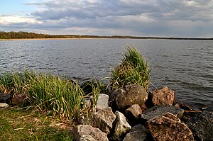
The bank is overgrown with reeds over long stretches. The bottom consists mainly of sand, but it is also interspersed with stones. It has several elevations and sharply sloping sharp edges. A reed island in the southern part of the lake forms a prominent part of the lake. In front of this island, the sharp edge drops steeply from around 1 meter to 8 meters.
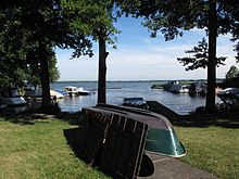
There are five public harbors on Lake Wolziger:
- Fishing port on the west bank in Blossin, draft 2 meters
- Marina of the youth education center on the west bank in Blossin, draft 2 meters
- Sports boat harbor of the Blossin youth education center on the west bank, draft 1.8 meters
- Boathouse Erkner on the north bank in Wolzig, draft 1.5 meters
- Natural harbor on the south bank in Kolberg, draft 1.4 meters
First mentions and naming
The body of water was first mentioned in 1514 in the Beeskow estate register as vf den See woltzigk . The document reproduced in the Codex diplomaticus Brandenburgensis compiled by Adolph Friedrich Riedel contains the information in the Woltzigk section :
"Item Valten Mertten is a fisherman judge vf den See woltzigk, see next to the Schultzen that it is right, before that he has free fishing with wading and buffering."
In 1518 the Beeskow hereditary register found the spelling auff dem Woltziger ... and others see and in 1643 a Storkow document the indication on Woltziger See . According's Brandenburg Namenbuch the lake was formerly as Blossiner lake called, for example, the Royal Prussian Urmesstischblatt of 1844. The naming with the suffix -lsk- indicated according Namenbuch out that here the place name was transferred to the lake. The name of Wolzig, first mentioned in 1443 as Wolzck , is traced back to the linguist and Slavist Reinhard E. Fischer from the Old Sorbian meaning for place where alder trees grow .
See also
literature
- Brandenburg name book. Part 10. The names of the waters of Brandenburg . Founded by Gerhard Schlimpert , edited by Reinhard E. Fischer . Edited by K. Gutschmidt, H. Schmidt, T. Witkowski. Berlin contributions to name research on behalf of the humanities center for history and culture of East Central Europe eV Verlag Hermann Böhlaus successor, Weimar 1996 ISBN 3-7400-1001-0 .
- Brigitte Nixdorf, Mike Hemm u. a .: Documentation of the condition and development of the most important lakes in Germany, part 5, Brandenburg , environmental research plan of the Federal Ministry for the Environment, Nature Conservation and Nuclear Safety , final report R&D project FKZ 299 24 274, on behalf of the Federal Environment Agency at the Chair of Water Protection at the Brandenburg Technical University Cottbus , 2004 Chapter 1.37 Wolziger See pp. 155–158 PDF
Web links
Individual evidence
- ^ Directory of the federal inland waterways serving general traffic. Federal Waterways and Shipping Administration, accessed on February 10, 2020 .
- ↑ See Hartwig Krumbeck, Ute Mischke (Ed.): Gewässerreport (No. 6): Developments in the waters in the Scharmützelsee area and applied problems of water protection, Tab. 1, p. 99 ( Memento of the original of August 21, 2014 in the Internet Archive ) Info: The archive link was inserted automatically and has not yet been checked. Please check the original and archive link according to the instructions and then remove this notice.
- ↑ a b c Brandenburg name book. Part 10. The names of the waters of Brandenburg , p. 309.
- ↑ Codex diplomaticus Brandenburgensis, first main part, Volume VIII, Berlin 1847, p. 474.
- ↑ Brandenburg name book. Part 10. The names of the waters of Brandenburg , p. 36.
- ↑ Reinhard E. Fischer: The place names of the states of Brandenburg and Berlin , Volume 13 of the Brandenburg Historical Studies on behalf of the Brandenburg Historical Commission, be.bra Wissenschaft verlag, Berlin-Brandenburg 2005 ISBN 3-937233-30-X , ISSN 1860-2436 . P. 185.

