Wolzig
|
Wolzig
municipality Heidesee
Coordinates: 52 ° 16 ′ 3 " N , 13 ° 50 ′ 18" E
|
|
|---|---|
| Height : | 35 m above sea level NHN |
| Area : | 6.9 km² |
| Residents : | 581 (December 31, 2016) |
| Population density : | 84 inhabitants / km² |
| Incorporation : | October 26, 2003 |
| Postal code : | 15754 |
| Area code : | 033767 |
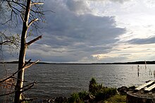
Wolzig ( Lower Sorbian Wólsk ) has been a district in the municipality of Heidesee in Brandenburg , southeast of Berlin in the Dahme-Spreewald district since October 26, 2003 . The place is on Wolziger See , the largest lake in the municipality of Heidesee, which is named after the place, near the main town of the municipality, Friedersdorf .
Wolzig's origins go back to an old Slavic settlement.
history
A Jewish youth and nursing home was built in Spreenhagener Strasse 1 in 1929 , in which young people who had committed criminal offenses were rehabilitated in the spirit of reform pedagogy . In June 1933, SA men attacked the home and deported 40 young people and five educators to Berlin and further to the Oranienburg concentration camp . The house was given to Nazi organizations and from 1948 it was used as a retirement and nursing home. After a long period of vacancy, the building was refurbished in 2001 and converted into a laboratory. The biopharmaceutical company Seramun Diagnostica has been based there since 2003.
Attractions
In the lichen and heather pine forest, about 500 meters from the entrance to the village, there is a root tree that is protected as a natural monument; the pine is 17 meters high and has a root circumference of 19.7 meters. By traversing the inland dune located under the pine in the 1930s, the pine now stands on its exposed roots.
The pier in Wolzig, which leads to the mouth of the lake on the Storkower Canal , is accessible again. From here you have a wonderful view over the lake. The Storkower Canal separates the village, but can be crossed over a bridge; the canal runs right through the village and offers a long mooring area for boats and small yachts.
Until shortly before it flows into the Wolziger See, the canal is accompanied by the Storkower Canal nature reserve , which includes the Stahnsdorfer Fließ and is intended to preserve wild plant communities, forest communities and animal species in the muddy lowland between Wolziger and Stahnsdorfer See . These include tall herbaceous corridors and crab claw corridors and endangered species such as otters , asp and bitterling . The area is also designated as an FFH area in the Natura 2000 network .
Economy and Infrastructure
Means of transport
The nearest train station is in Friedersdorf , 3 kilometers away , on the RB 36 line between Königs Wusterhausen and Frankfurt (Oder) . The town's only connection to public transport is via bus lines to Storkow and Königs Wusterhausen (via Friedersdorf). The buses stop at three stations in Wolzig.
The Friedersdorf airfield is located between Friedersdorf and Wolzig .
Public facilities
- Beach with beach bar and beach house
- Community center and youth club "Alte Kaufhalle"
Individual evidence
- ↑ Community and district directory of the state of Brandenburg. Land surveying and geographic base information Brandenburg (LGB), accessed on June 20, 2020.
- ^ Sophie Wauer: The place names of the Beeskow-Storkow district (= Brandenburg name book. Volume 12 = Berlin contributions to name research. Volume 13). After preliminary work by Klaus Müller. Franz Steiner Verlag, Stuttgart 2005, ISBN 3-515-08664-1 , pp. 226–228 → Wolzig / Wólsk.
- ^ StBA: Changes in the municipalities in Germany, see 2003
- ↑ History of Seramun Diagnostica
- ^ Minister for Agriculture, Environmental Protection and Regional Planning of the State of Brandenburg: Ordinance on the nature reserve “Storkower Canal” of May 24, 2004. (GVBl.II / 04, No. 13, p. 338). Potsdam, May 24, 2004.
- ↑ 3749-306 Storkower Canal. (FFH area) Profiles of the Natura 2000 areas. Published by the Federal Agency for Nature Conservation . Retrieved November 18, 2017.

