Wallberg transmitter
|
Wallberg transmitter
|
||
|---|---|---|
| Basic data | ||
| Place: | Wallberg mountain near Rottach-Egern | |
| Country: | Bavaria | |
| Country: | Germany | |
| Altitude : | 1618 m above sea level NN | |
| Coordinates: 47 ° 39 ′ 41 ″ N , 11 ° 47 ′ 38 ″ E | ||
| Use: | Broadcasting station | |
| Accessibility: | Transmission system not accessible to the public | |
| Owner : | Bavarian radio | |
| Data on the transmission system | ||
| Waveband : | FM transmitter | |
| Radio : | VHF broadcasting | |
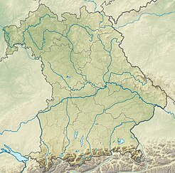
| Position map | ||
|
|
||
The Wallberg transmitter is a broadcasting system of the Bavarian Broadcasting Corporation , which is located near the mountain station of the Wallbergbahn on the 1,722 meter high Wallberg in the Mangfall Mountains .
From here the localities around the Tegernsee , the municipality of Kreuth and the rest of the federal highway 307 to the Austrian border are primarily supplied . Due to the exposed location, however, the transmission area extends very far to the north and in places reaches the state capital Munich .
Frequencies and Programs
Analog radio (VHF)
|
Frequency (MHz) |
program | RDS PS | RDS PI | Regionalization |
ERP (kW) |
Antenna pattern round (ND) / directional (D) |
Polarization horizontal (H) / vertical (V) |
|---|---|---|---|---|---|---|---|
| 87.7 | Bavaria 2 |
Bayern2S Bayern_2 |
D412 (regional), D312 |
Southern Bavaria | 0.1 | D (190–50 °) | H |
| 94.0 | Bavaria 1 |
B1_Obb__ Bavaria_1 |
D411 (regional), D311 |
Upper Bavaria | 0.1 | D (190–50 °) | H |
| 97.9 | BR classic | BR class | D314 | - | 0.1 | D (190–50 °) | H |
| 99.7 | Bayern 3 | BAYERN 3 | D313 | - | 0.1 | D (190–50 °) | H |
| 101.8 | B5 currently | B5_akt__ | D315 | - | 0.1 | D (190–50 °) | H |
Analog television (PAL)
Before the switch to DVB-T, the broadcasting location was still used for analog television:
| channel |
Frequency (MHz) |
program |
ERP (kW) |
Transmission diagram round (ND) / directional (D) |
Polarization horizontal (H) / vertical (V) |
|---|---|---|---|---|---|
| 9 | 203.25 | The First (BR) | 0.005 | D. | H |


