Sereine
| Sereine | ||
|
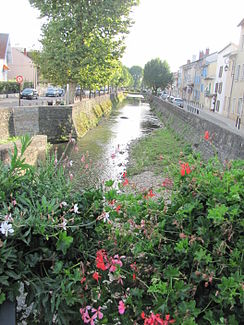
The river in Montluel |
||
| Data | ||
| Water code | FR : V3000560 | |
| location | France , Auvergne-Rhône-Alpes region | |
| River system | Rhône | |
| Drain over | Rhône → Mediterranean | |
| source | in the municipality of Saint-André-de-Corcy 45 ° 56 ′ 30 ″ N , 4 ° 56 ′ 46 ″ E |
|
| Source height | approx. 288 m | |
| muzzle | in the municipality of Beynost in the Canal de Miribel , a shortcut channel of the Rhône Coordinates: 45 ° 49 ′ 0 ″ N , 4 ° 59 ′ 33 ″ E 45 ° 49 ′ 0 ″ N , 4 ° 59 ′ 33 ″ E |
|
| Mouth height | approx. 170 m | |
| Height difference | approx. 118 m | |
| Bottom slope | approx. 4.7 ‰ | |
| length | 25 km | |
| Small towns | Montluel | |
The Sereine is a river in France that runs in the Ain department in the Auvergne-Rhône-Alpes region . It rises in the municipal area of Saint-André-de-Corcy , initially drains in a south-easterly direction through the southern foothills of the Dombes landscape , which is rich in lakes , reaches the Rhône valley near Montluel , swings to the southwest and after a total of 25 kilometers flows into the municipality of Beynost as a right tributary the Canal de Miribel , a currently non-navigable shortcut canal of the Rhône in the northeast of the greater Lyon area .
Places on the river
See also
Web links
Commons : Sereine - collection of images, videos and audio files
Remarks
- ↑ Source geoportail.fr (1: 32,000)
- ↑ mouth geoportail.fr (1: 32,000)
- ↑ a b The information on the river length is based on the information about the Sereine at SANDRE (French), accessed on January 5, 2012, rounded to full kilometers.
