Serra Geral
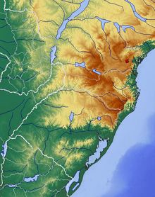
The Serra Geral is a mountainous area on the break edge of the plateau to the coastal region on the border between Rio Grande do Sul and Santa Catarina in southern Brazil . In a plateau of the Serra Geral, the Campo dos Padres , are the highest elevations in the state of Santa Catarina.
National park
On May 20, 1992, the Parque Nacional da Serra Geral was founded with an area of 173 km² in the municipalities of Cambará do Sul , São Francisco de Paula , Jacinto Machado and Praia Grande . It is the extension of the Aparados da Serra National Park .
The canyons , waterfalls and some 100 m high vertical walls are impressive . Are known Fortaleza and Malacara . Very often fog arises which obstructs the view.
Because of the great differences in altitude, there is both rainforest and highland forest with araucarias . Accordingly, the animal world is diverse. Some of the mammals are maned wolf , howler monkey , ocelot . Many birds can also be seen: seriemas , azure blue and others.
The park is easily accessible. Only hiking trails open up the spectacular sights, you have to rely on a tent to stay overnight.
Web links
- Information page of the Brazilian Ministry of Environment (Portuguese)
- Information page of the Cadastro Nacional de Unidades de Conservação (Portuguese)
Coordinates: 29 ° 8 ′ S , 50 ° 0 ′ W

