Shoshone Mountains
| Shoshone Mountains | ||
|---|---|---|
| Highest peak | North Shoshone Peak ( 3,143 m ) | |
| location | Nevada , United States | |
|
|
||
| Coordinates | 38 ° 54 ′ N , 117 ° 33 ′ W | |
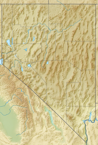
The Shoshone Mountains are a mountain range in the state of Nevada in the United States . The mountain range runs north-south in Counties Nye and Lander . The mountain range has a length of about 106 km and a width of 9.7 km with an area of about 1000 km².
geography
The Shoshone Mountains are an eyrie in the eyrie-and-ditch structure of the Basin and Range Province . They are oriented approximately in a north-south direction.
Named for the Shoshone Indians, the area receives around 38 inches or less of rainfall in an average year. Almost all of the area is owned by the US federal government, with about 58% of the mountain range managed by the Bureau of Land Management and the Forest Service responsible for nearly 42% of the area. A small part of the area is occupied by the Yomba Indian reservation and private land.
The small town of Ione is in the west of the mountains and the Berlin-Ichthyosaur State Park is on the western edge of the mountains bordering the Ione Valley immediately south of the ghost town of Berlin . The ghost town of Golden is located at the southern end of the mountains. The US Highway 50 runs through the extreme northern end of the mountain range some 26 kilometers west of Austin . The Nevada Route 722 crosses the mountains on Railroad Pass after the Reese River Valley US has crossed at Austin 50 southwest. The Nevada Route 844 crosses the Paradise Range further west and the Ione Valley to Berlin-Ichthyosaur State Park on the western edge of the Shoshone Mountains.
The surrounding basins or valleys include the Ione Valley and Smith Creek Valley to the west, the Reese River Valley to the east, and the Big Smokey Valley to the south. The surrounding mountain ranges include the Toiyabe Range in the east, the New Pass Range in the north, the Desatoya Mountains and Paradise Range in the west, and the Cedar Mountains in Mineral County in the southwest.
summit
Named peaks in the area are from south to north:
- Mount Ardivey , 2867 m
- Buffalo Mountain , 2754 m
- South Shoshone Peak , 3067 m
- North Shoshone Peak , 3,143 m
- Iron Mountain , 2371 m
- Emigrant Peak , 2392 m
- Mount Airy , 2320 m
Flora and fauna
The vegetation consists mainly of Sagebrush -Strauchland and juniper - and pinyon pine -Waldgebieten. The Shoshone Mountains are home to mule deer , chipmunks , coyotes , elk and many other small animals such as shrews and squirrels . At least 21 species of birds can be found in the area during the year, including sparrows , woodpeckers and trupials .
Web links
- Shoshone Mountains in the United States Geological Survey's Geographic Names Information System
- Shoshone Mountains on Peakbagger.com (English)
Individual evidence
- ↑ a b c Ione Valley, Nevada, 30x60 Minute Quadrangle Topographic Map, USGS 1985 (38117-E1-TM-100)
- ↑ a b c Smith Creek Valley, Nevada, 30x60 Minute Quadrangle Topographic Map, USGS 1985 (39117-A1-TM-100)
- ↑ a b c Edwards Peak Valley, Nevada, 30x60 Minute Quadrangle Topographic Map, USGS 1983 (N3930-W11700 / 30X60)
- ^ Federal Writers' Project: Origin of Place Names: Nevada . WPA, 1941, p. 59.
- ^ Nevada 2011-2012 Official Highway Map. Nevada DOT, archived from the original ; Retrieved April 25, 2013 .

