Sihl Canal
The Sihl Canal ("tame Sihl") used the water of the Sihl ("wild Sihl") to drive the water wheels in the old town of Zurich and for rafting . The former old course of the Sihl was expanded into a canal from 1651 and filled in from 1901 to 1904.
course
Up until the end of the 19th century, water was diverted from the wild Sihl above the Sihlhölzli ( 412.6 m above sea level ): an approximately 300-meter-long Wuhr between the Giesshübel train station and the center of the Sihlpromenade fed the water into the canal was needed for the operation of mills and factories. The Sihl Canal followed more or less parallel to the course of the Sihl. In the 1920s, in connection with the lowering of the left bank Zurichseebahn, the Sihl was relocated over a length of 900 meters to the south over the old Wuhr and partly to the site of the former Sihl Canal.
The rake at Giesshübel directed wood that had washed up into the canal. As far as the Sihlporte, the wood had to be pulled onto the bank before the water had to drive the various water wheels. The municipal wood depot was located on the site of today's Selnau train station .
Until the city fortifications were removed in the mid-19th century, the Sihl Canal was routed through the outer, third city fortification. At the Sihlporte he was guided over the Schanzengraben on an aqueduct . Today's Uraniastrasse roughly follows the course of the canal through the city center. North of the racing path below the Rennwegtores united the Sihlkanal with the water from the Fröschengraben (was filled to this 1864) and led below the convent Oetenbach when Covered Brüggli above the paper Werds ( 408.3 m above sea level. M. ) in the Limmat.
geology
During the so-called “Zurich Stadium” (about 20,000 years ago) the moraine wall was created , which closes Lake Zurich in the north. It is marked by the ridge between the lake and the Sihltal , by the height at the Lindenhof in the old town and by the Burghölzli, while the Sihl valley absorbed the meltwater flow at the edge of the glacier. In the area of the old town there were next to the “Lindenhof”, the moraine hills “St. Anna ”(near Selnau, removed today),“ Bonzisbühl ”(now the old botanical garden) and“ Ulmberg ”(near the Ulmberg tunnel ). Between these moraine hills (moraine gates), the lake water should have flowed through for some time at the beginning of the post-ice age. The strongest strand of water deepened its sole more than the others and gradually dried it out.
The wild Sihl filled these lake outlets with its debris and formed the Sihl gravel cone. At that time, it flowed below the Lindenhof moraine (area of the lower Mühlesteg ) into the Limmat and brought there debris in large quantities into the Limmat bed. Due to the damming up of the lake water, this sediment input led to a higher lake level and created the island of Papierwerd. From the slope of the “Sihlbühl” moraine part in front of the Lindenhof, on which the Oetenbach nunnery had stood since 1288, the “Besenrain” led down steeply to “Sihlwiesli” (today “Beatenplatz”).
In later times the "wild Sihl" shifted more to the left, while the side arms remained in the old direction of the river and were from now on referred to as the "tame Sihl". Between “Selnau” and “Steinmühle” the width of the tame Sihl corresponded to a third of the bed of the wild Sihl. The tame arm first formed a flat "S" and then spread out into several crooked streams. The later “Sihl Canal” got its direction from the old natural watercourses. Finds of Roman millstones outside the Rennweg near the “Trülle” house and in the garden of the green Seidenhof as well as an amphora for grain or flour in the “Glockenhaus” garden ( Füssli bell foundry on Sihlstrasse) are evidence of this. The place names on the Murer map from 1566 indicate that the tame Sihl was originally an old river and not an artificially created canal.
history
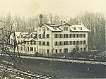
A drawing by Johann Balthasar Bullinger shows a fulling mill on the Sihl Canal in Sihlhölzli in the 18th century . The Dannersche Sihlhölzlimühle was built in 1845. In 1870 the Baumann Older silk weaving mill put its first mechanical looms into operation there. The Hofstetter marble workshop followed around 1900. In 1917 the Sihlhölzlimühle was demolished. In the 1920s the lowering of the left bank of the lake was carried out . Instead of going through the Ulmberg Tunnel, the tracks were run in a tunnel under the Sihl. For this purpose, the Sihl had to be relocated from 1918 to 1920 over a length of 900 meters on the east side of the Sihlhölzli at the location of the Sihl Canal. The old Sihllauf was filled up, the Sihlwuhr, the Sihlkanal and the Sihlhölzli island disappeared.
Since 1265 a stream was known as the "Sihlrunse", on which the nuns of the Selnau monastery had built a mill on their farm since 1312 at the latest. In the historic Selnau district, this stream was derived from the “small” or “tame Sihl”, later the “Sihl Canal”, and from there led into Lake Zurich . In the lower reaches, among other things, he watered the bleaching there .
From the 13th century, the "tame Sihl" was used to operate the six mill wheels. During this time, the most important access to the city was via the Rennwegtor via Sihlstrasse. The Schanzengraben was after 1642 the outer moat of the third fastening the city of Zurich, which according to the plan of Hans Georg Werdmüller was created. From 1651 the "tame Sihl" was expanded into the "Sihl Canal" when the hill was built.
In the late 18th century there were 32 mills, sawmills and fulling mills in Zurich. Most were on the upper and lower Mühlesteg in the Limmat and the others on the Sihl Canal. The city of Zurich had no more than 10,000 inhabitants until 1800. The end of the timber floating on the Sihl came after shortly before 1860, the city with new street plays an all Sihltal was created by pulling traffic route on which the wood from the Sihlwald could be dissipated.
From 1901 to 1904 the Sihl Canal from the Sihlporte to the Limmat was drained and filled in and used as a road in the section between Bahnhofstrasse and Steinmühleplatz. With the construction of the large-volume office building complex in the area of today's Uraniabrücke (1902–1914), Uraniastrasse received its first striking urban appearance. The lower part of the street, from Steinmühleplatz to Sihlporte, was not built until the 1930s. In older plans before 1900, the street was called "Sihlhofgasse", even earlier this partly very narrow path was called "Am Sihlkanal". Sihlhofstrasse stretched along what was then the Sihl Canal between Bahnhofstrasse 73 and Steinmühlegasse near the synagogue.
The former Sihl Canal can only be recognized today by the course of the Uraniastrasse and the spaces in between buildings from that time. The former Sihlhofstrasse now forms part of the Uraniastrasse.
Hydropower on the Sihl Canal
The mill of the Selnau monastery ("Seldenowermühle am Boncisbühl"), first mentioned in 1312, stood on the monastery grounds south of the moraine dome (Boncisbühl) of the "Old Botanical Garden" (in the 17th century, the "zur Katz" bastion) directly beyond the Schanzengraben. It was driven by the “Sihlrunse” brook, which can be seen on the Müllerplan from 1788/1793. The new archaeological information shows that the stream passed directly in front of the west facade of the monastery church.
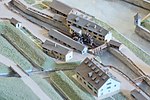
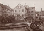
The Vogelimühle, or underwater mill , was the imperial fief of the Free von Schwarzenberg, afterfeit of the Mülner knights and came to the Selnau monastery in 1288. It was owned by Werdmüller until 1524 and by Vögeli (Vögelimühle) from 1527 to 1717. The men's saw belonged to the Vogelimühle. It was the first mill on the Sihl Canal after it had passed the city fortifications, and stood immediately after idling in the Sihl. It was on the city map from 1900 at Sihlstrasse 69 and was canceled in 1938.
The mill mentioned in 1218 ( mill near Sankt Stephan ) stood below the Sihlporte near today's Steinmühlegasse near the former chapels of Sankt Stephan and Sankt Anna. It was inherited from the Fraumünster Abbey . From 1271 to 1278 it was called "Mühle zum Stein", later called the stone mill . In 1389 an associated saw was mentioned. The stone mill burned down in 1488, was rebuilt in 1493 and demolished in 1926.
The Finslermühle or Bletschersmühle stood opposite the stone mill with which it was merged in 1865. She had a saw that was operated by the town sawmaker in 1492 and broken off in 1858.
The silk industry gained a foothold in 1592 with the construction of the Old Seidenhof near the Sihl Canal by David & Heinrich Werdmüller as a publishing system in Zurich. Business went so well that the Werdmüller family had the Neue Seidenhof built next door in 1606 , which, with eight Seidenhöfe, became Zurich's first factory district. At the site of the green Seidenhof (today Jelmoli department store ), a brickworks ("gentlemen's" or "authoritarian hut") was first mentioned in 1364 .
1717 was based in the company Hans Conrad Escher new Seidenhof the mill house Sihlhof purchased Sihlwiesli. Heinrich Escher the Younger and his brothers sold the Sihlhof mill house to Hans Conrad Finsler in 1747. His four daughters sold the Sihlhof he had inherited in 1785 to the silk merchant Hans Heinrich Gessner. Gessner and his brother Hans Konrad have converted the neighboring Kleiner Sihlhof into a factory. Around 1806 there were cotton spinning machines there. Before 1812 the Sihlhof was owned by Colonel Jakob Füssli, later by the Kunkler brothers and by Captain Füssli, and in 1860 by the City of Zurich.
The upper Werdmühle (also Ammann , sparks , Schweizermühle and Werdmühle Waser called) already existed in the 13th century (1489 new mill ) and stood near the Rennwegtores above the spot where the Fröschengraben resulted in the Sihlkanal. The Sihl Canal flowed past the mill (around 1900 Werdmühlegasse 7) on both sides. In 1455 it was owned by Hans Funk, from 1464 to 1524 by Werdmüller and from 1539 to the 19th century by the Schweizer family. In 1901/02 the mill was demolished.
The Werdmühle (1503 lower Werdmühle ) on the Sihl Canal was first mentioned as the property of the Fraumünster Abbey and was called Hinderburg . After the Froschengraben entered the Sihl Canal, it stood just below the upper Werdmühle and was the last mill before the canal confluence with the Limmat. In 1276 the fiefdom of knight Rudolf Biber was passed on to Rudolf von Opfikon, who gave it to the Oetenbach monastery in 1290. The monastery ran the "women at Oetenbach-Mühle Hinderburg" until 1357 under its own management. From 1489 it was called St. Christoffel and from 1429 to 1769 it was owned by Otto Werdmüller and his heirs as an inheritance with mill, house, farmstead, ring and saw. In 1444 the mill was set on fire and destroyed by the Confederates in the Old Zurich War. Afterwards it was rebuilt larger. The lucrative mill had a monopoly on grinding spices since the 17th century and also included a sawmill, which over time surpassed the mill yield.
In 1769, the mill passed into the ownership of the neighboring miller family, Schweizer, by inheritance. Beat Werdmüller did not succeed in securing this as a family entourage for the Werdmüller. After the Helvetic , the owner and the company often changed. In addition to the mill and the saw, an oil mill, a “silk wheel” and a twisting mill were set up, later the Rordorf dye works, the Bodmerische silk factory and the Schinz cloth mill. In 1860 the mill burned down completely and was no longer rebuilt. Its hydropower was used by the David Sprüngli & Co. chocolate factory, which was built in 1870. The brothers Johann Rudolf and David Robert Sprüngli had lived at Werdmühlegasse 14 since 1870. The chocolate factory and residential building were demolished in 1901.
Hydroelectric power plants on the Sihl Canal
Legend: ID = water law
| ID | photo | object | Cat. | Type | address | Coordinates |
|---|---|---|---|---|---|---|

|
Wehr / Wuhr Giesshübel – Sihlhölzli with lock, 1917 |
682006 / 246669
|
||||

|
Derivation of the Sihl Canal, Sihlhölzli, Wehr, city map 1900 |
681997 / 246687
|
||||

|
Sihlhölzlimühle 1916 (1845-1917) | Sihlhölzlistrasse 3 and 5 |
682258 / 246912
|
|||

|
Sihlpromenade, formerly on the Sihl Canal, today on the Sihl, which has been diverted since 1927 | Sihlhölzli |
682066 / 246822
|
|||

|
Mill Monastery Selnau , Mur map 1566 |
682601 / 247157
|
||||

|
Sihl Canal underpass at Stadelhofer Ravelin with water tower, city model 1800 |
682602 / 247303
|
||||

|
Vögelimühle 1917, canal not yet covered | Selnaustrasse 69 |
682657 / 247366
|
|||

|
Men's saw, Vögelimühle, city model 1800 |
682640 / 247389
|
||||

|
Water tower 1724, Männerbad 1864 | Badweg 21 |
682615 / 247300
|
|||

|
Bollwerk zur Katz («Bonzisbühl»), third city fortification from 1642 | Old Botanical Garden |
682631 / 247251
|
|||

|
Sihl Canal Bridge over the Schanzengraben, 1901 before demolition |
682700 / 247461
|
||||

|
Sihlegg, Sihlporte 1902 | Sihlstrasse 73 |
682675 / 247458
|
|||
| 70 |

|
Stone mill around 1908 | Sihlstrasse 42 |
682874 / 247510
|
||

|
Finsler Mill 1928 | Sihlstrasse 40 |
682888 / 247509
|
|||

|
"Bell house" 1496/1667 of the Füssli family of bell foundries | Sihlstrasse 35 |
682873 / 247458
|
|||

|
Alter Seidenhof 1592 by David & Heinrich Werdmüller | Steinmühleplatz |
682914 / 247587
|
|||

|
Neuer Seidenhof 1606 (eight courtyards, Zurich's first factory district) | Sihlstrasse 20 |
682959 / 247640
|
|||

|
Salt magazine 82, large Sihlhof 83, small Sihlhof 84, sawmill 87, Müllerplan 1793 |
683094 / 247643
|
||||

|
upper Werdmühle, 1900 | Werdmühlegasse 7 |
683109 / 247656
|
|||
| 72, 74-75 |

|
Werdmühle, chocolate factory David Sprüngli & Son , 1900 | Werdmühlegasse 22 |
683140 / 247684
|
||

|
Kleine Werdmühle (left bank of the canal), Müllerplan 1793 |
683133 / 247705
|
||||

|
Limmat estuary of the Sihl Canal below the Covered Brügglis , 1900 |
683282 / 247835
|
literature
- Robert Huber: The rubble cone of the Sihl in the area of the city of Zurich and the prehistoric delta in the lake . Manuscript from 1937
- Leo Weisz, Johann Otto Werdmüller: The Werdmüller. Fates of an old Zurich family. On behalf of the Otto Werdmüller Family Foundation. Schulthess publishing house, Zurich 1949.
- Ulrich Pfister: The Zurich Fabriques, proto-industrial growth from the 16th to the 18th century. Chronos Verlag, Zurich 1992.
- Hans-Peter Bärtschi: Industrial culture in the canton of Zurich. Rotpunktverlag, Zurich 1994, ISBN 978-3-85869-407-2 .
- Christine Barraud Wiener, Peter Jezler: The city of Zurich I. The city in front of the wall, medieval fortifications and the Limmatraum . In: The art monuments of the Canton of Zurich. New edition Volume I, Wiese Verlag, Basel 1999, ISBN 3-909164-70-6 .
- Dölf Wild, Jürg Hanser, Elisabeth Langenegger: New Findings on the Cistercian Convent in Selnau. Archeology and Monument Preservation, City of Zurich 2006
- Markus Brühlmeier: Flour and bread, power and money in old Zurich. On the cultural history of bread . Zunft zur Weggen (Ed.), Chronos Verlag, Zurich 2013, ISBN 978-3-0340-0967-6
Web links
Individual evidence
- ↑ Schweizerische Bauzeitung from 1917: The Sihl overpass of the SBB during the renovation of the left bank of the Zürichsee railway
- ↑ Zurich's missing unique piece. In: Tages-Anzeiger of November 7, 2017.
- ^ Local museum Wiedikon: From the distant past
- ↑ Today's Beatenplatz got its name in 1904 from the former field name "Beatenrain". The Beatenrain passed the Werdmühle (today Werdmühleplatz) by Beat Werdmüller (1517–1574), whose name he received. (Robert Huber: The rubble cone of the Sihl in the area of the city of Zurich and the prehistoric delta in the lake. Manuscript from 1937).
- ↑ On the Murerplan, the two mill streams are designated as the “Silfluss”, the “Frauenmühle” of the Oetenbach monastery as the “Mill on the Sil” and a house that was demolished in 1866 for the construction of the Bahnhofstrasse as the “Sihlhof”. The top mill of the Selnau monastery (“am Bonzisbühl”) was “between the Silenus”.
- ^ City of Zurich: Sihlhölzli
- ↑ Local museum Wiedikon: "Wilde Sihl" and "tame Sihl"
- ↑ Dölf Wild, Jürg Hanser, Elisabeth Langenegger: New findings on the Cistercian monastery in Selnau. City of Zurich, Archeology and Monument Preservation, 2006
- ↑ Wiedikon local museum: brickworks
- ^ Leo Weisz, Jakob Otto Werdmüller: Die Werdmüller. Fates of an old Zurich family, on behalf of the Otto Werdmüller Family Foundation. Schulthess publishing house, Zurich 1949


