Simberg
| Simberg | ||
|---|---|---|
|
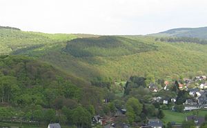
Simberg; in front left his west- south -west foothills Simrich |
||
| height | 527.7 m above sea level NHN | |
| location | near Burbach ; District of Siegen-Wittgenstein , North Rhine-Westphalia ( Germany ) | |
| Mountains | Rothaar Mountains | |
| Coordinates | 50 ° 45 ′ 41 " N , 8 ° 5 ′ 27" E | |
|
|
||
The Simberg is a 527.7 m above sea level. NHN high elevation of the Rothaargebirge . It is located near Burbach in the Siegen-Wittgenstein district of North Rhine-Westphalia .
geography
location
The Simberg, located in the southern part of the Rothaargebirge in the municipality of Burbach between the eponymous core town in the south-south-west and the Burbach districts of Wahlbach in the west -south- west, Gilsbach in the north-north-west and Würgendorf in the east, belongs to the Kalteiche massif . To northeast the landscape passes over the Hude ( 522 m ) for wood Holzer head ( 542.9 m ) and southwest directly to Simberg Streamers Simrich ( 442.4 m ) above. A landfill and the former “Heinrichsburg” mine are located on the southeastern lower mountain slope . To the south past the Simberg, the Heller flows roughly in a west-east direction , into which the Gilsbach, which runs northwest of the elevation, flows near the village of Wahlbach. The 1.4 km long Fisselbach , which flows west of the Simberg and northeast of the Simrich and flows west of the Simberg into the Gilsbach, rises on the Simberg southwest flank ; In addition, a small Heller tributary rises on the southern slope.
Natural allocation
The Simberg belongs to the natural spatial main unit group Süderbergland (No. 33) in the main unit Rothaargebirge (with Hochsauerland ) (333) and in the subunit Dill-Lahn-Eder source area (333.0) to the natural area Kalteiche (with Haincher Höhe) (333.00), directly, especially south and west, in the main unit Siegerland (331) and in the subunit Hellerbergland (331.3) the natural area Middle Hellertal (331.31) connects.
traffic
State road 723 runs between the Simberg and Simrich rivers at a maximum height of 441 m as a connecting road from Gilsbach to Burbach. It meets the L 531 south of the Simberg, which leads from Burbach to Würgendorf. The elevation itself can be reached on forest trails and paths.
Individual evidence
- ↑ a b Map services of the Federal Agency for Nature Conservation ( information )
- ↑ Heinz Fischer: Geographical Land Survey: The natural spatial units on sheet 124 Siegen. Federal Institute for Regional Studies, Bad Godesberg 1972. → Online map (PDF; 4.1 MB)

