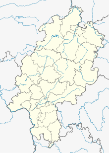
Simmenhausen
Coordinates: 51 ° 16 ′ 22 " N , 9 ° 14 ′ 56" E
Simmen Hausen was a village settlement in today's district of Balhorn , in the municipality of Bad Emstal in northern Hesse Kassel district .
Geographical location
The place was about 800 m east of the original center of Balhorn at about 345 m altitude in the area of today's new development area "Am Distelberg" on the upper reaches of a small brook that drained west to the Spolebach . The village street “Simmenhausen” leading there reminds of the disappeared village.
history
Very little is known about the history of the small settlement. It was first mentioned in a certificate from Mainz in 1081 , according to which Archbishop Siegfried I confirmed that the Hasungen Monastery, founded in 1074, owned “Simanneshusun” or “Simaneshusun”. The place was probably in the 14th or 15th century desolate . When the Salbuch of the High Hospital Merxhausen in 1557 and the Salbuch of the Gudensberg Office in 1579 recorded tax obligations in "Simtehusen" and "Simmedehusen", respectively, these were only hall names . The field mark of the abandoned village remained until the second half of the 19th century; only then was it incorporated into the district of Balhorn, as well as parts of the districts of Gershausen , Holzkirchen and Schwalgenhausen .
Footnotes
- ↑ The certificate is, however, a forgery made around 1100. (Manfred Stimming (edit): Mainzer Urkundenbuch, Volume 1: The documents up to the death of Archbishop Adalbert I (1137) , Historischer Verein für Hessen, Darmstadt, 1932, pp. 253-258, no. 358).
- ↑ Georg Landau : Historical-topographical description of the desolate localities in the Electorate of Hesse and in the grand-ducal Hessian parts of Hessengaue, Oberlahngaue and Ittergaue (= journal of the Association for Hessian History and Regional Studies. Supplement 7, ZDB -ID 200295-4 ). Theodor Fischer, Kassel 1858, p. 172 (“Holzkirchen”) .
literature
- Georg Landau : Historical-topographical description of the desolate localities in the Electorate of Hesse and in the grand-ducal Hessian parts of Hessengaue, Oberlahngaue and Ittergaue (= journal of the Association for Hessian History and Regional Studies. Supplement 7, ZDB -ID 200295-4 ). Theodor Fischer, Kassel 1858, p. 158 .
- Heinrich Reimer (Hrsg.): Historical local lexicon for Kurhessen (publications of the historical commission for Hessen). Elwert, Marburg, 1974, p. 445.
Web links
- Simmenhausen, district of Kassel. Historical local dictionary for Hessen. In: Landesgeschichtliches Informationssystem Hessen (LAGIS).
- History of Bad Emstal, at www.bad-emstal.de
