Berchem-Sainte-Agathe / Sint-Agatha-Berchem
| Berchem-Sainte-Agathe Sint-Agatha-Berchem |
||
|---|---|---|

|

|
|
|
|
||
| State : |
|
|
| Region : | Brussels capital | |
| Province : | ("de-provincialized" since January 1st, 1995) | |
| District : | Brussels capital | |
| Coordinates : | 50 ° 52 ′ N , 4 ° 18 ′ E | |
| Area : | 2.95 km² | |
| Residents: | 25,179 (Jan. 1, 2019) | |
| Population density: | 8,535 inhabitants per km² | |
| Post Code: | 1082 | |
| Prefix: | 02 | |
| Mayor: | Joël Riguelle ( cdH ) | |
Local government address : |
Administration communale 33 Avenue du Roi Albert 1082 Berchem-Sainte-Agathe Gemeentebestuur Koning Albertlaan 33 1082 Sint-Agatha-Berchem |
|
| Website: | www.1082berchem.brussels | |
Berchem-Sainte-Agathe ( French ) or Sint-Agatha-Berchem ( Dutch ) is a municipality on the western edge of the bilingual Brussels-Capital region in Belgium . It borders the municipalities of Ganshoren , Koekelberg and Molenbeek-Saint-Jean / Sint-Jans-Molenbeek in the Brussels-Capital Region and the Flemish municipalities of Asse and Dilbeek .
The community area begins immediately behind the National Basilica of the Sacred Heart on the Koekelberg, which is the most important point of reference, but does not belong to the community itself.
The center of the community is Albert-Schweitzer -Platz on Chaussée de Gand / Gentse Steenweg , an arterial road to the northwest.
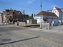
Berchem has a station of the National Company of Belgian Railways on the Ghent route and is served by tram lines 19, 82 and 83.
sons and daughters of the town
- Rudi Vervoort (* 1958), politician
- Jean-Claude Van Damme (born 1960), actor
- Mohamed Abrini (* 1984), Islamist terrorist
- Alexis Saelemaekers (* 1999), football player

