Soldiersau
| Soldiersau | ||
|---|---|---|
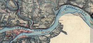
| Original position sheet with the old town of Passau in the southwest (bottom left) and the city of Au in the northeast (top right) | ||
| Waters | Danube | |
| Geographical location | 48 ° 35 '18 " N , 13 ° 30' 49" E | |
|
|
||
| length | 1.18 km | |
| width | 340 m | |
| surface | 30.8 ha | |
| Residents | uninhabited | |
The soldiersau , also Stadtau , is an Austrian Danube island three kilometers downstream from the old town of Passau . It is not to be confused with the former island of the same name in Linz, which was also called Straßerau or Straßerinsel .
administration
The soldiersau belongs to the cadastral community Hinding , district Achleiten of the community Freinberg in the Upper Austrian district of Schärding . It forms the northernmost land mass in the Schärding district.
Landowner of the island for about 100 years the city of Passau.
geography
The island is 1180 meters long in the direction of the Danube and has a maximum width of 340 meters and an area of 30.8 hectares . It is 40 meters from the right (Austrian) bank of the Danube, but 170 meters from the left bank of the Danube, which here belongs to the city of Passau (district Grubweg ) and the municipality of Thyrnau (district Kellberg ). The uninhabited, very flat river island extends from river kilometers 2222.5 to 2221. In the series of Danube islands it lies between the Kräutelstein , which is 500 meters upstream, and the Jochenstein , which is 18 km downstream.
In the southwest the island is connected to the right bank of the Danube by a 160 meter long and eight meter wide concrete dam, called Der Sporn .
The island still has old poplar and willow trees . The alluvial forest, however, was partially rebuilt after the Jochenstein power plant was built, as it has been in the area of influence of the Jochenstein reservoir since 1955.
history
The town of Au has played an important role in the water supply of Passau since 1550 . The city part of the name Stadt-Au refers to the city of Passau. Until then, Passau had drawn its drinking water from cisterns . The name soldiersau comes from a soldier army that was stationed here for one year in 1610 by Prince-Bishop Leopold .
Judging by old maps, the island used to belong to Bavaria, namely to the former municipality of Kellberg . The state border with Austria ran on the right bank of the Danube.
Even today (2018) Passau gets all of its drinking water from the Achleiten waterworks on the Soldierau. Entering the island is therefore prohibited for unauthorized persons. When the Danube floods in 2013 , the island was almost completely flooded and the drinking water supply to Passau was cut off for several days.
Individual evidence
- ^ Community Freinberg: What's NEW ... ????
- ↑ Office of the Upper Austrian Provincial Government, Subdivision Regional Spatial Planning, Head: w.Hofrat Mag. Helmut Weiss, Clerk: Wiss.ORat Thilde Lichtenauer: The valley landscape of the Danube between Passau and Aschach Spatial planning concept with special consideration of the factors landscape and recreation. Linz 1987
- ^ 19th century land map

