Spechtritzgrund
The Spechtritzgrund is a gneiss rock notched valley of the Roten Weißeritz near Rabenau in the Saxon Switzerland-Eastern Ore Mountains district . It connects the Rabenauer reason with the Seifersdorfer reason and since 1974 as part of the conservation area, the valley of the Red Weißeritz reported.
location
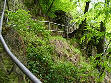
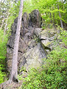
The section between the Rabenauer Grund (staircase at the mill weir) and the Langegrundbach, which is the border to the Seifersdorfer Grund, is called Spechtritzgrund. Rock formations can be seen on both sides, through which the Rote Weißeritz has created its river bed over millions of years. The Lübauer Gründel flows into the bottom.
Confluent tributaries are the Langegrundbach at the upper end, the Spechtritzer Dorfbach, the Borlasbach and smaller tributaries.
history
The Spechtritzmühle was first mentioned in 1562 , a new building with a pub was built in 1880, and all buildings were demolished in 2009. The upstream Felsenmühle was built between 1886-87 on the acquired land of Freiguts Kleinoelsa and was initially used as a bone mill and later as Korkmühle. In 2008 their buildings were also demolished.
At the level of the mouth of the Lübauer Gründel lies the Goldstampfe, where gold was once mined; in earlier centuries it was also known as the Kleiner Nixentump. On a rock on the Rote Weißeritz you can find the inscription "Built in 1896 1st Company", which refers to the construction of the hiking / footpath between Seifersdorf via Spechtritz to Rabenau. The railway line of the Weißeritztalbahn , inaugurated on October 30, 1882, ran directly along the Rote Weißeritz . After the Spechtritz train station, it was relocated to higher ground due to the construction of the Malter dam , where on April 24, 1912 the first train drove towards Seifersdorf . Since the last tracks were dismantled in 1914, the old railway embankment in the direction of Seifersdorfer Grund has been used as a hiking trail.
Landscape and nature protection
From the barrier wall of the Malter dam including the Gründel, parts of the village of Seifersdorf, Mittelgrund, Lange-Grund, Spechtritzgrund, Lübauer Gründel to the Rabenauer Mühle, the area was placed under protection on July 4, 1974 under the name "Valley of the Rote Weißeritz". Species-rich meadows with water sources, forest sections and various animal species can be found in the ground. Part of the reason is designated in the LSG , at the level of the forest path coming down from the Buchwald, on the hiking path below the Lübauer Grund to the road from Rabenau to Lübau as a nature reserve Rabenauer Grund .
The reason is also in the FFH area "Täler von Roter Weißeritz and Oelsabachtal" and the European bird sanctuary "Weißeritztäler" of Natura 2000 .
literature
- Between Tharandt forest, Freital and the Lockwitztal (= values of our homeland . Volume 21). 1st edition. Akademie Verlag, Berlin 1973.
- Our little hiking booklet. The Weißeritztalsperren. VEB Bibliographisches Institut, Leipzig 1954
- Rabenauer Grund, Malter and Klingenberg dams. VEB FA Brockhaus Verlag, Leipzig 1967
- Rabenauer Grund Nature Park. Meißner Druckhaus, Wilsdruff branch in 1955
- Rabenau. A walk through the history of the chair-making town and its districts. Printing house S. Ell, Rabenau 2010
Coordinates: 50 ° 57 ′ 4.2 " N , 13 ° 38 ′ 34.7" E


