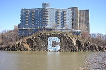
Spuyten Duyvil Creek
The Spuyten Duyvil Creek is a short stretch of river in New York City that connects the Hudson River with the Harlem River Ship Canal .
location
Spuyten Duyvil Creek is in north Manhattan and separates the island from the Bronx . Today it represents the connection between the Hudson River and the Harlem River . Inwood Hill Park is on the south side and the Spuyten Duyvil and Riverdale districts on the north .
The Henry Hudson Bridge and the Spuyten Duyvil Swing Bridge cross the river along the Henry Hudson Parkway . The tracks of the former Hudson River Railroad , today Amtrak Empire Connection , which lead to Albany, run over this swing bridge . Below the Henry Hudson Bridge, directly on the river, on the Bronx side, is Spuyten Duyvil Station , a stop on the Hudson Line, which is operated by the Metro-North Railroad .
history
Manhattan and the Bronx used to be separated only by a narrow tidal body, in which high currents prevailed. The Spuyten Duyvil Creek connected the Hudson River with the East River and Long Island Sound . The tides resulted in high level differences between these waters, which caused the high current speeds. The first mention of the river comes from the year 1609 by Henry Hudson , who anchored with his ship, the Halve Maen (Crescent Moon) in the Spuyten Duyvil. The Spuyten Duyvil Creek originally flowed north of Marble Hill , which was then still part of Manhattan. Dutch farmers used the river at low tide to get from Manhattan Island to the mainland without paying for the ferry at 125 Street. To prevent this, the ferry was moved to 231st Street.
King's Bridge , built by Frederick Philipse in 1693, was the first bridge to span Spuyten Duyvil Creek. The bridge was built exactly at the point that allowed the crossing at low tide and thus blocked this possibility. The bridge connected the Bronx to Marble Hill, and there was a fee to use it. With the construction of the Harlem River Ship Canal, which was supposed to save boat traffic the journey through the winding loop of the Harlem River, Marble Hill became an island in its own right in 1895. Later the old bed of the Spuyten Duyvil Creek was filled in and the district was located in the Bronx. The old bridge is said to still be there, it was buried when the bed of the Spuyten Duyvil Creek was filled in. Only a small piece of the original Spuyten Duyvil Creek remains behind the mouth. The Henry Hudson Bridge was completed on December 12, 1936. Use is still chargeable.
Surname

The name "Spuyten Duyvil" comes from Dutch and literally means "devil's drain", which can also be translated as "Devil's whirlpool" and is a reference to the strong currents that occurred here. The Lenape , the indigenous people of this area, called the banks of Spuyten Duyvil Creek Shorakapok , which means something like "the place to sit".
Individual evidence
- ↑ a b c Watercourses: Spuyten Duyvil Creek, Manhattan / Bronx
- ↑ a b c Washington Heights history: Spuyten Duyvil Creek ( Memento of the original dated August 28, 2003 in the Internet Archive ) Info: The archive link was inserted automatically and has not yet been checked. Please check the original and archive link according to the instructions and then remove this notice.
- ^ New York Times FYI
Coordinates: 40 ° 52 ′ 30 ″ N , 73 ° 55 ′ 5 ″ W.


