Storm head
| Storm head | ||
|---|---|---|
|
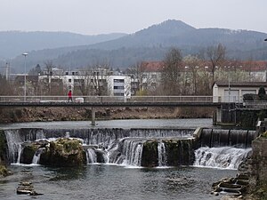
Stürmenchopf, in the foreground the Laufen waterfall |
||
| height | 768 m above sea level M. | |
| location | Basel-Country , Switzerland | |
| Mountains | law | |
| Coordinates | 604 349 / 248802 | |
|
|
||
| rock | lime | |
| Development | Forest road up to a hut at 620 m altitude, then hiking trail with an average of 25% gradient | |
| Normal way | Trail T1 / T2 | |
| particularities | Remains of a Roman fortification from the 3rd century AD | |
The storm head or storm head is a 768 m above sea level. M. situated, wooded hills in the municipality of elections in the canton of Basel in Switzerland .
It offers a good view of the relatively flat Laufner Basin, which is characterized by settlements and agriculture (clockwise: Laufen , Zwingen , Brislach , Breitenbach , Büsserach and Wahlen). The south and east sides of the hill are closed off by rock faces.
Roman buildings
The storm head is known for the remains of a Roman observation tower. The scientist, engineer and politician Auguste Quiquerez (1801-1882) recognized the archaeological importance of the hill in 1839. In 1861 he started excavations and found remains of the foundation, iron slag, bones and a shard of a terra sigillata .
Alban Gerster carried out further excavations in 1919, 1929 and 1931 and found the remains of a Roman wall. It closed on two protective walls, 80 and 100 meters long, which enclosed the two unprotected west and north sides of the hill. He also found the remains of a watchtower (base area 8.1 m × 6.25 m), a bronze coin from the time of Emperor Aurelian (270 to 275 years AD) and other objects.
In the vicinity of the Stürmenchopf are the ruins of Bännlifels (1.3 km east) and a Roman villa (1.1 km east-northeast), further relics from Roman times.
literature
- "Storm head, elections" in the Lexicon of the Jura

