Steep slopes of the Saar
|
Steep slopes of the Saar
|
||
|
Nature reserve steep slopes of the Saar (May 2019) |
||
| location | Saarland , Germany | |
| surface | 10.86 km² | |
| WDPA ID | 555638656 | |
| Geographical location | 49 ° 31 ' N , 6 ° 35' E | |
|
|
||
| Setup date | 2017 | |
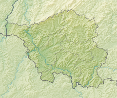
The steep slopes of the Saar nature reserve lie in the area of the municipalities of Mettlach and Perl and the city of Merzig in the Merzig-Wadern district in Saarland .
meaning
The 1086 hectare area has been designated as a nature reserve since June 21, 2017 and replaces the previous protected areas “Saar-Steilhang / Lutwinuswald”, “Steinbachtal west of Saarschleife”, “Hundscheiderbachtal” and “Hundscheiderbachtal (extension)”. It is largely congruent with the EU bird sanctuary and FFH area of the same name.
The area, which consists of four sub-areas, extends northeast and southwest of Saarhölzbach , a district of Mettlach. The state road L 176 runs through the area, the L 178 to the west and the B 51 to the south-east and through the area . The Saar flows on the northeast and southeast edge and through the area, while the state border with Rhineland-Palatinate runs on the northeast edge .
See also
- List of nature reserves in the Merzig-Wadern district
- Saar slopes on Kaiserweg (Rhineland-Palatinate part)
Web links
- 791-88 Ordinance on the nature reserve “steep slopes of the Saar” (N 6505-301) from June 21, 2017 on sl.juris.de, accessed on November 25, 2019
- World Database on Protected Areas - nature reserve "steep slopes of the Saar" (N 6505-301) (English)


