Strážný (mountain)
| Strážný | ||
|---|---|---|
|
Way to Strážný |
||
| height | 1115 m nm | |
| location | Bohemia , Czech Republic | |
| Mountains | Bohemian forest | |
| Dominance | 2.7 km → Žlíbský vrch | |
| Notch height | 117 m ↓ Žďárecké jezírko (Scheureker threshold) | |
| Coordinates | 48 ° 55 '14 " N , 13 ° 41' 55" E | |
|
|
||
| particularities | Kunžvart spur mountain with castle ruins | |
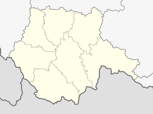
The Strážný ( German Schlösselberg ) is a 1115 meter high mountain in the Bohemian Forest in the Czech Republic . He is close to the Market town Strážný (until 1955 Kunžvart , dt. Kuschwarda ). The mountain is forested with spruce , fir , whitebeam and beech . Part of the south and east slopes is protected by landscape.
Its secondary peak, the 1033 meter high Kunžvart spur mountain, is crowned by the castle ruins of the same name (Kunzwarte, Kuschwarda Castle, Königswart Castle) . The castle was first mentioned in 1359 as Castrum Kungenslen and fell into disrepair since the middle of the 16th century. Archaeological investigations in the area of the spur brought up remains of pottery and horseshoes from the 13th – 15th centuries. Century to the surface. Further finds can be assigned to the Hallstatt period (6th century BC).
Surrounding villages are Polka (Elendbachl) in the northeast, Kořenný (Schlösselbach) and Strážný in the southeast and Dolní Silnice (country roads) in the south.
A yellow hiking trail leads from Strážný to the remains of the castle. The difference in altitude is almost two hundred meters. From there another path leads to the summit after 650 m. The nearest train station is Lenora (Eleonorenhain) eight kilometers away.
Web links
- the mountain on tisicovky.cz (Czech)
Individual evidence
- ↑ Prominence a izolace na Ultratisicovky.cz
- ↑ tisicovky.cz: Strážný (HLV 178; 1115 m) . (Czech, accessed December 3, 2019)
- ↑ Excursus č. 19 Hrad Kunžvart (Kunzwarte) . In: František Kubů, Petr Zavřel: Zlatá stezka. Historický a archeologický výzkum významné středověké obchodní cesty . Volume 2: Úsek Vimperk - státní hranice (VI. Úsek). České Budějovice 2007. ISBN 978-80-86260-82-2 . Pp. 150-172.

