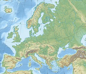
Strait of Dover
| Strait of Dover | ||
|---|---|---|
| Connects waters | North Sea | |
| with water | English Channel | |
| Separates land mass | Great Britain | |
| of land mass | mainland Europe | |
| Data | ||
| Geographical location | 51 ° 1 ′ N , 1 ° 29 ′ E | |
|
|
||
| Smallest width | 27 km | |
| Coastal towns | Dover , Calais | |
| tunnel | Eurotunnel | |
The Strait of Dover ( English Strait of Dover ) or Strait of Calais ( French Pas de Calais ) is the narrowest part of the English Channel , the strait between Great Britain and continental Europe . It connects the North Sea or its southern sea area Hoofden in the northeast with the broader English Channel or the Atlantic in the west.
geography
The width of the strait is traditionally given very differently and sometimes contradicting itself in the well-known reference works. It was reported to the United Nations in the 1950s that there was 19.5 miles (31.4 km) between Cap Gris-Nez and Folkestone , and the narrowest point north of Cap Gris-Nez to the breakwaters off Dover at low tide 17 Miles (27.4 km) wide.
traffic
The Strait of Dover is one of the waterways with the densest maritime traffic in the world (about 400 ships per day). The shortest ferry connection is between the French port city of Calais and the port of Dover . The Eurotunnel , which opened in 1994, runs under the Strait of Dover .
In the Strait of Dover there are a number of nautical shallows due to sandbanks , such as the Goodwin Sands and the Varne Sandbank near the English coast and the Sandettie Bank about the middle of the eastern entrance of the Strait of Dover .
Emergence
The Dover Strait was not created slowly, but rather through the sudden rupture of the natural dam that the chalk cliffs there formed after an ice age 400,000 years ago. The sea level was about 100 m lower than today, and where the southern North Sea is today, rivers and meltwater fed a lake. When the Weald Artois saddle gave way, enormous amounts of water poured into the Atlantic for months. A subsequent ice age created a moraine dam , and when this also gave way, the Dover Strait ripped open. Two long valleys in the English Channel bear witness to these floods.
See also
Individual evidence
- ↑ How wide is the English Channel? In: The time . September 21, 1962 ( online [accessed November 10, 2014]).
- ^ A Brief Geographical and Hydro Graphical Study of Straits Which Constitute Routes for International Traffic. (PDF; 2 MB) United Nations, 1958, accessed on November 10, 2014 .
- ↑ A similar, if not quite as heavily used, shipping route in Europe is the Kadetrinne in the Baltic Sea .
- ↑ Why Britain is an island. (No longer available online.) Forschungszentrum Jülich , archived from the original on November 8, 2014 ; Retrieved November 8, 2014 . Info: The archive link was inserted automatically and has not yet been checked. Please check the original and archive link according to the instructions and then remove this notice.
- ↑ Great floods separated Great Britain from the mainland. ORF , July 19, 2007, accessed on November 8, 2014 .
- ↑ The Birth of England . In: Frankfurter Allgemeine Zeitung . July 25, 2007 ( online [accessed November 8, 2014]).
- ^ The original Brexit: How tremendous ice age waterfalls cut off Britain from Europe. Science, April 4, 2007, accessed May 8, 2018 .


