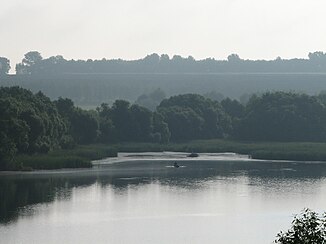
Sula (Dnepr)
|
Sula Сула |
||
| Data | ||
| location | Poltava , Sumy ( Ukraine ) | |
| River system | Dnepr | |
| Drain over | Dnepr → Black Sea | |
| source | in the south-western foothills of the Central Russian Ridge, 50 ° 51 ′ 58 ″ N , 34 ° 26 ′ 23 ″ E |
|
| muzzle | in the Dnepr dammed up to the Kremenchuk reservoir coordinates: 49 ° 33 ′ 19 ″ N , 32 ° 45 ′ 16 ″ E 49 ° 33 ′ 19 ″ N , 32 ° 45 ′ 16 ″ E
|
|
| length | 363 km | |
| Catchment area | 18,500 km² | |
| Outflow location: 106 km above the mouth |
MQ |
29 m³ / s |
| Right tributaries | Udaj , Slyporyd , Romen , Tern | |
| Medium-sized cities | Romny , Lubny | |
| Small towns | Lochwyzja , Zavodske , Sentscha , Nedryhajliw | |
| Communities | Korowynzi | |
|
Catchment area of the Dnepr with the course of the Sula (Сула) |
||
The Sula (Ukrainian and Russian Сула ) is a left tributary of the Dnepr with a length of 363 km and a catchment area of 18,500 km². It rises in the southwestern foothills of the Central Russian Ridge about 30 km west of the northern Ukrainian oblast capital Sumy . From its source it flows in a south-westerly direction, with the right bank cutting deep into the Poltava plateau in the middle course. The Sula flows into the Poltava Oblast in the Dnepr, which is dammed up to form the Kremenchuk reservoir . Due to the damming, it now has a large delta with numerous islands on which rare bird species nest. An important tributary is the údaj to the smaller tributaries include Orschyzja , Slyporyd , Romen and Tern .
Larger towns on the Sula are Romny , Lochwyzja , Sawodske and Lubny .
Web links
Individual evidence
- ↑ a b c Article Sula in the Great Soviet Encyclopedia (BSE) , 3rd edition 1969–1978 (Russian)


