Swoboda (Mishhirja)
| Swoboda | ||
| Свобода | ||

|
|
|
| Basic data | ||
|---|---|---|
| Oblast : | Zakarpattia Oblast | |
| Rajon : | Mishhirja Rajon | |
| Height : | 958 m | |
| Area : | Information is missing | |
| Residents : | 239 (20043) | |
| Postcodes : | Information is missing | |
| Area code : | +380 3146 | |
| Geographic location : | 48 ° 38 ' N , 23 ° 45' E | |
| KOATUU : | 2122487204 | |
| Administrative structure : | 1 village | |
| Address: | 90040 с. Синевирська Поляна 147 | |
| Statistical information | ||
|
|
||
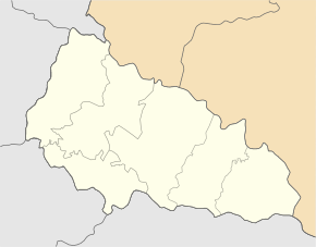
Swoboda ( Ukrainian Свобода ; Russian Свобода , Hungarian Szloboda , Slovak Sloboda ) is a mountain village in the Synevyr National Park in the north of the Ukrainian Zakarpattia Oblast with a population of over 200 (2004).
The village, founded around 1600, is located on the ridge of the Carpathian Forest , which forms the border with the Ivano-Frankivsk Oblast , at an altitude of 958 m , close to the Synevyr lake, which gives the national park its name, and the source of the Tereblja , an 80 km long tributary of the Tisza .
Swoboda belongs administratively to the district council of the neighboring village Synewyrska Poljana , to which the only road connection from Swoboda leads.
Synewyrska Poljana is 8 km southwest, the district center Mishhirja is 34 km southwest and the oblast center Uzhhorod 173 km west of the village.
Individual evidence
- ^ Village website on the Verkhovna Rada official website ; accessed on April 22, 2017 (Ukrainian)


