Synewyr (village)
| Synewyr | ||
| Sinevir | ||

|
|
|
| Basic data | ||
|---|---|---|
| Oblast : | Zakarpattia Oblast | |
| Rajon : | Mishhirja Rajon | |
| Height : | 659 m | |
| Area : | Information is missing | |
| Residents : | 4,805 (2004) | |
| Postcodes : | 90041 | |
| Area code : | +380 3146 | |
| Geographic location : | 48 ° 30 ' N , 23 ° 37' E | |
| KOATUU : | 2122486901 | |
| Administrative structure : | 2 villages | |
| Address: | 90041 с. Sinevir 1066 | |
| Website : | City council website | |
| Statistical information | ||
|
|
||
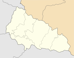
Synewyr ( Ukrainian Синевир ; Russian Синевир Sinewir , Slovak Sinovír, Sinijvir , Hungarian Alsószinevér ) is a village in the Ukrainian Transcarpathian Oblast with about 4,800 inhabitants.
The first written mention in the second half of the 16th century village is located in the National Park Synewyr the Waldkarpaten on 659 m height in the upper reaches of the river Tereblya and the territorial road T-07-20 . The National Park also includes Synevyr Lake and the 1707 m high mountain Nehrowez ( Негровець or Негрова Nehrowa ).
Synevyr is the administrative center of the 18 km² district council of the same name in Mishhirja Rajon , which also includes the village of Saverchnja Kytschera ( Заверхня Кичера ⊙ ) with about 160 inhabitants. Mishhirja Rajon Center is 31 km across the road west of the village.
Until 1919 the village belonged to the Hungarian half of the Austro-Hungarian Empire and subsequently to the Carpathian Ukraine within Czechoslovakia . With the annexation, the village came back to Hungary between 1939 and 1945. After World War II , Synevyr became part of the Ukrainian Soviet Socialist Republic within the Soviet Union in 1946 and, since 1991, of independent Ukraine .
Web links
Individual evidence
- ↑ Synevyr on the official website of the Verkhovna Rada , accessed on August 27, 2017 (Ukrainian)
- ↑ Synevyr local history in History of the Cities and Villages of the Ukrainian SSR ; accessed on August 28, 2017 (Ukrainian)
- ^ Institute for Natural Sciences, Geography and Natural History - The highest peaks of the Ukrainian Carpathians and their geomorphological regions ; accessed on January 31, 2019 (Ukrainian)
- ↑ Synevyr District Council on the official website of the Verkhovna Rada , accessed on August 27, 2017 (Ukrainian)


