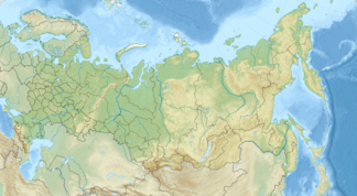
Sywermaplateau
| Sywermaplateau | ||
|---|---|---|
| Highest peak | Nakson ( 1071 m ) | |
| location | Krasnoyarsk region , Siberia , Russia | |
| part of | Central Siberian mountain country | |
|
|
||
| Coordinates | 65 ° 23 ' N , 95 ° 37' E | |
The Sywermaplateau ( Russian Сыверма ) is a maximally 1071 m high and extensive plateau - southern foothills of the Putorana Mountains , the north-western part of the Central Siberian Mountains , in the north of the Krasnoyarsk region , Siberia and Russia ( Asia )
geography
Geographical location
In the north the Sywermaplateau borders seamlessly on the Putorana Mountains, in the east its almost uninhabited landscape leads over to the Wiljuiplateau and in the south and southwest it slopes down to the Untere Tunguska river , which delimits the plateau . In the west-east direction, the plateau is about 400 to 450 km long. It has an average height of 600 to 900 m , and its highest point is the Nakson at 1071 m . The volcanic rocks of the plateau come from the Triassic .
Flowing waters
The plateau is traversed by right tributaries of the Lower Tunguska, mostly coming from the Putorana Mountains and running in a predominantly south-easterly direction, including in particular: Tutontschana , Wiwi , Tembentschi , Embentschime and Kotschetschum when viewed from west to east .
Localities
The localities of the plateau include - viewed from west to east: Noginsk , Tutontschany , Utschami , Babkino , Nidym and Tura ; these villages are all on the Lower Tunguska, partly on its southern bank and thus on the side facing away from the plateau.
Climate and flora
The climate on the Sywermaplateau is characterized by short and cool summers and long and hard winters. In the village of Tura , at the confluence of the Kotschetschum in the Lower Tunguska, the monthly temperatures are between a minimum of −40.5 ° C in January and a maximum of +23.8 ° C in July. While tundra and forest tundra predominate in the mountains , boreal coniferous forest (taiga) spreads in the river valleys . Given the climate with permafrost soil , the larch forest grows slowly despite a lot of precipitation.
