Tamarissi (Marneuli)
|
Tamarissi თამარისი |
||
| State : |
|
|
| Region : | Niederkartlien | |
| Municipality : | Marneuli | |
| Coordinates : | 41 ° 26 ' N , 44 ° 45' E | |
| Height : | 375 m. ü. M. | |
| Residents : | 1,399 (2014) | |
| Time zone : | Georgian Time (UTC + 4) | |
|
|
||
Tamarissi ( Georgian თამარისი , tʰɑmɑrɪsɪ , also transcribed as Tamarisi ; German Grape Mountain ) is a village in the Georgian region of Niederkartlien with 1,399 inhabitants (2014 census).
Location and traffic
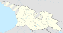
The village belongs to the Marneuli municipality . It is located in the western part of the Lower Cartographic Plain , also known as the Marneuli plain , about seven kilometers as the crow flies southwest of the center of the city of Marneuli , on the left bank of the Chrami river , a little below the confluence of the right tributary Maschawera .
Tamarissi is the capital of a rural community of the same name (Georgian თამარისის თემი , Tamarissis temi ), to which two other, smaller villages belong, Alawari and Dioknissi (formerly Achali Dioknissi ) , about 1.5 and 3.5 km to the east .
There is a road connection to the international trunk road S6 , which runs a few kilometers north from Tbilisi via Marneuli and Bolnissi to the Armenian border, part of the European route 117 , as well as to the international trunk road S7 running a few kilometers to the east , which branches off the S6 in Marneuli and also leads to the Armenian border. To the northwest of Tamarissi, the railway line runs from Marneuli via Bolnissi to Kasreti , which crosses the Chrami above the village and has a stopping point . However, passenger traffic on the route has been discontinued (as of 2017). The Marneuli military airfield is located between Tamarissi and Marneuli .
history
The village was founded in 1908 as a daughter colony of the Caucasian-German colony Katharinenfeld (today the city of Bolnissi), which was located 20 km to the west and was founded at the beginning of the 19th century under the name of Traubenberg . The corresponding Russian name was Winogradowka ( Russian Виноградовка , "winograd" means grape ), the later Georgian spelling ტრაუბენბერგი (Traubenbergi). In 1926 the village had 420 inhabitants. After the German invasion of the Soviet Union , all Germans were deported to the eastern parts of the country , the place was settled with ethnic Georgians and renamed Tamarissi in 1944 , referring to the medieval Georgian kings Tamar .
At the end of the 1970s, about 4.5 km north-northwest of the village on the edge of the plain, already in the neighboring Bolnissi Rajon , a prefabricated housing estate was built , which in 1982 received the status of an urban-type settlement and also the name Tamarissi . Today it has the status of a minority (Georgian daba , დაბა ) and is the seat of the Tamarissi territorial body in the Bolnissi municipality .
Web links
Individual evidence
- ↑ Population Census 2014 (English)
- ↑ Former German settlements in Transcaucasia
- ↑ Viktor This village: Nemeckie naselënnye punkty SSSR do 1941 g .: Geografija i naselenie . Moscow 2002, ISBN 5-93227-001-2 (Russian, online [PDF]).

