
Tandjilé region
| Tandjilé | |
|---|---|
  |
|
| Basic data | |
| Country | Chad |
| Capital | Laï |
| surface | 18,045 km² |
| Residents | 661,906 (2009 census) |
| density | 37 inhabitants per km² |
| ISO 3166-2 | TD-TA |
Coordinates: 9 ° 29 ' N , 16 ° 22' E
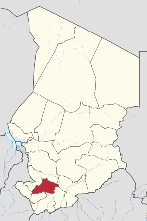
Tandjilé is a region of Chad and corresponds to the former prefecture of the same name. Their capital is Laï . The region has about 661,906 inhabitants.
geography
Tandjilé has an area of 18,045 km² and is located in the south of the country. Important cities are Laï, Kélo , Bénoy and Béré . The north of the region is part of the Ramsar reserve Plaines d'inondation du Logone et les dépressions Toupouri .
Breakdown
The region is divided into two departments ( départements ):
| department | main place | Sub-prefectures |
|---|---|---|
| Tandjilé Est | Laï | Laï, Deressia, Dono Manga, Guidari, N'Dam |
| Tandjilé Ouest | Kélo | Kélo, Béré, Dafra, Delbian |
population
The population grew from around 453,000 in 1993 to 662,000 in 2009. As in all of Chad, population growth is high.
Ethnic groups in Tandjilé are the Marba , Nangtchéré , Lélé , Ngambay and Gabriella .
swell
- ↑ bevölkerungsstatistik.de (2007)
- ↑ Chad: Regions, Cities & Urban Places - Population Statistics in Maps and Tables. Retrieved May 8, 2018 .
- ↑ French-language version of the article
Barh El Gazel |
Batha |
Borkou |
Chari-Baguirmi |
Ennedi
(divided into Ennedi-Est
and Ennedi-Ouest since 2012 ) |
Guéra |
Hadjer Lamis |
Kanem |
Lac |
Logone Occidental |
Logone Oriental |
Mandoul |
Mayo Kebbi Est |
Mayo-Kebbi Ouest |
Moyen-Chari |
Salamat |
Sila |
Tandjilé |
Tibesti |
Wadai |
Wadi Fira
and Ville de N'Djamena