Terceira (island)
| Terceira | |
|---|---|
| Terceira from space | |
| Waters | Atlantic Ocean |
| Archipelago | Azores |
| Geographical location | 38 ° 43 ′ N , 27 ° 12 ′ W |
| length | 29 km |
| width | 17.5 km |
| surface | 396.75 km² |
| Highest elevation | Santa Bárbara 1023 m |
| Residents | 55,955 (2016) 141 inhabitants / km² |
| main place | Angra do Heroísmo |
| The Serra de Santa Bárbara | |
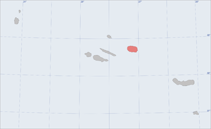
Terceira is an island in the central group of the Azores . It covers approx. 400 km², is 29 km long and 17.5 km wide. About 56,000 people live on Terceira (as of 2016).
Terceira was discovered in the 15th century by Portuguese seafarers as the third of the Azores islands, from which its name is derived (port .: terceira ⇒ German: the third ). Originally they called their discoverers Ilha de Jesus Cristo (Island of Jesus Christ) or Brazil . A mountain near Angra do Heroísmo is still called Monte Brasil today.
The capital of Terceira is Angra do Heroísmo with around 12,000 inhabitants. Angra is because of its beautifully preserved old town and reaching back to the early modern fortifications since 1983 World Heritage Site of UNESCO .
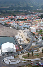
Terceira is only populated on the coast. A large part of the island's population lives in the two cities of Angra and Vila da Praia da Vitória . Angra and Praia are the centers of the districts of the same name. Angra comprises 19, Praia 11 municipalities.
Terceira owned the largest airport in the archipelago until the runway on the Azores island of São Miguel was built in the 1960s. The reasons for this go back a long way: Long before aviation, Terceira was an important stopover for international merchant ships in the North Atlantic; Angras fortresses against pirates were considered impregnable. The spiritual historian Gaspar Frutuoso wrote in the 16th century:
- "Angra is the universal stopover of the western sea, where the whole world celebrates the heart that beats for all the islands."
It was not a classic trading town, but it thrived on the trading ships that stopped on the way from America to Europe. The first airport in the Azores that can be approached by larger planes emerged from this transfer tradition.
During the Second World War , the merchant ships were popular targets of the German submarine fleet . The Allies spoke of the “Azores gap”, a kind of black hole where one was powerless against German attacks from below. As a result, the British expanded the airport massively in 1943 with Portuguese permission and converted it into the most important stopover for the Allied Air Force in the North Atlantic. Two runways were created, long enough for large transport planes and long-range bombers. In order not to transport the kerosene delivered by Allied ships over land to the aircraft, the port of Praia da Vitória was deepened and expanded. After the World War, American troops remained stationed on the island for decades. The airport, which is now also used for civilian purposes, is called Lajes Field .
literature
- Guido de Monterey, João Magina: Terceira, Açores. A ilha de Jesus Cristo . Ver Açor, 2006, ISBN 972-99965-1-2
Web links
- The portal of the Azores - information about the nine islands
- Information sites and photo tours Azores
- Terceira in the Global Volcanism Program of the Smithsonian Institution (English)
- Homepage of the Serviço Regional de Estatística dos Açores (SREA) (engl./port.)
Individual evidence
- ↑ Isabel Soares de Albergaria, Rui Monteiro, Filipe Jorge (photos): Azores in Aerial View , Argumentum, Lisbon 2008. ISBN 978-972-8479-60-2


