Graciosa (Azores)
| Graciosa | |
|---|---|
| NASA image of Graciosa | |
| Waters | Atlantic Ocean |
| Archipelago | Azores |
| Geographical location | 39 ° 2 ′ 38 ″ N , 27 ° 59 ′ 1 ″ W |
| length | 10 km |
| width | 7 km |
| surface | 60.84 km² |
| Highest elevation | 402 m |
| Residents | 4301 (2016) 71 inhabitants / km² |
| main place | Santa Cruz da Graciosa |
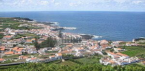
| The main town Santa Cruz da Graciosa | |
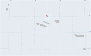
Graciosa (German: petite ) is the second smallest island in the Azores . Together with Faial , Pico , São Jorge and Terceira, it forms the central group of the archipelago and lies in its north. The island covers an area of 60.84 km² and has an approximately oval shape. The largest north-south extension is 10 kilometers, the largest east-west extension 7 kilometers. The main town of the island is Santa Cruz da Graciosa with around 1,800 inhabitants (2011 census). In recent years, the labor emigration caused by the purely agricultural economy seems to have stopped.
history
The exact date of the island's discovery is not known, although some authors claim that Graciosa was discovered on May 2, 1450 by the settler Vasco Gil Sodré . He allegedly came from the neighboring island of Terceira, 30 nautical miles away, and settled permanently with his family in the south of the island. By exporting grain and wine, Graciosa soon achieved a modest prosperity that repeatedly attracted pirates: In the period after the settlement, a total of 13 fortresses were built to protect the island from pirate attacks. In the 19th century, the Portuguese romantic poet Almeida Garrett lived on Graciosa for a while , and in 1879 Prince Albert of Monaco visited the island. In the 19th century, whaling and brick-making were important economic drivers. The last brick factory was closed in the 1960s. Whaling stopped in 1982.
In the 20th century, and more clearly between the 1950s and 1970s, the island experienced some waves of emigration, especially to the USA . On January 1, 1980, an earthquake caused considerable damage in Luz, Guadalupe and especially in Carapacho. The Graciosa Airport was built 1,981th
In 2007, UNESCO added Graciosa Island to the list of Biosphere Reserves .
administration
Graciosa is part of the Autonomous Region of the Azores and belongs to the Republic of Portugal . The island consists of only one circle ( concelho ), which has its seat in the town of the same name Santa Cruz da Graciosa.
The district is formed by four municipalities:
| location |
Freguesias (municipalities) |
Residents | Area km² |
Population density inh. Per km² |
|---|---|---|---|---|
| Guadalupe | 1096 | 20.62 | 53 | |
| Luz | 683 | 11.70 | 58 | |
| Praia (Sao Mateus) | 836 | 12.82 | 65 | |
| Santa Cruz da Graciosa | 1776 | 15.52 | 114 | |
| Graciosa | 4393 | 60.84 | 72 |
geography
The island is of volcanic origin and is considered to be the driest and flattest of the Azores - 94% of its area is deeper than 300 m. ü. d. M. In the south is the highest point of an extensive caldera with a height of 402 meters . The second highest point of Graciosa is the 398 m high Pico Timão. The island is part of the Mid-Atlantic Ridge , which extends in a north-south direction across the entire North Atlantic. Graciosa is largely deforested. The largest contiguous forest area is located between Santa Cruz and Praia and covers an area of only a few square kilometers.
economy
Today the dairy industry is the most important economic factor on the island. About 2/3 of the agriculturally usable area is taken up by meadows and pastures, on which over 6,000 cows graze. Most of the milk is processed into cheese in the island's food processing plants, which is shipped to mainland Portugal. Mainly maize and, to a lesser extent, wheat, sugar cane and wine are grown on the fertile soil on areas protected from the wind by lava stone walls. The island's administration rests on the development of tourism, with the aim of cultural and ecotourism. Graciosas Airport, which opened in 1981, has been modernized and shipping connections to the neighboring islands have been improved. The main port is Praia (São Mateus).
Web links
- The portal of the Azores. Information about the nine islands.
- Câmara Municipal da Graciosa (in Portuguese)
- Information sites and photo tours Azores
- Graciosa in the Global Volcanism Program of the Smithsonian Institution (English)
- Homepage of the Serviço Regional de Estatística dos Açores (SREA) (engl./port.)
Individual evidence
- ^ A b Luís Daniel: Graciosa - Guía do Patrimonio Cultural , p. 11. Lisbon 2004
- ↑ Stéphan Szeremeta: Acores , p. 177. Paris 2014
- ↑ Stéphan Szeremeta: Acores , p. 178. Paris 2014
- ↑ Luís Daniel: Graciosa - Guía do Patrimonio Cultural , p. 47. Lisbon 2004
- ↑ Luís Daniel: Graciosa - Guía do Patrimonio Cultural , p. 26. Lisbon 2004
- ^ Marion Zorn: Azoren , p. 74. Ostfildern 2000
- ↑ List of all UNESCO biosphere reserves on the homepage of the German UNESCO Commission , accessed on July 25, 2018.
- ^ Wilhelm Voss-Gerling: Madeira, Azoren , p. 59. Munich 1972
- ↑ Luís Daniel: Graciosa - Guía do Patrimonio Cultural , p. 13. Lisbon 2004


